• Hurricane Isaias leaves at least six dead, hundreds of thousands without power after Florida landfall

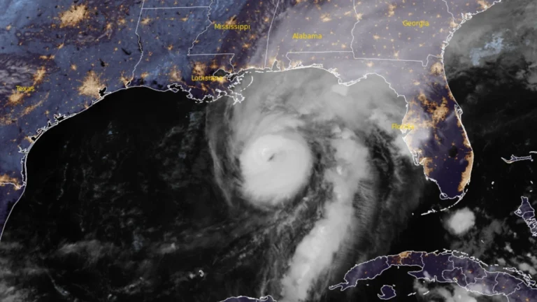
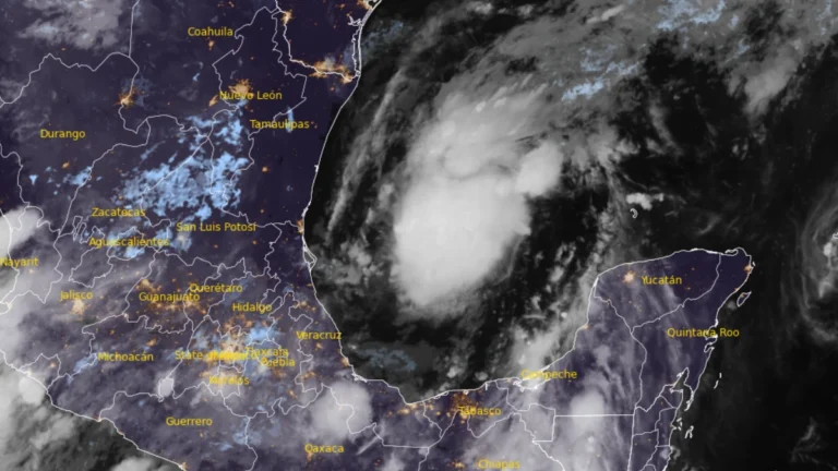
    At least six people died after Hurricane Isaias made landfall near Destin, Florida, as a Category 2 hurricane at about 20:30 LT on October 9 (01:30 UTC on October 10). Approximately 408 000 customer accounts remained without power across Florida, Alabama, Georgia and Mississippi shortly before 13:00 UTC on October 11, while the post-tropical cyclone continued producing flooding and wind hazards farther northeast.

  • Tropical Storm Rachel brings flash-flood threat to Southern California and U.S. Southwest

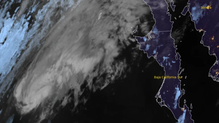
    Tropical Storm Rachel strengthened while accelerating northeast over the eastern Pacific at 06:00 UTC on October 10, 2026, and is forecast to approach northern Baja California or Southern California late October 10 or early October 11. Heavy rain, flash and urban flooding, strong winds, dangerous surf and coastal flooding are forecast across parts of the southwestern United States, where the Weather Prediction Center (WPC) has issued Moderate Risk areas for excessive rainfall.

  • Tornado threat forecast as Hurricane Isaias strengthens ahead of northern Gulf Coast landfall, United States

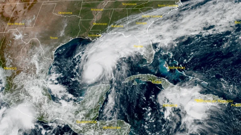
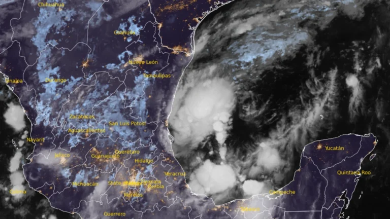
    The Storm Prediction Center (SPC) issued a Slight Risk of severe thunderstorms for parts of the Florida Panhandle, southeastern Alabama, and southwestern Georgia on October 9, 2026, as rainbands from Hurricane Isaias were forecast to bring a tornado threat from the afternoon into the overnight hours. At 09:00 UTC, the National Hurricane Center (NHC) said Isaias had strengthened to 175 km/h (110 mph), with a minimum central pressure of 963 hPa, ahead of an expected northern Gulf Coast landfall Friday night or early Saturday.

  • Life-threatening storm surge of up to 2 m (7 feet) forecast as Hurricane Isaias approaches U.S. Gulf Coast

    Life-threatening storm surge is forecast along the northern U.S. Gulf Coast as Hurricane Isaias approaches landfall. NHC said water could rise 1.5–2 m (5–7 feet) above ground between Ocean Springs, Mississippi, and Indian Pass, Florida, and within Mobile Bay if the peak surge coincides with high tide.saias is forecast to produce 75–180 mm (3–7 inches) of rain from southeastern Louisiana to Florida’s Big Bend from Friday through the weekend, with localized totals approaching 380 mm (15 inches) in the Florida Panhandle and Big Bend. NHC warned of considerable flash and urban flooding and significant river flooding.

  • Florida battles largest dengue outbreak in decades as locally acquired cases reach 252

    lorida reported 252 locally acquired dengue cases across seven counties in 2026 through September 26, including 223 in Hillsborough County, according to the state’s latest available weekly surveillance report. One death has been confirmed, and Tampa Bay counties declared local emergencies as Hillsborough expanded aerial mosquito-control operations.

  • Hurricane and storm surge watches issued for northern Gulf Coast as Isaias strengthens, U.S.

    Hurricane, storm surge and tropical storm watches were issued for portions of the U.S. northern Gulf Coast on Wednesday morning, October 7, 2026, as Tropical Storm Isaias strengthened over the Gulf of America, according to the National Hurricane Center (NHC). The watches extend from the mouth of the Mississippi River eastward to Yankeetown, Florida.

  • Tropical Depression Nine forms over Gulf of America, forecast to become hurricane before approaching U.S. Gulf Coast

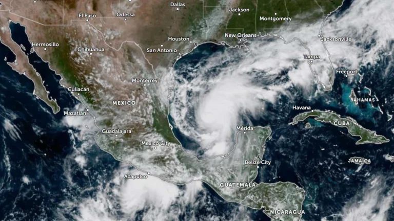
    Tropical Depression Nine formed over the southwestern Gulf of America on October 6, 2026, and is forecast to strengthen into a tropical storm early Wednesday and a hurricane on Thursday. The system is expected to approach the U.S. northern Gulf Coast on Friday, with an increasing risk of dangerous wind, storm surge and heavy rainfall impacts.

  • Flood Watch issued for northeastern Florida as AL92 raises late-week Gulf Coast rainfall threat, U.S.

    A Flood Watch is in effect for northeastern Florida and Camden County, Georgia, from 10:00 to 20:00 EDT (14:00 UTC October 6 to 00:00 UTC October 7), with the National Weather Service (NWS) forecasting locally 76–127 mm (3–5 inches) of rain. The Weather Prediction Center (WPC) maintains a Marginal Risk of excessive rainfall across much of Florida through Thursday, while a broader heavy-rain threat is forecast along the northern Gulf Coast from Friday as disturbance AL92 moves northeastward and interacts with an upper-level trough.

  • Extreme Heat Warnings and Heat Advisories cover much of California as October heat wave persists

    Extreme Heat Warnings and Heat Advisories covered a broad section of California on October 5, 2026, as potentially record-breaking early-October heat persisted from Southern California to the Bay Area, Central Valley and northern interior. Forecast highs reached 41°C (106°F) in inland Los Angeles and Ventura counties and 43°C (110°F) in Death Valley, while unusually warm nights limited relief. Most alerts remained in effect through October 7 or 8, with the Death Valley warning continuing through October 9.