• Polar vortex winds at 60°N drop from 22.13 to 5.44 m/s in eight days in rare November disruption; major SSW remains forecast

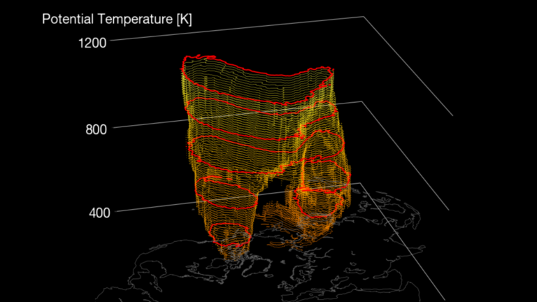
    A rare November disruption of the Northern Hemisphere stratospheric polar vortex is underway, with the daily-mean wind at 60°N and 10 hPa weakening from 22.13 m/s (49.5 mph) on October 25 to 5.44 m/s (12.2 mph) on November 2. Forecast guidance continues to indicate a possible brief reversal during the second week of November, which would meet the defining wind-reversal threshold used to identify a major sudden stratospheric warming, while any surface-weather response remains uncertain.

  • NWS confirms EF0 tornado near Spring Grove, Virginia, with 115 km/h winds and a 4.3 km path, no injuries reported

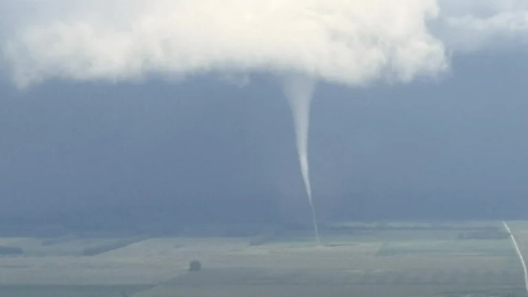
    An EF0 tornado tracked approximately 4.3 km (2.7 miles) across part of Surry County, Virginia, from 16:41 to 16:46 EDT (20:41–20:46 UTC) on September 12, 2026, with estimated peak winds of 115 km/h (70 mph). National Weather Service (NWS) survey teams found tornado-related tree damage along VA-10 near Spring Grove.

  • More than 6 000 evacuated north of Reno as Bug and Fred Mountain fires reach 23 458 ha at 0% containment under Nevada state of emergency

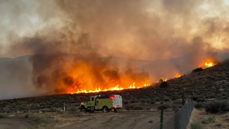
    More than 6 000 people were evacuated from residential neighborhoods in Washoe County and the Reno-Sparks Indian Colony–Hungry Valley as the Bug and Fred Mountain fires threatened communities north of Reno, Nevada. By the evening of August 11, the combined Bug-Fred incident was listed at 23 458 ha (57 966 acres) with 0% containment, while the separate Stallion Fire was listed at 12 767 ha (31 548 acres) with 0% containment. Nevada’s state of emergency remains in effect through August 17 unless terminated sooner.

  • NTSB examines weather and possible in-flight breakup after Learjet 60 crash kills nine in Florida

    A Learjet 60 crashed near Cresthaven in Palm Beach County, Florida, at about 17:50 UTC (12:50 EST) on November 1, killing all nine people aboard and injuring one person on the ground. NTSB investigators are examining reported icing, moderate turbulence and precipitation, the rapid descent and preliminary evidence that parts may have separated before impact.

  • Record tides flood California coast as Huntington Beach declares emergency and warnings persist

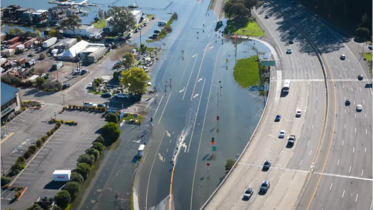
    Exceptionally high tides have flooded coastal communities across California since October 26, 2026, inundating homes, businesses and roads, forcing closures along Pacific Coast Highway and prompting a local emergency declaration in Huntington Beach. Water levels set a new record at San Diego, while the National Weather Service extended coastal flood advisories around San Francisco, San Pablo and Monterey bays through Sunday, November 1.

  • Flood watches cover the Southwest ahead of a Four Corners heavy-rainfall event, U.S.

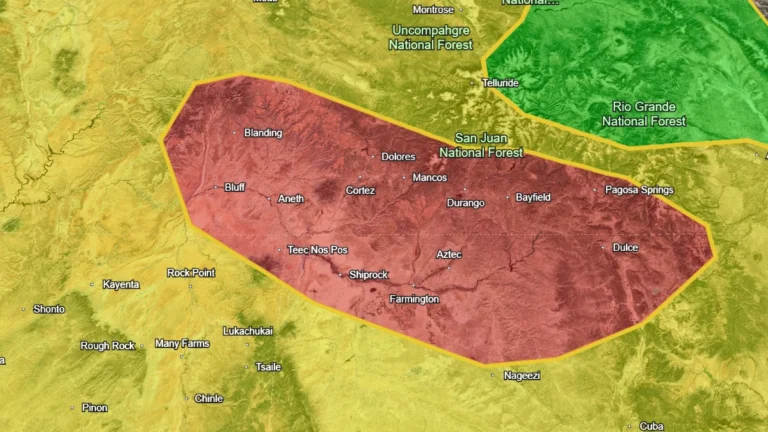
    Flood Watches are in effect across parts of Arizona, New Mexico, Utah and Colorado as successive Pacific moisture surges raise the flash-flood threat through early November 2, 2026. The Weather Prediction Center (WPC) has placed the Four Corners under a Moderate Risk of excessive rainfall for November 1, when it expects a high-impact heavy rainfall event over saturated ground.

  • Lake Worth Pier and South Port Everglades reach record water levels, King tides flood Florida’s Atlantic coast

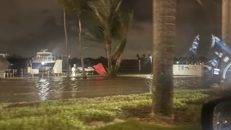
    King tides, persistent onshore winds and elevated seas caused coastal flooding along Florida’s Atlantic coast from October 26 to 29, 2026. Preliminary water levels reached 0.82 m (2.70 feet) above mean higher high water at Lake Worth Pier and 0.76 m (2.48 feet) at South Port Everglades, both above the highest values in NOAA’s current station tables. Virginia Key recorded its highest king tide and third-highest overall level since consistent observations began in 1994.

  • Coastal flooding forecast at Hooper Bay as Bering Sea storms continue, Alaska

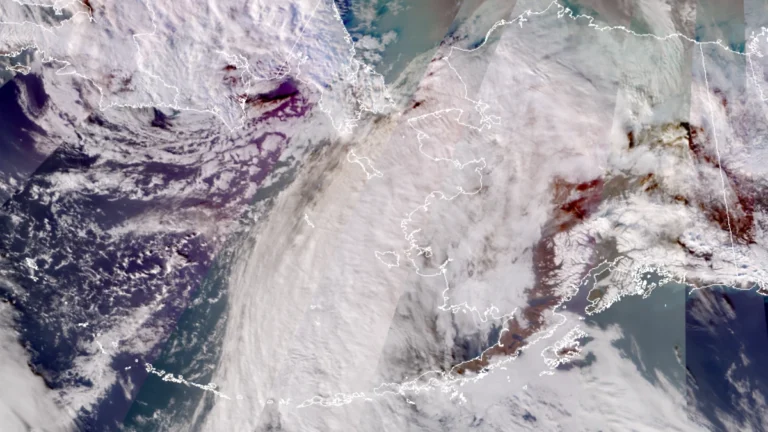
    A Bering Sea storm associated with the remnants of Typhoon Champi is forecast to raise water levels at Hooper Bay, Alaska, by 0.6–1.2 m (2–4 feet) above normal high tide from October 29 into early October 31, 2026. A Coastal Flood Advisory is in effect, while state officials reported that power had been mostly restored in Kivalina after an earlier storm damaged a powerline and prompted residents to shelter at a school.