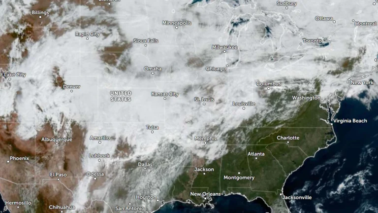
• Life-threatening flash flooding reported across Oklahoma City, major flooding forecast on Canadian River

    Life-threatening flash flooding was reported across the Oklahoma City metropolitan area on October 14 after thunderstorms produced 76–152 mm (3–6 inches) of rain, while radar indicated 102–279 mm (4–11 inches) farther west, according to the National Weather Service (NWS) in Norman. Major flooding was forecast on the Canadian River near Bridgeport, while the Weather Prediction Center (WPC) maintained a Moderate Risk of excessive rainfall from Oklahoma into the Red River Valley of Texas through 12:00 UTC on October 15.
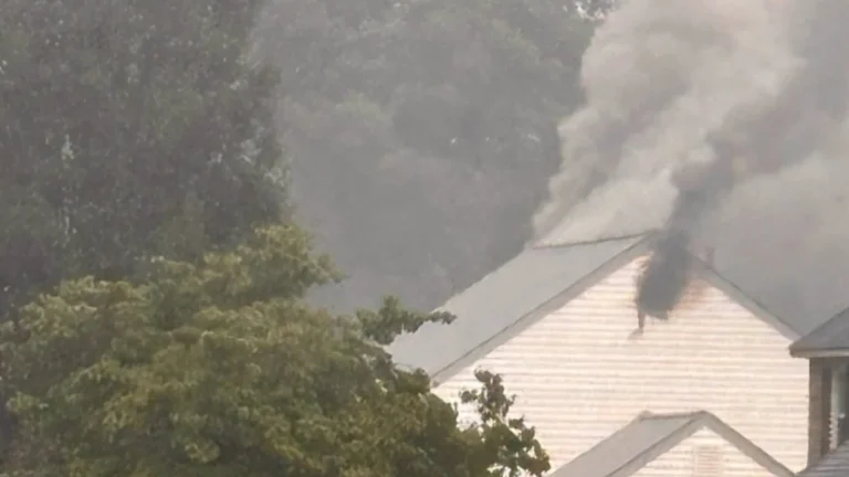
  • Heat Advisories span 12 states from Texas to Indiana, heat index up to 46°C (114°F) forecast

    Heat Advisories issued by 16 National Weather Service (NWS) forecast offices cover portions of 12 U.S. states from September 14 through September 16, 2026, with heat index values forecast to reach 46°C (114°F) in southern Texas. The advisories extend from Texas and Oklahoma through the Lower Mississippi Valley and Mid-South into Indiana and Kentucky.

  • Extreme Heat Warnings and Heat Advisories issued from the Central Plains to the Southwest U.S.

    Extreme Heat Warnings and Heat Advisories were issued across parts of the central and southern United States, the Southwest and California on September 8, 2026. The National Weather Service (NWS) forecast heat index values up to 44°C (112°F) in parts of Arkansas and Oklahoma and temperatures up to 47°C (116°F) in Death Valley and the Colorado River Valley, with several western alerts continuing through September 11.

  • NWS heat advisories cover parts of 17 states on September 1, heat indices up to 43°C (110°F) forecast, U.S.

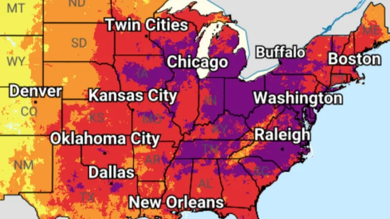
    Heat Advisories covered a broad corridor from the southern Plains and lower Mississippi Valley through the Midwest, Ohio Valley and parts of the Mid-Atlantic on September 1, 2026. National Weather Service (NWS) offices forecast heat indices from around 37.2°C (99°F) to 43°C (110°F), with several multi-day products citing limited overnight relief as a factor in maintaining the advisories.

  • Lightning strike triggers fire in three natural gasoline tanks at Explorer Pipeline facility in Glenpool, Oklahoma

    A suspected lightning strike triggered a fire involving three natural gasoline storage tanks at the Explorer Pipeline facility in Glenpool, Oklahoma, at approximately 08:33 CDT (13:33 UTC) on August 17, 2026, prompting evacuations and shelter measures around the site. No injuries were reported. Officials said the fire was no longer actively burning by 20:30 CDT (01:30 UTC on August 18), and the response transitioned to cleanup and recovery on August 18.

  • Extreme heat alerts cover portions of 31 U.S. states, heat index up to 46°C (115°F)

    Extreme Heat Warnings, Extreme Heat Watches, and Heat Advisories are in effect across 31 U.S. states after the National Weather Service (NWS) issued a series of heat alerts on June 29, 2026. Peak heat index values are forecast to reach 46°C (115°F), with dangerous heat and humidity expected to persist into early July across parts of the Midwest, Northeast, Southeast, and central United States.

  • Exceptional drought returns to Texas Panhandle and western Oklahoma for first time since July 2023

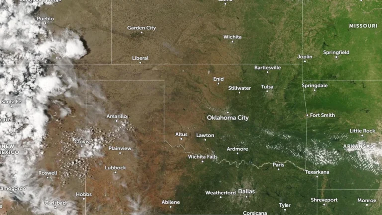
    Exceptional drought (D4) has returned to parts of the Texas Panhandle and western Oklahoma for the first time since July 2023, according to the National Weather Service Arkansas-Red Basin River Forecast Center (ABRFC). Drought conditions continue worsening across large parts of the Southern Plains following one of the driest and warmest starts to spring on record. Extreme Drought (D3) conditions are already affecting 36% of the Arkansas-Red Basin, while forecasters warned that very dry conditions are expected to persist across western portions of the region.

  • Enhanced Risk of severe thunderstorms issued for northern Texas into lower Mississippi Valley

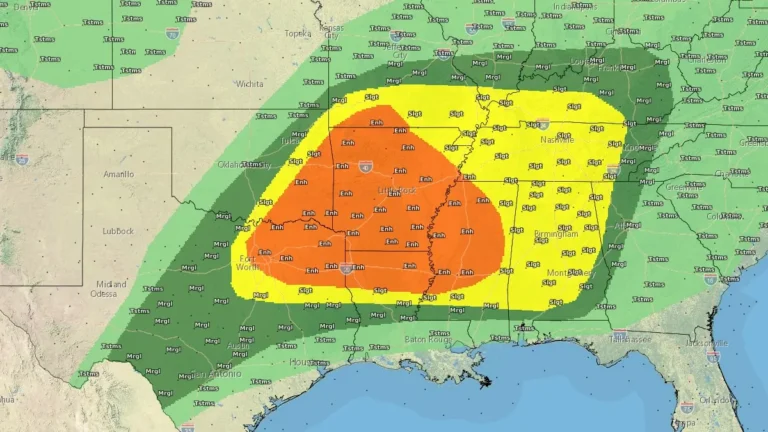
    Severe thunderstorms and heavy rainfall are forecast across parts of northern Texas into the lower Mississippi and Tennessee Valleys on April 28, 2026, with an Enhanced Risk issued for parts of the region. Very large hail, damaging winds, and a few tornadoes are to be expected, while repeated storm activity may increase the risk of flash flooding.

  • Moderate Risk issued for central and southeast Oklahoma as strong tornadoes and very large hail threaten southern Plains

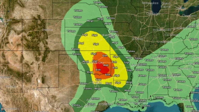
    NOAA’s Storm Prediction Center placed parts of central and southeast Oklahoma under a Moderate Risk for severe thunderstorms on April 25, 2026, with large to very large hail, tornadoes, and damaging winds forecast across parts of the southern Plains and Ark-La-Tex. Hailstones over 7.6 cm (3 inches) and strong tornadoes are possible during the afternoon and evening, where discrete supercells develop.