• Enhanced Risk issued, strong tornadoes, giant hail, and damaging winds forecast across the Midwest and Great Lakes

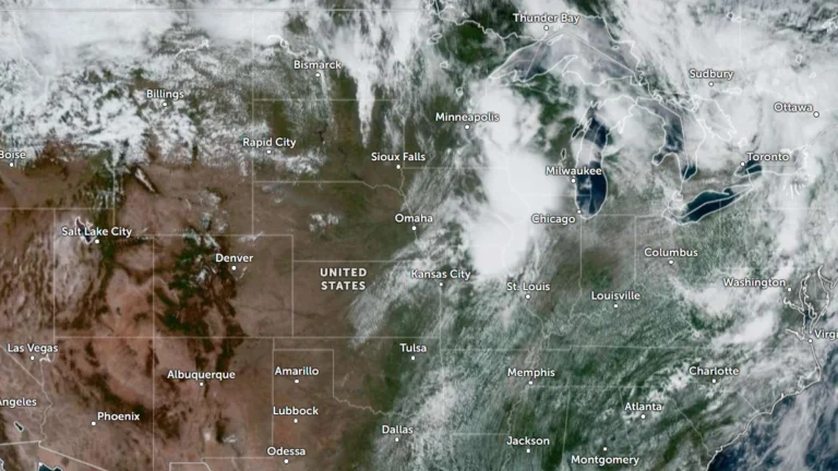
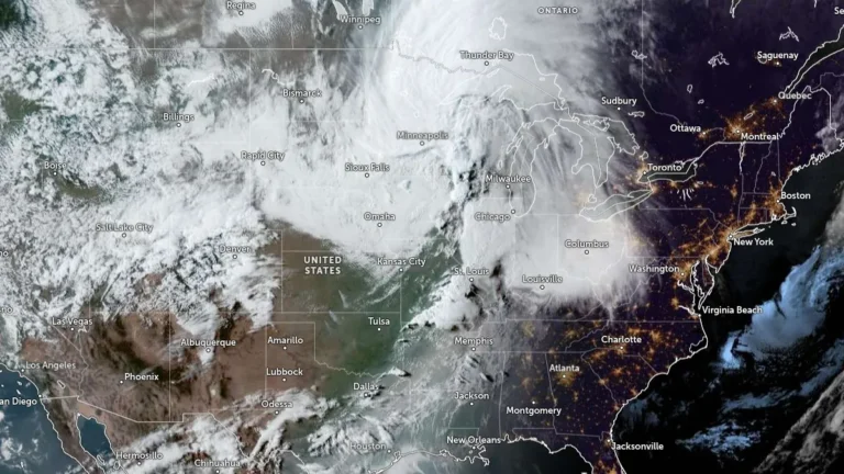
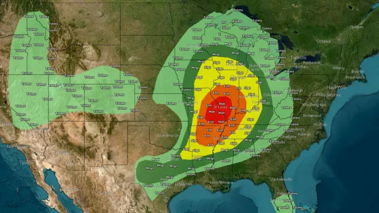
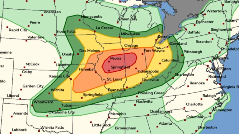
    The Storm Prediction Center (SPC) has placed parts of the Upper Mississippi Valley, Midwest and Great Lakes region under Enhanced Risk (Level 3 of 5) through June 11 and 12, 2026, warning that thunderstorms may produce hail larger than 5 cm (2 inches), wind gusts exceeding 120 km/h (75 mph) and several tornadoes, including a few strong tornadoes.

  • Heat Advisories in effect across central U.S., heat index values up to 42°C (108°F) forecast

    Dangerous heat is expected across much of the central United States on June 9, 2026, with multiple National Weather Service offices warning that heat index values will reach 38 to 42°C (100 to 108°F) during the afternoon and evening. Heat Advisories remain in effect across Kansas, Missouri, Arkansas, Tennessee, Mississippi, Iowa, Nebraska, South Dakota, Minnesota, and Wisconsin, with the most dangerous conditions forecast across the Mid-South.

  • PDS tornado watch followed by 19 tornado reports, large hail and damaging winds across central U.S.

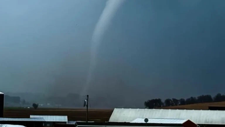
    A Particularly Dangerous Situtation (PDS) Tornado Watch issued for northeast Kansas and southeast Nebraska on May 18, 2026, was followed by multiple tornado reports, hail up to about 7 cm (2.75 inches), and damaging wind reports across the central U.S. Preliminary SPC storm reports included 19 tornadoes, damage to farm structures, grain bins, trees, and power lines.

  • Giant hail up to 11.4 cm (4.5 inches) reported in Texas, destructive 10.2 cm (4 inches) hail swath impacts Missouri

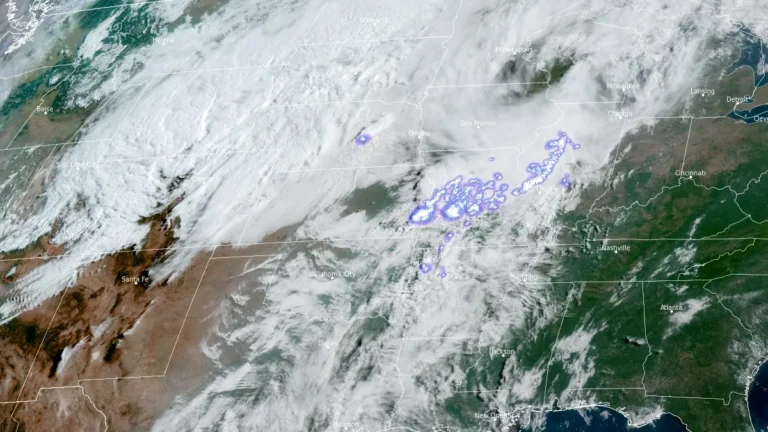
    Giant hail up to 11.4 cm (4.5 inches) was reported in Johnson County, Texas, late on April 28, 2026, while a separate corridor of 7.6–10.2 cm (3–4 inches) hail caused structural and vehicle damage across southwest Missouri earlier the same day. The storms were part of a multi-state severe weather outbreak stretching from Oklahoma and Arkansas into Mississippi, producing widespread reports of large hail, damaging winds, and isolated tornadoes. Confirmed impacts included broken windows, roof damage, and an animal fatality at a zoo in Springfield, Missouri.

  • Severe storms leave over 260 000 without power, 1 dead across Midwest after tornado warnings in St. Louis and Illinois

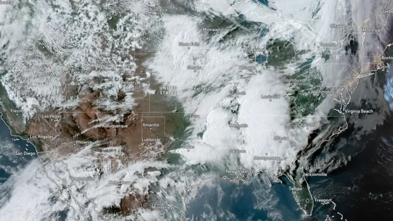
    Severe storms moved across the Midwest on Monday, April 27, 2026, producing tornado warnings in the St. Louis area and Illinois, while heavy rain caused flooding into early Tuesday. More than 250 000 customers lost power across Missouri, Illinois, Kentucky, Indiana, Wisconsin, and Michigan, and at least one fatality was reported in Michigan after a tree fell during the storms.

  • Freeze Warnings issued for parts of Kentucky, Indiana, Illinois and Missouri

    Freeze Warnings have been issued across Kentucky, southern Indiana, southern Illinois, and southeast Missouri, with sub-freezing temperatures forecast overnight into March 28, 2026. The warnings are in effect from late March 27 through the morning hours of March 28, with minimum temperatures expected between −4°C and −1.5°C (24–29°F). Frost and freeze conditions are expected to damage crops, sensitive vegetation, and exposed outdoor plumbing.

  • Freeze Warnings and Watches issued across parts of Texas, Oklahoma, Arkansas, Louisiana, Mississippi, Alabama, Missouri, and Tennessee

    Freeze Warnings and Watches have been issued for parts of eight southern U.S. states as sub-freezing temperatures are forecast from March 16 into March 17, 2026. Temperatures could fall as low as −12°C (10°F) in the coldest parts of Arkansas, while many other areas are expected to bottom out in the −7°C to −2°C (19 to 28°F) range. Frost, freeze conditions, and gusty post-frontal winds may damage sensitive vegetation and, in the coldest areas, affect exposed outdoor plumbing.