
PDS tornado watch followed by 19 tornado reports, large hail and damaging winds across central U.S.
A Particularly Dangerous Situtation (PDS) Tornado Watch issued for northeast Kansas and southeast Nebraska on May 18, 2026, was followed by multiple tornado reports, hail up to about 7 cm (2.75 inches), and damaging wind reports across the central U.S. Preliminary SPC storm reports included 19 tornadoes, damage to farm structures, grain bins, trees, and power lines.
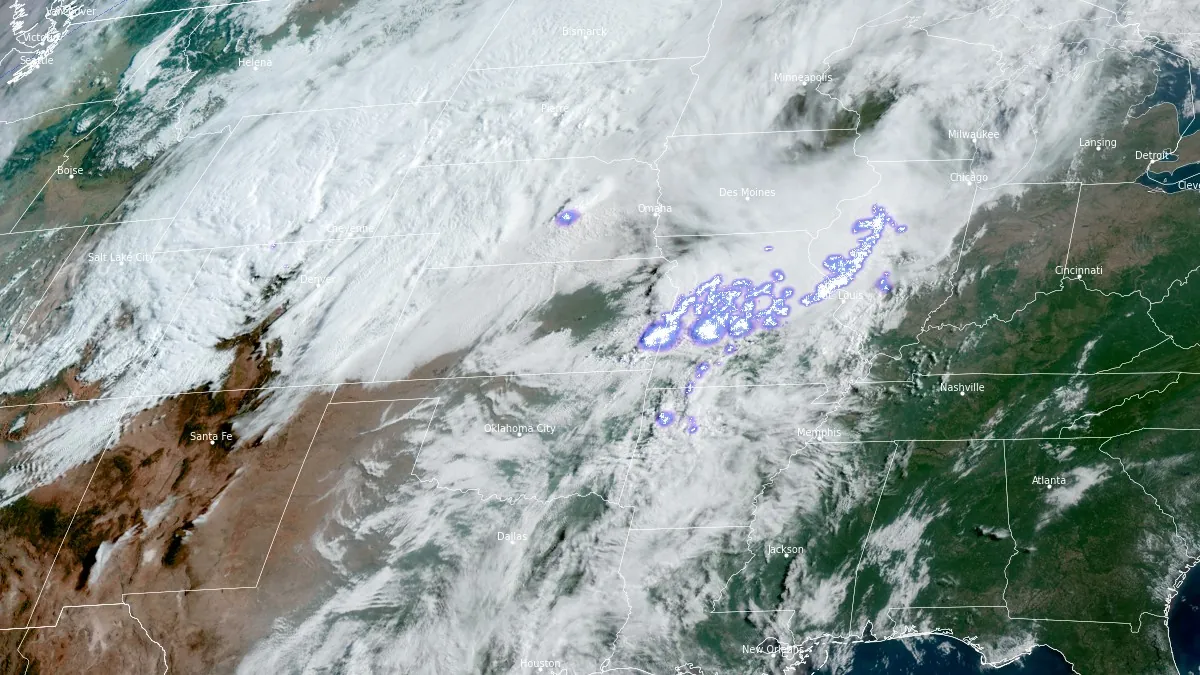
Satellite image with lightning mapper acquired at 13:30 UTC on May 18, 2026. Credit: NOAA/GOES-East, RAMMB/CIRA, The Watchers
The Storm Prediction Center issued a Particularly Dangerous Situation Tornado Watch 222 at 12:50 CDT (17:50 UTC) on May 18, covering parts of northeast Kansas and southeast Nebraska until 20:00 CDT (01:00 UTC on May 19).
The center warned of several tornadoes and a few intense tornadoes, scattered large hail and isolated very large hail up to 7.6 cm (3 inches), and scattered damaging wind gusts up to 115 km/h (70 mph). The watch covered an area about 64 km (40 miles) north and south of a line from west of Salina, Kansas, to east-southeast of Falls City, Nebraska.
SPC received 19 tornado reports — 8 from Kansas, 5 from Nebraska, 4 from Iowa, one from Missouri, and one report of a brief EF-0 tornado near Paxton, Illinois, which damaged an outbuilding at a farmstead.
Damage reports included grain-bin and tree damage near Frankfort, Kansas, and damage to a home, barn, and trees near Circleville, Kansas.
A related wind damage entry near Paxton, Illinois, mentioned multiple broken power poles and nearby outbuilding damage, while the Frankfort-area entry listed grain bins in fields, downed power lines, and tree damage.
The largest hail report on May 18 was 7 cm (2.75 inches) measured at Sheridan, Missouri, followed by 5 cm (2 inches) found near Lincoln and Inman, Kansas.
The strongest wind was measured at 150 km/h (92 mph) about 5 km (3 miles) east of Jarbalo, Kansas, followed by 145 km/h (90 mph) near Johnson, Nebraska, 130 km/h (81 mph) near Lewiston, Nebraska, and 130 km/h (81 mph) at Dundee, Michigan, where the value was measured by a handheld anemometer.
Chicago Midway Airport recorded a 130 km/h (79 mph) gust, while a Kansas City report listed a downed tree branch on overhead streetcar wires, suspending service. Other damage reports described trees on homes, trees blocking roads, broken power poles, downed wires, and power outages from Illinois and Indiana into Kansas, Missouri, Nebraska, and Michigan.
As of 12:00 UTC on May 19, Michigan had 32 500 customers without power, and Missouri 13 700. At the height of the storm, 20 000 outages were reported in Wyandotte County, KS alone.
Preliminary Local Storm Reports relay information received from sources such as spotters, local officials, media and the public, and remain preliminary until they are certified locally and nationally and ingested into Storm Data.
Final tornado count, EF ratings, path lengths, maximum widths, injury totals, and consolidated damage assessments require NWS survey statements or Storm Data certification.
References:
1 SPC Storm Reports for May 18, 2026 – NWS/SPC – May 19, 2026
I'm a dedicated researcher, journalist, and editor at The Watchers. With over 20 years of experience in the media industry, I specialize in hard science news, focusing on extreme weather, seismic and volcanic activity, space weather, and astronomy, including near-Earth objects and planetary defense strategies. You can reach me at teo /at/ watchers.news.
Commenting rules and guidelines
We value the thoughts and opinions of our readers and welcome healthy discussions on our website. In order to maintain a respectful and positive community, we ask that all commenters follow these rules.