
Enhanced Risk issued, strong tornadoes, giant hail, and damaging winds forecast across the Midwest and Great Lakes
The Storm Prediction Center (SPC) has placed parts of the Upper Mississippi Valley, Midwest and Great Lakes region under Enhanced Risk (Level 3 of 5) through June 11 and 12, 2026, warning that thunderstorms may produce hail larger than 5 cm (2 inches), wind gusts exceeding 120 km/h (75 mph) and several tornadoes, including a few strong tornadoes.
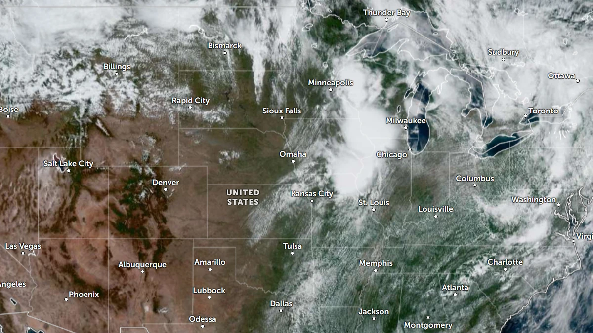
Satellite image of the United States at 18:30 UTC on June 10, 2026. Credit: NOAA/GOES-19, Zoom Earth, The Watchers
For the Day 1 period, valid through the morning of June 11, SPC forecasts scattered to numerous severe thunderstorms across parts of Iowa, Missouri, Wisconsin, Illinois, and nearby states.
A very moist and unstable air mass is forecast to develop during the afternoon and evening, creating favorable conditions for severe thunderstorms.
Radar imagery showed an ongoing cluster of strong thunderstorms across southern Iowa and northern Missouri. According to SPC, these storms are forecast to strengthen as they move into an increasingly unstable environment.
A strong bowing line of thunderstorms could develop from northeastern Iowa into southern Wisconsin and northern Illinois. This type of storm system can produce widespread damaging winds.
Additional storms forming ahead of the main line may produce large hail before merging into the larger thunderstorm complex.
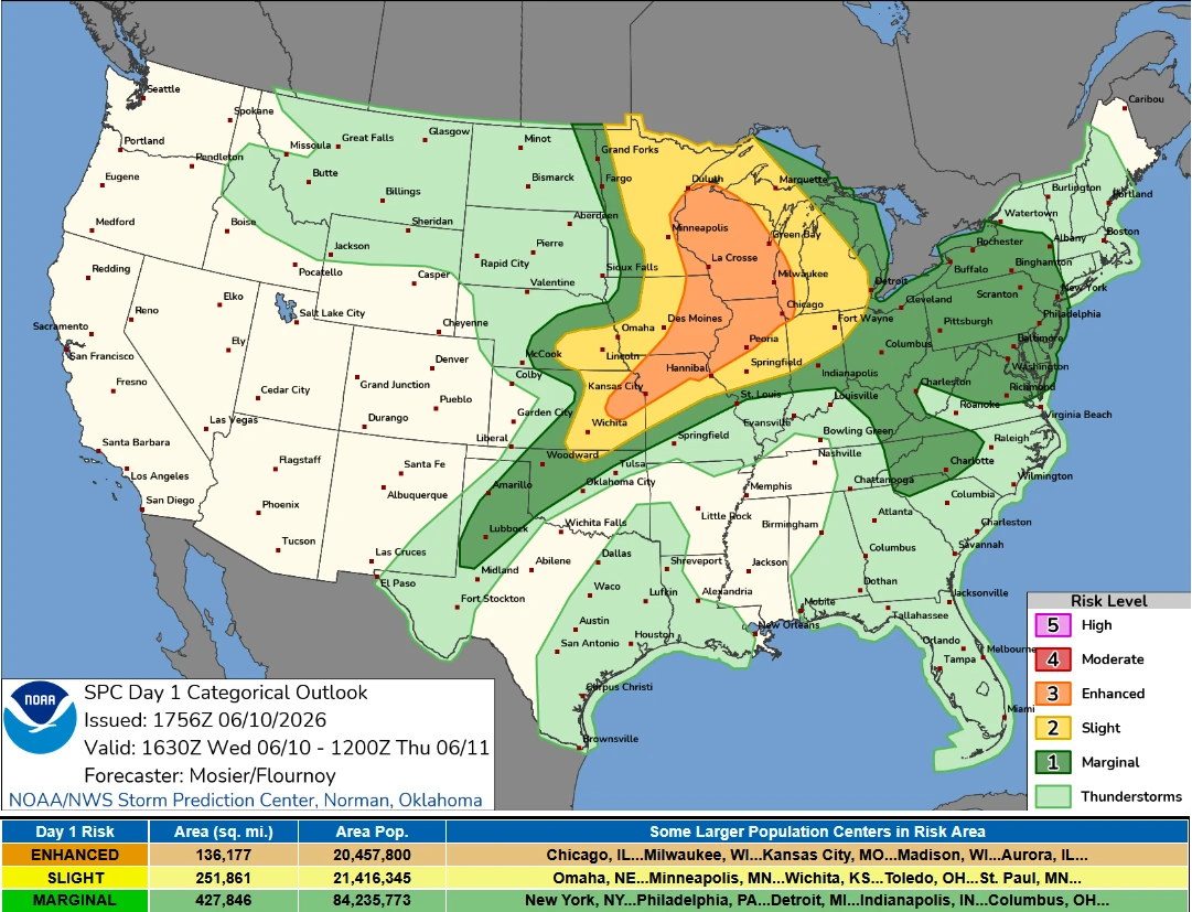
Farther north, a triple-point low is located over northeastern South Dakota, with an occluded front extending into Manitoba and a cold front stretching southward into the central Plains. This weather system is forecast to move eastward into the Upper Midwest, and it will interact with rich low-level moisture and strong instability.
SPC says these conditions will support additional severe thunderstorm development capable of producing large hail, damaging winds, and tornadoes.
This system is forecast to move eastward into the Upper Midwest and interact with rich low-level moisture and strong instability. SPC says these conditions will support additional severe thunderstorm development capable of producing large hail, damaging winds, and tornadoes.
The June 11 outlook forecasts potential for hail larger than 5 cm (2 inches), with wind gusts going 120 km/h (75 mph), and a few strong tornadoes.
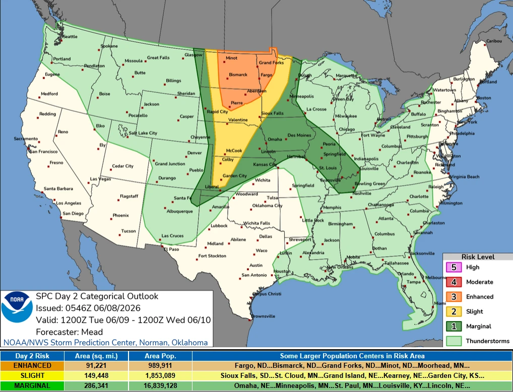
The severe weather threat is forecast to shift eastward into portions of the Midwest and Great Lakes region by June 12. The Enhanced Risk area covers southern and eastern Iowa, northeastern Missouri, northern and central Illinois, southern Wisconsin, northern Indiana, and central and southern Lower Michigan.
A short-wave trough moving eastward from the northern Rockies toward the Upper Midwest will support the development of one or two organizing thunderstorm clusters. The system is forecast to be accompanied by a secondary surface low tracking from the central Plains toward the Upper Midwest and Great Lakes region.
Severe thunderstorms developing within this environment may produce large hail, damaging winds, and a couple of strong tornadoes. The greatest threat is forecast through the afternoon and night of June 11 as storms organize along and ahead of the advancing frontal system.
References:
1 Day 1 Convective Outlook – NOAA/SPC – June 10, 2026
2 Day 2 Convective Outlook – NOAA/SPC – June 10, 2026

I am an Assistant Editor and Severe Weather & Science Journalist at The Watchers, specializing in real-time severe weather coverage, geophysical event reporting, and research-driven scientific analysis. You can reach me at rishav(at)watchers(.)news.
Commenting rules and guidelines
We value the thoughts and opinions of our readers and welcome healthy discussions on our website. In order to maintain a respectful and positive community, we ask that all commenters follow these rules.