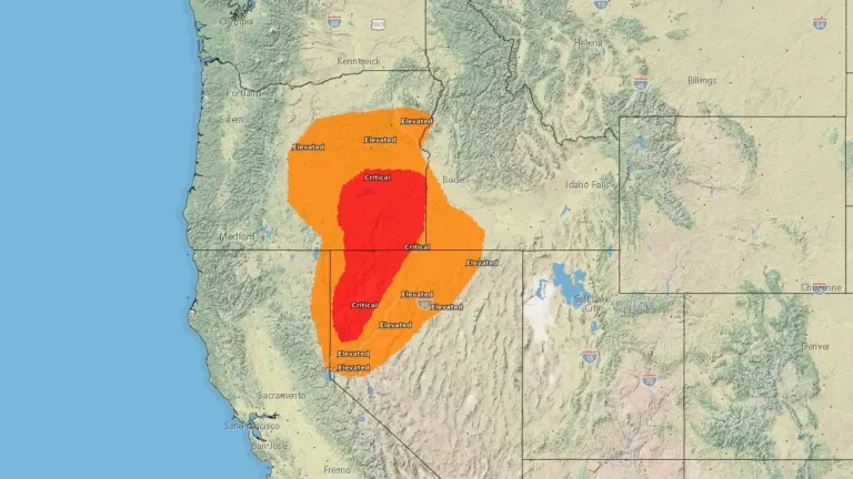
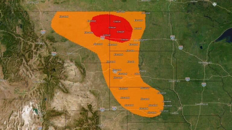
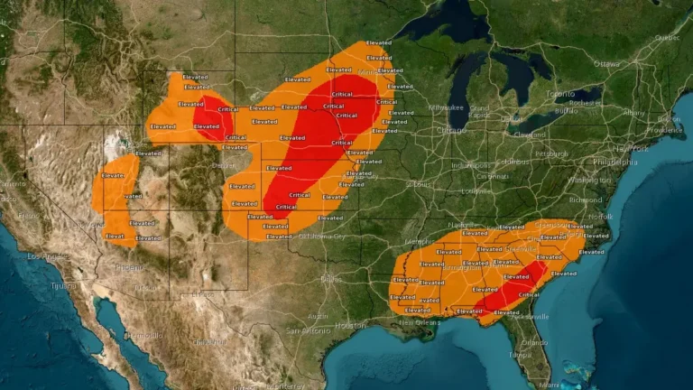
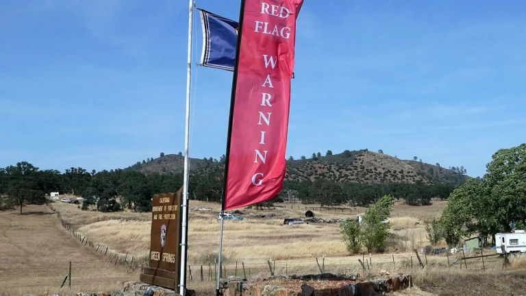
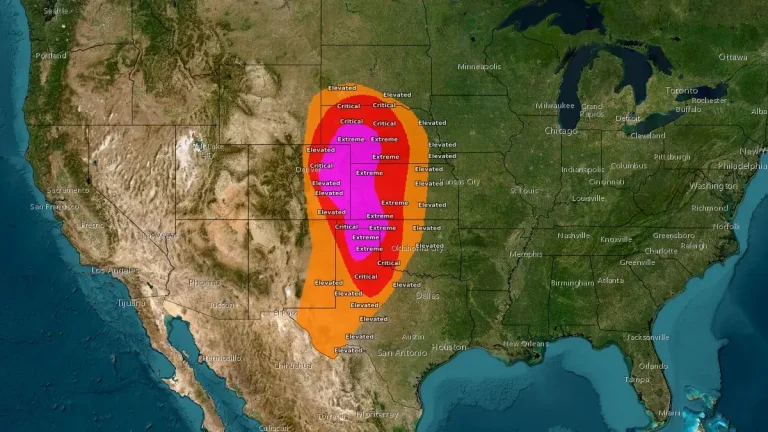
• Red Flag Warning issued in parts of Alaska due to lightning threat

    A Red Flag Warning remains in effect across large parts of Interior Alaska until 22:00 AKDT (06:00 UTC June 22) on June 21, 2026. Scattered thunderstorms capable of producing lightning along with low humidity, hot temperatures, and gusty winds to create critical fire weather conditions in the region.

  • Fire Weather Watches issued, SPC forecasts Critical conditions across parts of Nevada and Oregon

    Critical fire weather conditions are forecast across a corridor from northwestern Nevada into southeastern Oregon on Monday afternoon, May 25, with sustained southwesterly winds of 32–40 km/h (20–25 mph), minimum RH of 10–15%, and recent fire activity showing fuels becoming more receptive to wildfire spread. NWS offices issued Fire Weather Watches for parts of northern Nevada, northeastern California, and the West Humboldt Basin for Monday afternoon and evening.

  • SPC warns of Critical fire weather conditions across eastern Montana and west-central North Dakota

    The NWS Storm Prediction Center (SPC) issued a Critical fire weather forecast for parts of eastern Montana into west-central North Dakota valid from 12:00 UTC on May 11 through 12:00 UTC on May 12, 2026, as multiple National Weather Service offices warned that strong winds, low humidity, dry fuels, and frontal wind shifts would support rapid wildfire spread across parts of the northern and central Plains.

  • Red Flag Warnings issued from the Plains to the Southeast under critical fire weather conditions

    Red Flag Warnings are in effect across the Central Plains and Southeast United States on March 28, 2026, as the National Weather Service (NWS) warns of critical fire weather conditions driven by strong winds, low relative humidity, and dry fuels. Wind gusts up to 80 km/h (50 mph) and humidity levels as low as 10–20% are expected to promote rapid fire ignition and spread. Outdoor burning is strongly discouraged across all warned regions.

  • Extreme and Critical fire weather trigger widespread Red Flag Warnings across Plains and Front Range

    Extremely critical fire weather conditions developed across parts of eastern Colorado, western Kansas, and the Texas and Oklahoma Panhandles on February 17, 2026, as a strengthening storm system produced very strong winds and exceptionally low humidity. Wind gusts locally exceeded 95 km/h (60 mph), while afternoon relative humidity values fell into the single digits. The Storm Prediction Center issued an Extremely Critical Fire Weather Outlook, and multiple National Weather Service offices posted Red Flag Warnings, including Particularly Dangerous Situation designations in some counties.

  • Red Flag Warning in effect across Denver area as Xcel prepares for power outages

    Strong winds and very low humidity prompted the National Weather Service to issue a Red Flag Warning across Colorado’s Front Range on October 20 2025, creating critical fire-weather conditions and an increased risk of power disruptions. Xcel Energy warned customers in the Denver metropolitan area of potential outages and activated Enhanced Powerline Safety Settings (EPSS), which increase system sensitivity to prevent wildfire ignition during extreme weather.