
Red Flag Warning in effect across Denver area as Xcel prepares for power outages
Strong winds and very low humidity prompted the National Weather Service to issue a Red Flag Warning across Colorado’s Front Range on October 20, 2025, creating critical fire-weather conditions and an increased risk of power disruptions. Xcel Energy warned customers in the Denver metropolitan area of potential outages and activated Enhanced Powerline Safety Settings (EPSS), which increase system sensitivity to prevent wildfire ignition during extreme weather.
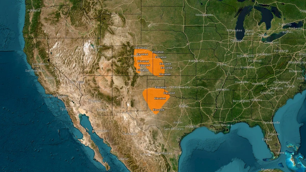
Critical Fire Weather ending 14:00 EDT on October 21, 2025. Credit: NWS
Red Flag Warning is in effect from 11:00 to 18:00 MDT (17:00–00:00 UTC) on Monday, October 20 for Jefferson, Douglas, Boulder, Broomfield, Adams, Denver, Arapahoe, Elbert, Lincoln and Washington counties, according to the National Weather Service (NWS).
Forecasts call for northwest winds of 40–55 km/h (25–35 mph) with gusts up to 80 km/h (50 mph) and relative humidity near 15 percent. The conditions are conducive to rapid fire spread and may affect power-distribution infrastructure across the metro area and adjacent plains.

Xcel Energy said on Sunday evening, October 19 that it would not proceed with proactive Public Safety Power Shutoffs (PSPS) after updated forecasts showed slightly lower wind speeds. However, the company warned that “extreme weather conditions” could still cause unplanned outages as winds interact with power lines and vegetation.
“Temporarily shutting off power … is not a step taken lightly and is only used when other methods are not enough to help prevent wildfires,” officials said. Under the EPSS protocol, power lines are configured to shut off automatically if they detect contact with vegetation or equipment faults. Electricity remains off until field crews complete visual inspections and confirm that it is safe to re-energize the circuit. This process increases wildfire safety but can extend outage durations.
Crews are being positioned throughout service areas in northern Colorado to patrol and restore power if needed. Customers are advised to prepare for possible interruptions by assembling outage kits with flashlights, batteries, food, water, and essential medications. Those using medical equipment requiring electricity are encouraged to develop a backup plan.
The Red Flag Warning also includes foothill and eastern plains counties. Winds over higher terrain may exceed 105–120 km/h (65–75 mph), while mountain areas above 3 000 m (10 000 feet) could experience localized snow showers. The NWS expects elevated to critical fire-weather conditions to continue through Tuesday, October 21, with humidity forecast to increase mid-week.
This warning follows an increased focus on power-line safety across Colorado since several utilities, including Xcel Energy, faced wildfire-liability scrutiny after the 2021 Marshall Fire. Since then, the company has expanded vegetation management, grid hardening, and the use of automatic shut-off systems during periods of extreme weather.
Residents are urged to avoid outdoor burning or any activity that could generate sparks and to monitor official updates from Xcel Energy and the NWS for any changes to forecasts or outage areas.
References:
1 URGENT – FIRE WEATHER MESSAGE – NWS Denver/Boulder – October 19, 2025
2 Xcel prepares for possible power outages in Denver area, Larimer County Monday due to high wind, fire risk – CBS – October 19, 2025

Teo Blašković founded The Watchers in 2011 and edited it until 2026, covering seismic and volcanic activity, extreme weather, space weather and near-Earth objects. Articles on this page are his archive.
Earlier reporting
Nothing on Watchers was published in the last 24 hours. These are older articles.
- On October 22, 2017, a single flash of lightning stretched 515 miles from eastern Texas to near Kansas City, a distance that takes eight hours to drive, and nobody realized how far it had gone until scientists went back through the satellite data years later Epicenter
- CPC posts a slight risk of heavy rain from the Gulf Coast to the Northeast urban corridor November 25-29, and a moderate risk of West Coast wind and Sierra snow on November 25
- Florida's east coast faces a moderate flash flood risk Wednesday through Friday, with 4 to 8 inches of rain forecast and the St. Johns River near Cocoa already in major flood at 17.13 feet
- Cyclone Akvan to make landfall between Nellore and Visakhapatnam around noon on November 20, IMD forecasts 120-130 km/h winds gusting to 145
