
Moderate risk of excessive rainfall issued for I-95 corridor from Washington D.C. to New Jersey
Heavy to excessive rainfall and severe thunderstorms are expected across parts of the Mid-Atlantic and the Northeast on July 31, 2025, as a slow-moving cold front interacts with favorable upper jet dynamics and anomalous moisture.

Convective Outlook for July 31, 2025. Credit: NWS
A slow-moving cold front, supported by favorable upper jet dynamics, sufficient instability, and anomalous moisture, is expected to produce heavy to excessive rainfall and potentially severe thunderstorms over parts of the Mid-Atlantic and the Northeast.
A Moderate Risk (level 3/4) of excessive rainfall has been issued for the I-95 corridor between Washington D.C. and northern New Jersey for July 31.
The Storm Prediction Center (SPC) has issued a Slight Risk (level 2/5) of severe thunderstorms for nearly the same region.
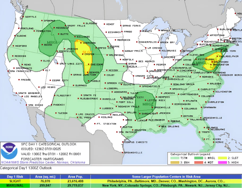
The warning area includes Washington D.C., Annapolis, Baltimore, Wilmington, and Philadelphia. Thunderstorms are forecast to bring rainfall rates of up to 80 mm (3 inches) per hour in the affected areas.
Localized rainfall totals are expected to reach 150 mm (6 inches), with significant flash flooding likely between northern Virginia and New Jersey.


I am an Assistant Editor and Severe Weather & Science Journalist at The Watchers, specializing in real-time severe weather coverage, geophysical event reporting, and research-driven scientific analysis. You can reach me at rishav(at)watchers(.)news.
Commenting rules and guidelines
We value the thoughts and opinions of our readers and welcome healthy discussions on our website. In order to maintain a respectful and positive community, we ask that all commenters follow these rules.