
Magma accumulation approches critical volume at Svartsengi, Iceland
Magma continues accumulating beneath Svartsengi at a rate nearing the levels observed before the previous eruption. Deformation measurements confirm ongoing ground uplift, with geophysical models estimating that the subsurface magma volume is approaching the threshold associated with past magma intrusions.
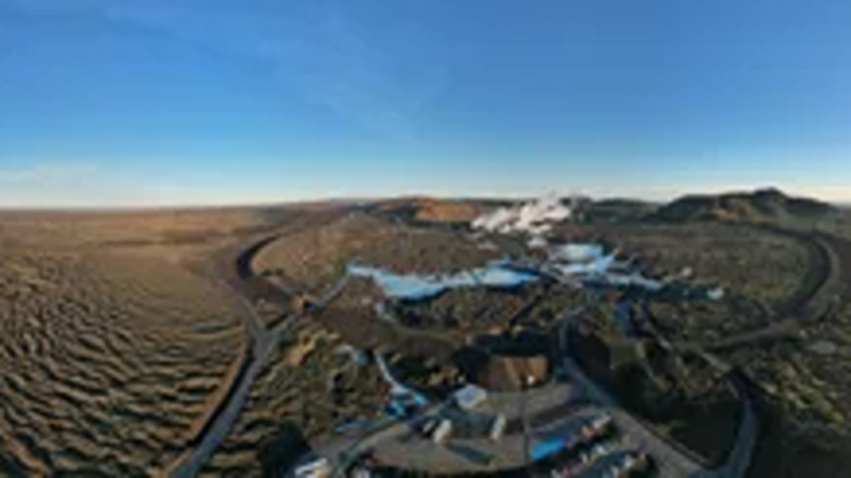
Protective barriers surrounding the Svartsengi area in early November 2024. Image credit: IMO / Bjarki Kaldalóns Friis
Deformation measurements indicate sustained ground uplift in the Svartsengi region which is consistent with patterns seen before past eruptions.
Modeling calculations estimate that the magma accumulating beneath the area is nearing the amount drained during the last eruption on December 9, 2024. If this trend continues, the probability of a new magma intrusion and subsequent eruption will rise in the coming weeks.
Scientists analyzing previous events have found that once a similar volume of magma builds up, intrusion events tend to occur, often followed by an eruption.
The overall earthquake count remains relatively low while seismic activity in the Sundhnúkar fissure system has been increasing slowly since December 9, 2024, suggesting that the next eruption might not be preceded by seismic activity.
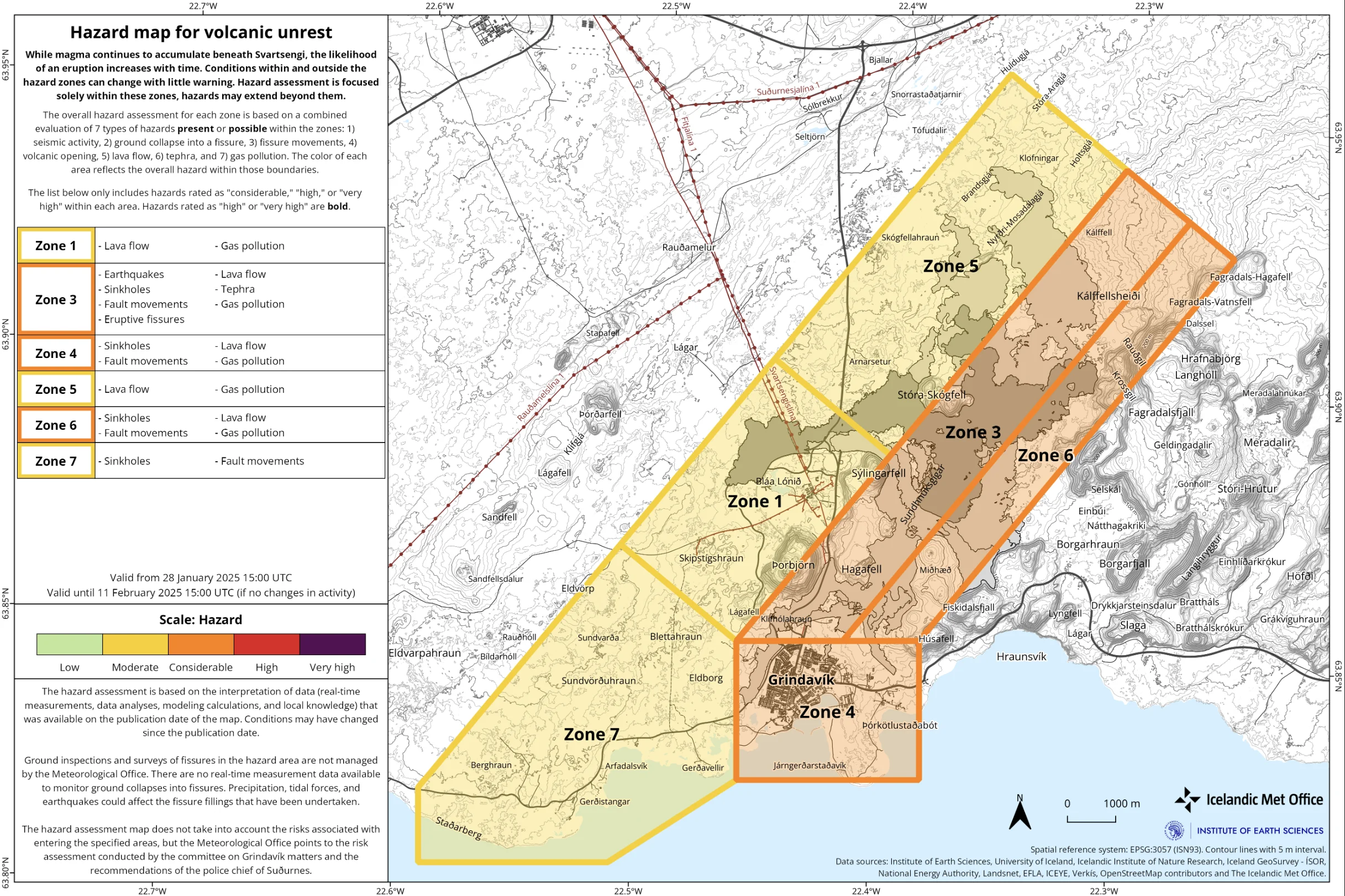
The updated hazard assessment from the IMO reflects the growing magma volume beneath Svartsengi.
Based on magma inflow rates, experts estimate that the subsurface magma volume could reach 12 million m3 (424 million feet3) by late January and potentially 13.5 million m3 (477 million feet3) by early February.
The estimates align with the amount of magma involved in the intrusion event on November 20, 2024, suggesting that conditions for another magma intrusion are becoming increasingly favorable.
The Icelandic Meteorological Office (IMO) has raised the hazard level in Zones 4 and 6 from moderate (Yellow) to considerable (Orange), and adverse weather conditions in the coming days may impact monitoring capabilities. The updated hazard assessment is valid until February 11 unless developments occur.
Starting January 30, extreme weather conditions are expected to impact southern and western Iceland. Forecasts predict a strong southern storm bringing heavy rain, rising temperatures, and drizzle, which could persist throughout the week. These conditions may reduce the sensitivity of monitoring equipment, potentially delaying the detection of magma movements or early eruption signals.
Although some seismic activity has been recorded in the Sundhnúkar fissure system, the number of earthquakes preceding magma intrusions has declined over the past year. This suggests that the next eruption could occur with minimal warning. Historical data shows that with each new intrusion, seismic signals have become less pronounced, reinforcing concerns that an eruption could happen with little to no preceding earthquake activity.
As of January 14, the IMO reported continued land uplift in the Svartsengi area, maintaining a similar rate to previous weeks. At that time, estimates suggested that magma accumulation beneath Svartsengi would reach approximately 12 million m3 by late January. The volume matches the threshold linked to previous eruptions, indicating an increased probability of a new magma intrusion and potential eruption.
Geodetic models show that the magma inflow rate is currently just over 3 m3/s (105.9 feet3/s), aligning with pre-eruption inflow rates observed before the December 9, 2024, event. Small fluctuations in magma inflow could influence intrusion timing but the overall trend points to an increased likelihood of an intrusion by early February.
While the overall hazard level in Zone 6 was previously downgraded to moderate (yellow) because of reduced lava flow risks, the existing lava field remains dangerous. High residual temperatures make the area unsafe for hikers and authorities continue to warn against attempting to cross these hazardous terrains.
Aside from the Sundhnúkar region, some seismic activity has been detected near Eldey on the Reykjanes Ridge. Between December 29 and 31, approximately 200 earthquakes, including 2 above M3.0 were recorded in that area. In the past 4 years, nearly 60 earthquakes above M3.0 have occurred near Eldey, making it a region of ongoing tectonic interest.
Minor earthquakes continue to be detected in the western part of Fagradalsfjall, with over 60 recorded in the past month at depths between 6 and 8 km (3.7 and 5 miles). While these seismic events are unrelated to the current Sundhnúkar activity, they indicate continued geophysical movement in the region.
References:
1 Increasing likelihood of a new eruption on the Sundhnúkar crater row – IMO – January 28, 2025

Rishika holds a Master’s in International Studies from Stella Maris College, Chennai, India, where she earned a gold medal, and an MCA from the University of Mysore, Karnataka, India. Previously, she served as a Research Assistant at the National Institute of Advanced Studies, Indian Institute of Science, Bengaluru, India. During her tenure, she contributed as a Junior Writer for Europe Monitor on the Global Politics website and as an Assistant Editor for The World This Week. Her work has also been published in The Hindu newspaper, showing her expertise in global affairs. Rishika is also a recipient of the Women Empowerment Award at the district level in Haryana, India, in 2022.
Commenting rules and guidelines
We value the thoughts and opinions of our readers and welcome healthy discussions on our website. In order to maintain a respectful and positive community, we ask that all commenters follow these rules.