
Magma accumulation beneath Svartsengi now largest since eruption sequence began, Iceland
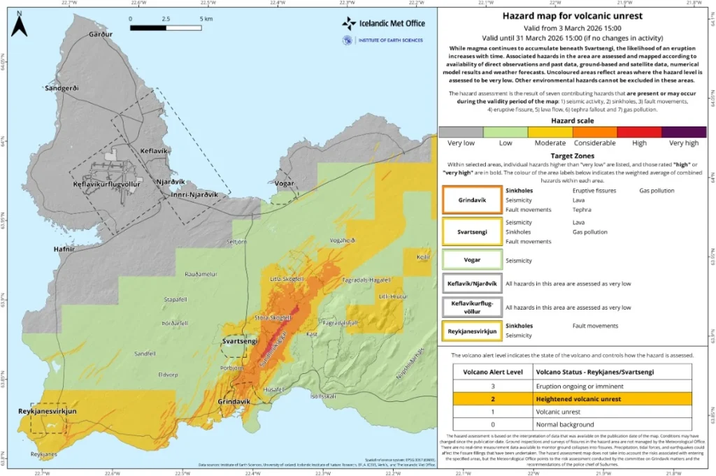
More than 23 million m³ (812 million feet³) of magma have accumulated beneath the Svartsengi volcanic system on Iceland’s Reykjanes Peninsula since the July 2025 eruption. Monitoring data released March 17, 2026, by the Icelandic Meteorological Office show this is the largest magma accumulation between eruptions since activity began on the Sundhnúksgígar crater row in December 2023. The official hazard assessment for the area remains unchanged and is valid until March 31.
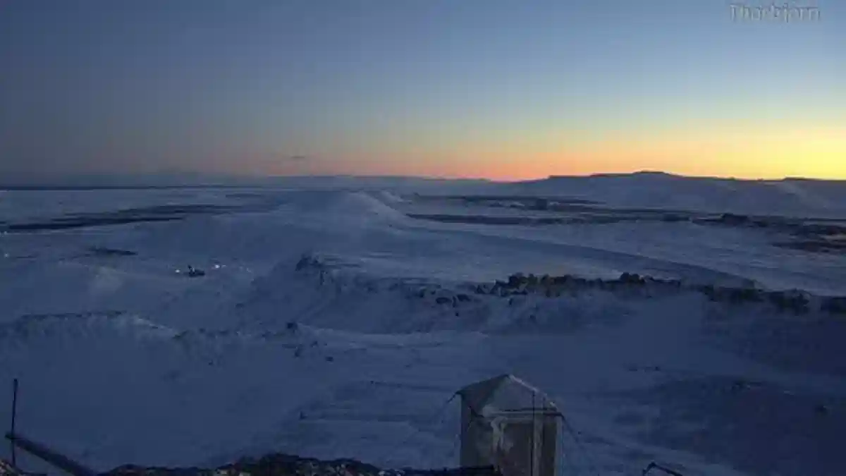
The eruption site as they appeared in a webcam located in Þorbjörn in the morning of October 20, 2025. The lights in Svartsengi can be seen on the left side of the picture. Credit: Veðurstofa Íslands
More than 23 million m³ (about 812 million cubic feet) of magma have accumulated beneath the Svartsengi volcanic system on the Reykjanes Peninsula, Iceland, since the July 2025 eruption.
Monitoring data released March 17 by the Icelandic Meteorological Office (IMO) indicates that this is the largest magma accumulation recorded between eruptions since the Sundhnúksgígar eruption sequence began in December 2023.
Deformation measurements show that magma inflow beneath Svartsengi has continued at a slow but steady rate in recent months. Model calculations place the magma accumulation zone at a depth of about 4 km (2.5 miles) below the surface.
The current magma recharge phase has now lasted approximately 224 days since the end of the last eruption, making it the longest continuous accumulation period recorded during the present eruption sequence.
The volume of magma stored beneath Svartsengi now exceeds the levels measured before several previous eruptions in the sequence. If magma continues to accumulate and pressure increases within the system, the most likely development remains a magma intrusion from Svartsengi toward the Sundhnúksgígar crater row, potentially producing a new fissure eruption.
The most probable location of a future fissure is between Stóra-Skógfell and Sýlingarfell, where multiple eruptions have occurred since December 2023. However, the zone where fissures could open may extend across a wider area, from Grindavík in the south toward areas northwest of Keilir.
Because the current magma volume is larger than that of earlier eruptions in this sequence, a future eruption could be more extensive if a significant portion of the stored magma reaches the surface.
Seismic activity above the dyke intrusion remains low. Most earthquakes detected in the area are small events generally below M1.5.
Microearthquake activity continues near Vík. These earthquakes are interpreted as trigger events caused by regional stress changes associated with magma movement beneath the Reykjanes Peninsula rather than direct magma intrusion beneath Vík.
Ground deformation measurements show that land uplift at Svartsengi since the onset of volcanic unrest in late 2023 now exceeds about 1 m (3.3 feet). The uplift rate was highest early in the unrest but has gradually slowed during successive eruptive cycles.
Monitoring data also show continued seismic activity and ground deformation near Krýsuvík and west of Lake Kleifarvatn. That area has experienced earthquake swarms and measurable subsidence since mid-2025. Current interpretations link this activity to regional stress adjustments associated with magma intrusions elsewhere on the Reykjanes Peninsula.
Model calculations show that magma accumulation beneath Svartsengi between eruptions since March 2024 has generally ranged between about 17 million and 23 million m³ (600–812 million cubic feet) before a new magma intrusion or eruption begins.
IMO is conducting additional analysis of possible scenarios for future volcanic activity in the area. Results of this work are expected later in March.
Scientists note that the long pause since the last eruption does not indicate that the eruption sequence on the Sundhnúksgígar crater row has ended. Previous eruptions in the sequence were preceded by extended periods of magma accumulation.
The official hazard assessment issued by IMO remains unchanged and valid until March 31, while monitoring of seismic activity, ground deformation, and magma movement continues across the Reykjanes Peninsula.
References:
1 Kvikusöfnun undir Svartsengi orðin meira en 23 milljónir rúmmetra frá síðasta eldgosi – Veðurstofa Íslands – March 17, 2026

I’m a science journalist and researcher at The Watchers, contributing to the Epicenter edition, where I cover peer-reviewed scientific research and emerging discoveries across Earth and space sciences. With a background in astronomy and a passion for environmental science, I’ve worked in shark and coral conservation in Fiji, conducting reef and shark-behavior research, contributing to mangrove restoration, and earning PADI Open Water and Coral Reef Certifications. I bring a blend of scientific rigor and storytelling to illuminate the discoveries shaping our planet and beyond.
Commenting rules and guidelines
We value the thoughts and opinions of our readers and welcome healthy discussions on our website. In order to maintain a respectful and positive community, we ask that all commenters follow these rules.