
Strong and shallow M6.2 earthquake hits the Gulf of California
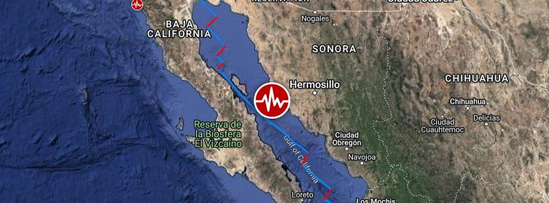
Image credit: TW/SAM, Google
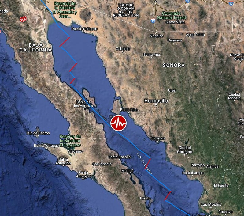
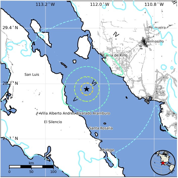
A strong and shallow earthquake, registered by the USGS as M6.2, hit the Gulf of California at 10:02 UTC on November 4, 2022. The agency is reporting a depth of 10 km (6.2 miles). EMSC is reporting M6.1 at a depth of 30 km (18.6 miles).
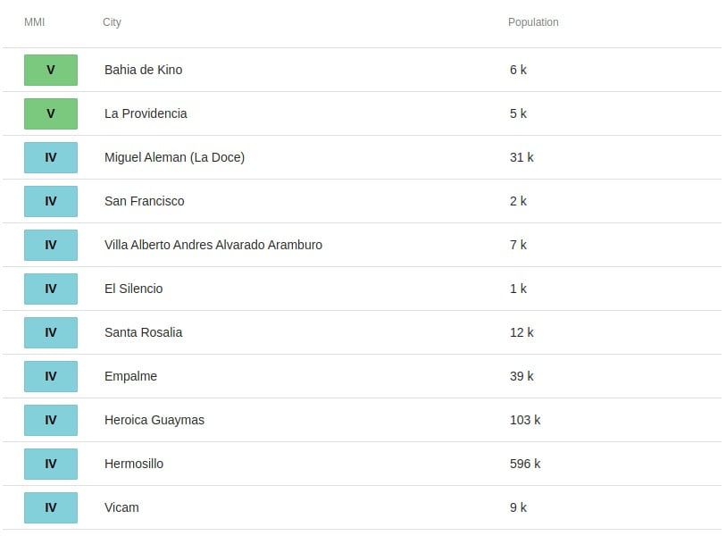
The epicenter was located about 83.5 km (51.9 miles) SSW of Bahía de Kino (population 6 050), Mexico and 89.2 km (55.4 miles) N of Santa Rosalía (population 11 7656), Mexico.
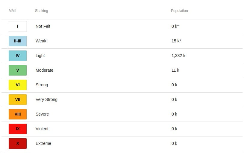
11 000 people are estimated to have felt moderate shaking and 1 332 000 light.
The USGS issued a Green alert for shaking-related fatalities and economic losses. There is a low likelihood of casualties and damage.
Overall, the population in this region resides in structures that are a mix of vulnerable and earthquake-resistant construction. The predominant vulnerable building types are mud wall and adobe block with concrete bond beam construction.
Estimated population exposure to earthquake shaking
Selected cities exposed
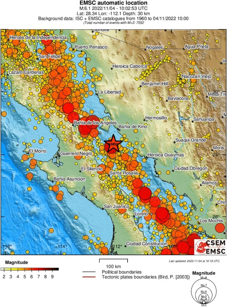
Regional seismicity
I'm a dedicated researcher, journalist, and editor at The Watchers. With over 20 years of experience in the media industry, I specialize in hard science news, focusing on extreme weather, seismic and volcanic activity, space weather, and astronomy, including near-Earth objects and planetary defense strategies. You can reach me at teo /at/ watchers.news.
Commenting rules and guidelines
We value the thoughts and opinions of our readers and welcome healthy discussions on our website. In order to maintain a respectful and positive community, we ask that all commenters follow these rules.