
M 6.0 earthquake hit Gulf of California
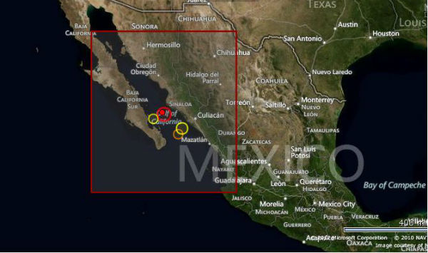
Image credit: TW
Earthquake M6.0 hit Gulf of California on October 08, 2012 at 06:26:22 UTC. The epicenter was located 93 km (58 miles) SSW (209°) from Ahome, Sinaloa and Los Mochis, Sinaloa, Mexico (25.182°N, 109.622°W) at depth of 10.1 km (6.3 miles) according to USGS.
EMSC recorded M5.7 at same depth.

The epicenter was in the sea and similar strong earthquakes before didn’t generated any serious damage.


Published in the last 24 hours
- A fog linked to about 12 000 excess deaths in London in 1952 puzzled scientists for decades, until researchers reconstructed how coal smoke formed acidic haze Epicenter
- In 2012, cameras filming a thunderstorm in western China caught ball lightning by accident, and its 1.64-second glow carried iron, silicon, and calcium from the soil it rose out of Epicenter
- Strong El Niño reinforces above-normal winter precipitation outlook across southern and eastern U.S.

THIS EARTHQUAKE WAS WARNED BUT IGNORED AS USUAL:
To: undisclosed recipients
Sent: Sunday, 30 September 2012 2:38 PM
Subject: MEXICO NORTH – BAJA / GULF OF CALIFORNIA
Dear Experts,
With the continuing / prevailing every individual weather changes in N Mexico, earthquakes will be followed in 10-15 days subsequently in Baja / Gulf of California.
With Thanks&Regards
S.Prakash
ASNT NDT Level III (MT,PT,RT,UT,VT)
Tamilnadu
INDIA
00919443922723