
Taal volcano alert status raised to Alert Level 2 (increasing unrest), Philippines
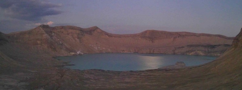
Featured image: Taal volcano on February 11, 2021. Credit: PHIVOLCS
The Philippine Institute of Volcanology and Seismology (PHIVOLCS) has raised the alert status of Taal volcano from Alert Level 1 (low level of unrest) to Alert Level 2 (increasing unrest) on March 9, 2021.
Since February 13, 2021, the volcano has been exhibiting increased unrest based on the following monitoring parameters:
Volcanic earthquakes:
The Taal Volcano Network (TVN) recorded a total of 28 volcanic tremor episodes, 4 low-frequency volcanic earthquakes (LFVQs), and 1 hybrid earthquake at shallow depths of less than 1.5 km (0.93 miles) beneath Taal Volcano Island or TVI in 24 hours to midnight UTC, March 9.
Volcanic tremors have increased seismic energy compared to previously recorded episodes and ranged between 3 to 17 minutes in duration.
The total number of volcanic tremor events has risen to 866 since the onset of increased activity on February 13.
In addition to these, a total of 141 LFVQs have occurred at depths within 1 km (0.62 miles) beneath TVI and immediate vicinities. Overall, seismic activity in the past month indicates increased magmatic and hydrothermal activity at shallow depths beneath TVI.
Changes in the Main Crater Lake (MCL):
Survey observations in mid-February 2021 recorded a temperature high of 74.6 °C (166 °F) and continuing increase in acidity to pH 1.59 from a pH of 2.79 in January 2020 of the MCL.
Increasing acidity is caused by sustained volcanic gas input into the shallow hydrothermal system that feeds into the lake, signifying degassing of magma intruded at depth during the January 2020 eruption.
Ground deformation:
Integrated real-time ground tilt and continuous GPS and daily Electronic Distance Measurement (EDM) monitoring and Interferometric SAR (InSAR) data analysis indicate ongoing slight deformation of TVI centered on a pressure source on its southeast sector.
Continuous GPS and InSAR data further yield very slow but steady inflation and/or expansion of the Taal region since the end of the 2020 eruption, at very much slower and stabilized rates compared to deformation before and right after the eruption.
Microgravity changes:
Campaign surveys have measured positive microgravity changes across Taal Caldera after the 2020 eruption consistent with density changes caused by magma migration, magma degassing and hydrothermal activity.
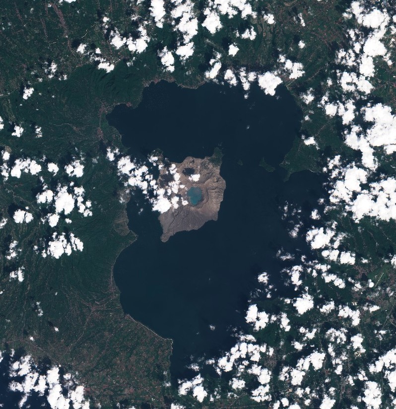
Taal volcano on February 26, 2021. Credit: Copernicus EU/Sentinel-2, TW
In view of the above, PHIVOLCS has raised the alert status of Taal from Alert Level 1 to Alert Level 2.
"This means that there is a probable magmatic activity that may or may not lead to an eruption," PHIVOLCS experts said.
At Alert Level 2, evacuation is not yet recommended. However, the public is reminded that Taal Volcano Island is a Permanent Danger Zone (PDZ) and that entry into TVI, especially the vicinities of the Main Crater and the Daang Kastila fissure, must remain strictly prohibited.
Local government units have been advised to continuously assess previously evacuated barangays around Taal Lake for damages and road accessibilities and to strengthen preparedness, contingency, and communication measures in case of renewed unrest.
Residents of these barangays are advised to be always prepared, to keep calm, and listen to information only from trusted or verified sources.
Civil aviation authorities advised pilots to avoid flying close to the volcano as airborne ash and ballistic fragments from sudden explosions and wind-remobilized ash may pose hazards to aircraft.
Disaster response officials have ordered the evacuation of residents living near the volcano on February 16, 2021.
Taal erupted in January 2020 for the first time in decades, ejecting volcanic ash up to 16.7 km (55 000 feet) above sea level and affecting the lives of at least 500 000 people.
Geological summary
Taal is one of the most active volcanoes in the Philippines and has produced some of its most powerful historical eruptions. Though not topographically prominent, its prehistorical eruptions have greatly changed the topography of SW Luzon.
The 15 x 20 km (9 x 12 feet) Talisay (Taal) caldera is largely filled by Lake Taal, whose 267 km2 (103 mi2) surface lies only 3 m (9.8 feet) above sea level.
The maximum depth of the lake is 160 m (525 feet), and several eruptive centers lie submerged beneath the lake. The 5 km (3.1 miles) wide Volcano Island in north-central Lake Taal is the location of all historical eruptions.
The island is composed of coalescing small stratovolcanoes, tuff rings, and scoria cones that have grown about 25% in the area during historical time. Powerful pyroclastic flows and surges from historical eruptions have caused many fatalities. (GVP)
I'm a dedicated researcher, journalist, and editor at The Watchers. With over 20 years of experience in the media industry, I specialize in hard science news, focusing on extreme weather, seismic and volcanic activity, space weather, and astronomy, including near-Earth objects and planetary defense strategies. You can reach me at teo /at/ watchers.news.
Commenting rules and guidelines
We value the thoughts and opinions of our readers and welcome healthy discussions on our website. In order to maintain a respectful and positive community, we ask that all commenters follow these rules.