
Shallow M6.2 earthquake hits the State of Yap, Federated States of Micronesia

Image credit: TW/SAM, Google
A strong and shallow earthquake registered by the USGS as M6.2 hit the State of Yap, Federated States of Micronesia at 18:16 UTC on July 6, 2020. The agency is reporting a depth of 12.4 km (7.7 miles). EMSC is reporting M6.3 at a depth of 10 km (6.2 miles).
The epicenter was located 254.8 km (158 miles) N of Fais and 364.2 km (225.8 miles) NE of Colonia, Micronesia.
There are no people living within 100 km (62 miles).
The USGS issued a green alert for shaking-related fatalities and economic losses. There is a low likelihood of casualties and damage.
This earthquake poses no tsunami risk.
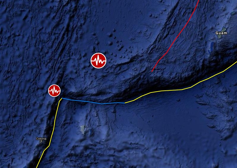
Image credit: TW/SAM, Google
Regional seismicity


Teo Blašković founded The Watchers in 2011 and edited it until 2026, covering seismic and volcanic activity, extreme weather, space weather and near-Earth objects. Articles on this page are his archive.
Earlier reporting
Nothing on Watchers was published in the last 24 hours. These are older articles.
- M6.6 earthquake hits the Banda Sea 148 km west-southwest of Tual, Indonesia, at 68 km depth, USGS issues Green alert
- On October 22, 2017, a single flash of lightning stretched 515 miles from eastern Texas to near Kansas City, a distance that takes eight hours to drive, and nobody realized how far it had gone until scientists went back through the satellite data years later Epicenter
- CPC posts a slight risk of heavy rain from the Gulf Coast to the Northeast urban corridor November 25-29, and a moderate risk of West Coast wind and Sierra snow on November 25
- Florida's east coast faces a moderate flash flood risk Wednesday through Friday, with 4 to 8 inches of rain forecast and the St. Johns River near Cocoa already in major flood at 17.13 feet
