
Intense winter thunderstorm produces 313 000 strikes over Western Australia’s South West
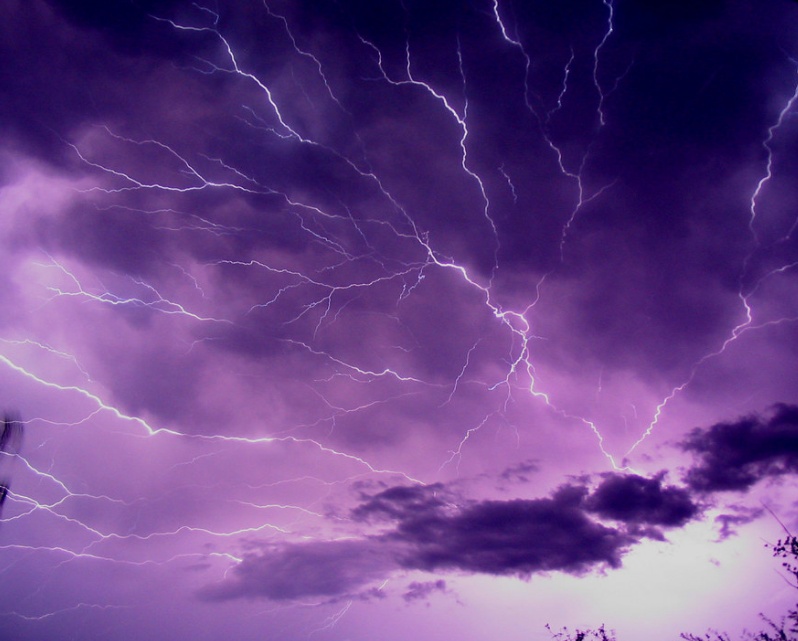
Image credit: Brandon Morgan/Unsplash
More than 313 000 lightning strikes were recorded across Western Australia's South West region in 12 hours to 19:00 LT on Sunday, July 5, 2020. Up to 40 000 were recorded in just 60 minutes. Residents of capital Perth witnessed 22 000 strikes within 12 hours, and of those 250 ground strikes over the city. Such thunderstorms are normal in spring and summer, but not in winter.
According to the Bureau of Meteorology (BOM), the strikes were recorded between 23:00 UTC on July 4 to 11:00 UTC on July 5 (07:00 to 19:00 LT on July 5).
BOM's Pete Clegg said it affected the broader South West region, from Jurien Bay through to Busselton. "It was a very active lightning system, with prolonged lightning activity."
There were between 30 000 to 40 000 strikes across WA between 18:30 to 19:30 LT alone.
"It’s not the first time we have seen something like this," Clegg continued, "but it is definitely a specific set of environmental conditions the lead to this kind of very active lightning situation."
Heavy rainfalls hit WA as well, with the South West bearing the brunt of the wold weather. Witchcliffe near Margaret River recorded 52.8 mm (2.1 inches), while Bunbury received 26 mm (1 inch).
Perth really turned it on last night, who else loves a good lightning storm?
Happy Monday, set some goals & smash them this week! pic.twitter.com/KxjLCTjgKD
— Pentanet Perth Powered Internet (@Pentanet_ISP) July 6, 2020
What a show! #Lightning #WAstorm #PerthStorm #perthlightning #perthnews #perthweather pic.twitter.com/L8oRx5hhha
— jessica zoe allen (@jessicazoeallen) July 6, 2020
Here's another stunner from the storm last night.
Photo by Devon-Daliah McNeill@10NewsFirstPER #perthlightning #perthstorm #perthnews #perthweather pic.twitter.com/UjlO4wQpEi— Lee Steele (@LeeSteele_) July 6, 2020
Thunderstorms were widespread across southwestern Australia on Sunday night, with over 50,000 lightning strikes detected within 100km of #Perth.
Full story at https://t.co/MmoAq1ox8N
Photo via Instagram: coen_87 at Burns Beach, WA.#PerthWeather #WAweather pic.twitter.com/1bFu1cKj8S
— Weatherzone (@weatherzone) July 6, 2020
Here is a couple from tonight's weather in Perth
.
.
.
.#weather #justanotherdayinWA #severeweather #extremeweather #Australia #storms #rainfall #perth #perthisok #yeeew #perthweather #Weatherchannel #lightning #Weathercloud #weatherunderground #weatherphotography #canonphoto pic.twitter.com/IOm1Yia1hO— Bedford weather (@BedfordAWS) July 5, 2020
In Perth, the southern suburbs were hit hardest, with Mandurah recording 16.4 mm (0.6 inches).
Emergency services accommodated six calls for help overnight but no major damage was reported.
The thunderstorm warning issued on July 5 is now canceled, but the wet weather is forecast to last until at least Wednesday, July 8.
As of July 6, BOM reported that thunderstorms with gusty winds are "firing up along the trough as the cold front moves eastwards through the Goldfields towards Kalgoorlie."
Commenting rules and guidelines
We value the thoughts and opinions of our readers and welcome healthy discussions on our website. In order to maintain a respectful and positive community, we ask that all commenters follow these rules.