
Tropical Cyclone “Harold” heading toward Fiji
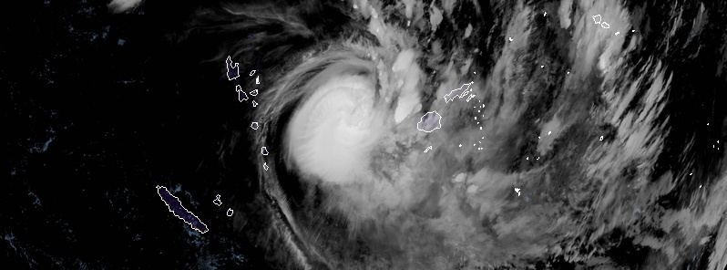
Featured image: Tropical Cyclone "Harold" at 07:20 UTC on April 7, 2020. Credit: JMA/Himawari-8, RAMMB/CIRA
After wreaking havoc across Vanuatu, Severe Tropical Cyclone "Harold" is now heading toward Fiji where the country's disaster management office has activated its national emergency operations center.
At 09:00 UTC on April 7, Category 4 Severe Tropical Cyclone "Harold" had central pressure of 945 hPa and was located about 490 km (304 miles) W of Nadi and 590 km (366 miles) WNW of Kadavu, according to the RSMC Nadi Special Weather Bulletin No. 8.
The cyclone was moving ESE at about 22 km/h (13 mph) with maximum sustained winds of 195 km/h (120 mph).
A Hurricane Warning remains in force for Kadavu and Ono-i-lau.
A Storm Warning remains in force for Vatulele, southern parts of Viti Levu [from Momi through to Pacific Harbour], Beqa, Moal, Matuku, Totoya and Vanuavatu.
A Gale Warning remains in force for the rest of Viti Levu, Yasawa and Mamanuca group, Loma Viti group and the rest of the southern Lau group including Lakeba and Cicia.
A Strong Wind Warning remains in force for the rest of Fiji.
A Damaging Heavy Swell Warning remains in force for Yasawa and Mamanuca group, western and southern coast of Viti Levu, Vatulele, Beqa, Kadavu, Moala group and southern Lau group.
A Heavy Rain Warning remains in force for the Fiji group.
A Flash Flood Warning remains in force for low lying areas and small streams within the Rakiraki catchment.

Tropical Cyclone "Harold" at 07:20 UTC on April 7, 2020. Credit: JMA/Himawari-8, RAMMB/CIRA

Image credit: RSMC Nadi
On this track, Harold's center is expected to be about 80 km (50 miles) E of Ono-i-lau, 150 km (93 miles) SSW of Nadi, 160 km (100 miles) W of Kadavu and 200 km (124 miles) SSE of Matuku at 21:00 UTC on April 7.
Damaging winds are likely to begin a few or several hours before the center passes nearby.


Tropical Cyclone "Harold" at 07:20 UTC on April 7, 2020. Credit: JMA/Himawari-8, RAMMB/CIRA
Kadavu and Ono-I-lau:
Moderate to fresh northerly winds increasing to strong with average wind speeds of 50 km/h (31 mph) from later today (LT). Winds increasing to damaging gale force winds with speeds of 85 km/h (55 mph) with momentary gusts to 120 km/h (75 mph) from tomorrow morning. Winds increasing further to very destructive hurricane force winds with speeds up to 170 km/h (105 mph) and momentary gusts to 240 km/h (150 mph) from mid-morning tomorrow. Occasional rain and few thunderstorms with isolated heavy falls. Rain becoming frequent and heavy with squally thunderstorms from later today. Damaging heavy swells with sea flooding of low lying coastal areas expected during high tides, with storm surge heights up to 2 m (6.5 feet) especially over Ono-I-lau expected along the coasts when centre passes nearby.
Vatulele:
Southern parts of Viti Levu [from Momi through to Pacific Harbour], Beqa, Moala, Matuku, Totoya, and Vanuavatu: moderate to fresh northerly winds increasing to strong with average wind speeds of 50 km/h (31 mph) from later today. Winds increasing to damaging gale force winds with speeds of 85 km/h (55 mph) with momentary gusts to 120 km/h (75 mph) from early tomorrow morning (LT). Winds increasing further to destructive storm force winds with speeds up to 110 km/h (70 mph) and momentary gusts to 155 km/h (95 mph) from mid morning tomorrow. Occasional rain and few thunderstorms with isolated heavy falls. Rain becoming frequent and heavy with squally thunderstorms from later today. Damaging heavy swells with sea flooding of low lying coastal areas expected during high tides, with storm surge heights up to 2 m (6.5 feet) expected along the coasts when centre passes nearby.
Viti Levu, Yasawa and Mamanuca group, Lomaiviti group and the rest of the southern Lau group including Lakeba and Cicia:
Expect moderate to fresh northerly winds. Winds increasing to strong with average wind speeds of 50 km/h (31 mph) from later today. Winds may further increase to damaging gale force winds with average speeds up to 85 km/h (55 mph) and momentary gusts to 120 km/h (75 mph) from tomorrow morning. Occasional rain and few thunderstorms. Isolated heavy falls expected.
Rain becoming frequent and heavy with squally thunderstorms from later today. Localised heavy rain may lead to flash flooding of low lying areas. Sea flooding of low lying coastal areas expected during high tides.
The rest of Fiji:
Expect moderate to fresh northerly winds. Winds may increase to strong with average wind speeds of 55 km/h (35 mph) and momentary gusts to 80 km/h (50 mph) from tomorrow. Occasional rain with isolated heavy falls and thunderstorms. Rain expected to become frequent and heavy with squally thunderstorms from later today.
I'm a dedicated researcher, journalist, and editor at The Watchers. With over 20 years of experience in the media industry, I specialize in hard science news, focusing on extreme weather, seismic and volcanic activity, space weather, and astronomy, including near-Earth objects and planetary defense strategies. You can reach me at teo /at/ watchers.news.
Commenting rules and guidelines
We value the thoughts and opinions of our readers and welcome healthy discussions on our website. In order to maintain a respectful and positive community, we ask that all commenters follow these rules.