
Kammuri rapidly intensified before hitting Philippines, more than 100 000 evacuated lahar-prone areas

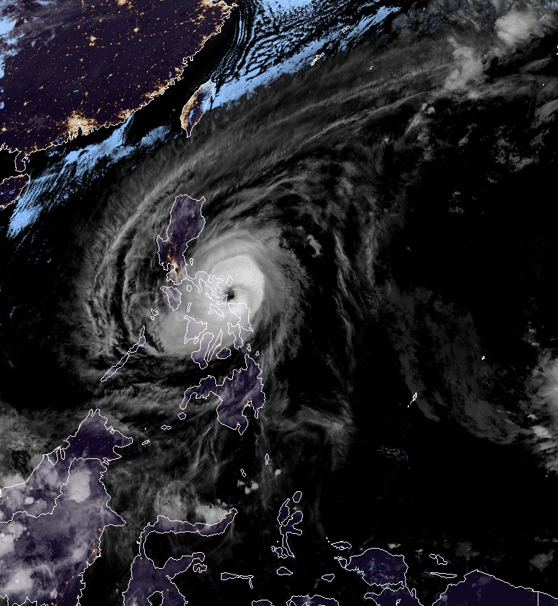
Featured image: Typhoon "Kammuri" at 13:10 UTC on December 2, 2019. Credit: JMA/Himawari-8, RAMMB/CIRA
Authorities are evacuating more than 100 000 people living in lahar-prone areas in the Bicol region, Philippines, ahead of the landfall of Typhoon "Kammuri", locally known as Tisoy. The storm has further intensified into Category 4 hurricane equivalent and its eyewall is now bringing violent winds over Northern Samar, Catanduanes, Albay, Camarines Sur, and Sorsogon.
As of 11:00 UTC on December 2, 2019, the eye was located based on all available data at 90 km (56 miles) east of Juban, moving west at 20 km/h (12 mph) with maximum sustained winds of 165 km/h (102 mph) near the center and gusts to 230 km/h (143 mph), according to weather agency PAGASA's update issued at 12:00 UTC.
Several airlines have canceled flights on December 2, December 3, and December 4, including AirAsia and NAIA. Manila City Mayor Isko Moreno has ordered the suspension of classes in all levels on December 3 as the storm approaches.
Ahead of landfall, Kammuri has already brought violent winds and heavy rains on the coast of the eastern Philippines.
Strong winds and heavy rain lashed the coast of eastern Philippines as Typhoon Kammuri -locally known as Tisoy – produced gusts of up to 120 kilometers-per-hour pic.twitter.com/wMlbZ9CXAl
— Reuters (@Reuters) December 2, 2019
WATCH: #TisoyPH brings wind and rain in Camarines Norte
Video courtesy of Princess Torralba pic.twitter.com/WHZSqetG6p— Rappler (@rapplerdotcom) December 2, 2019
Patuloy na inililikas ang mga residente ng Brgy. Cogon, Virac, Catanduanes #TisoyPH pic.twitter.com/HOT2JnLMSu
— Dennis Datu (@Dennis_Datu) December 2, 2019
According to Albay Public Safety and Emergency Management Office (APSEMO), 58 614 families or 307 493 persons living in 484 villages in the 15 towns and three cities are at risk due to flooding. Of this figure, 25 770 families or 106 211 persons are at risk by lahar and mudflows from Mount Mayon.
"We have to evacuate them and for those who are stubborn, I have directed the police to forcibly bring them to the nearest evacuation camps," Albay Governor Al Francis Bichara said.
Authorities and officials across the country have started preparing for the upcoming typhoon.
Typhoon "Kammuri" at 13:10 UTC on December 2, 2019. Credit: JMA/Himawari-8, RAMMB/CIRA
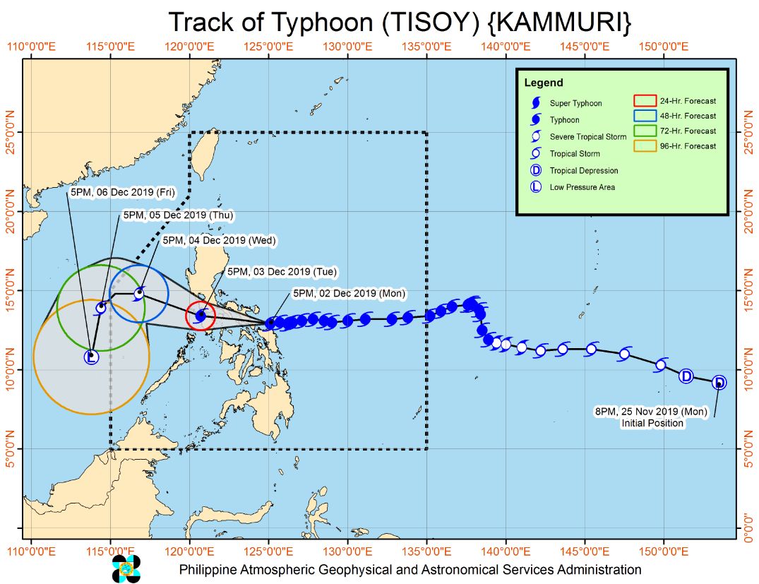
Image credit: PAGASA
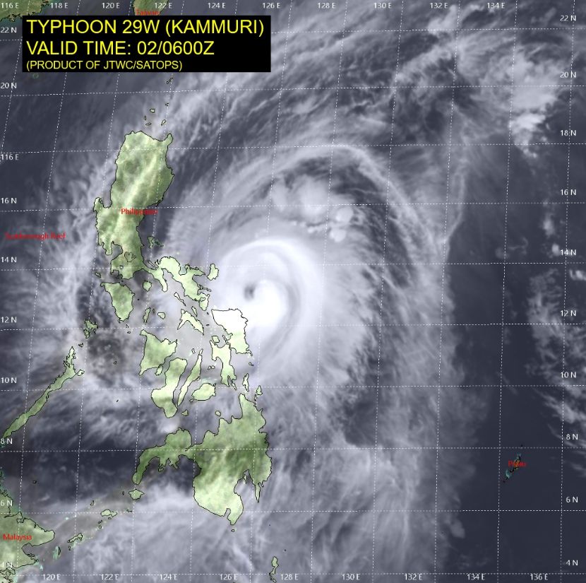
Image credit: JTWC
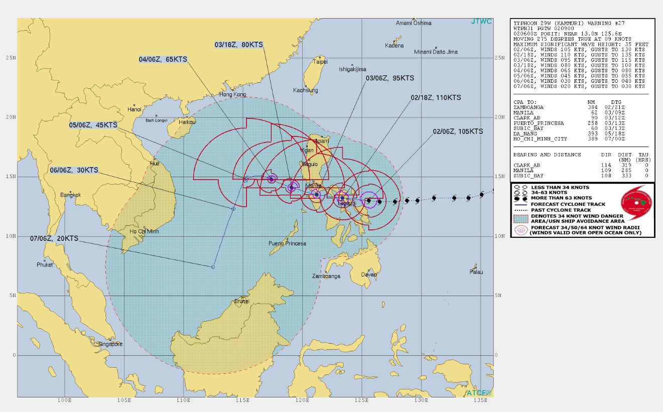
Image credit: JTWC
Tropical Cyclone Signal #3 is up in a lot of provinces in Luzon, including Catanduanes, Camarines Sur, Albay, Sorsogon, Camarines Norte, Masbate, and Quezon, and some provinces in the Visayas. Winds of greater than 121 up to 170 km/h (75 to 106 mph) may be expected in at least 18 hours.
Between December 2 evening and December 3 morning, frequent to continuous heavy rains to intense rains is expected over Bicol Region, Northern Samar, Southern Quezon, Marinduque, and Romblon, as well as Samar, Eastern Samar, Rizal, and the rest of Quezon, Laguna, and Oriental Mindoro.
Moderate to intermittent heavy rains are forecast over Metro Manila, Occidental Mindoro, the rest of CALABARZON, Cagayan, Isabela, Aurora, and the rest of Eastern Visayas.
Kammuri is set to make landfall in Sorsogon on Tuesday evening, December 2.
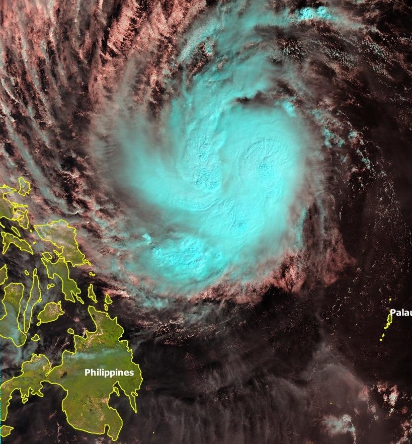
Typhoon "Kammuri" at 01:17 UTC on December 1, 2019. Credit: Copernicus Sentinel Data (2019), Antonio Vecoli
Updates
16:40 UTC
Kammuri made landfall in Sorsogon, Philippines as Category 4 hurricane equivalent (210 km/h, 130 mph).
#Typhoon #Kammuri (#Tisoy) has intensified to Category 4 strength (130 mph) as it makes landfall in Sorsogon, #Phillipines. pic.twitter.com/OCNv4XmiVP
— Philip Klotzbach (@philklotzbach) December 2, 2019
We are inside the eye. Wow! Ang tahimik ng paligid. Mas nakakatakot! #TisoyPH #Kammuri pic.twitter.com/ZlCJLsYhtA
— mј. (@mj16xx) December 2, 2019
A view of Typhoon #Kammuri seen by the #Himawari satellite between 14-16 UTC today as it makes landfall in the #Philippines.
A nasty storm, I hope everyone in its path remains safe.[ Data courtesy @JMA_kishou, processed at @OxfordAOPP using @PyTrollOrg] pic.twitter.com/bSQ0ppkbk7
— Simon Proud (@simon_sat) December 2, 2019
Eyewall conditions starting to hit Legazpi #Philippines as #typhoon #Kammuri pushes ashore – violent wind and sheets of rain filling the air – will move inside shortly, 1 remote camera rolling outside #TisoyPH the pic.twitter.com/mltc20VHpI
— James Reynolds (@EarthUncutTV) December 2, 2019
Commenting rules and guidelines
We value the thoughts and opinions of our readers and welcome healthy discussions on our website. In order to maintain a respectful and positive community, we ask that all commenters follow these rules.