
Nor’easter to pound areas along East Coast with strong winds, raging waves and drenching rain, U.S.
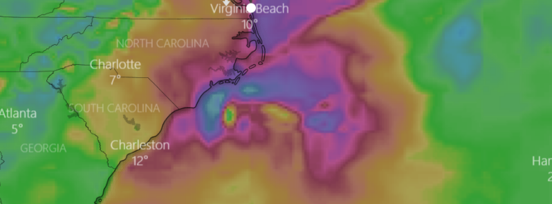
Image credit: Windy
Strong winds, raging waves, and drenching rain are expected to slam regions along the East Coast beginning this weekend, November 16 to November 17, 2019. Gale warnings are in place along the coastline, from South Carolina to New Jersey, as well as storm watches along the North Carolina coast.
After spreading downpour eastward across the Deep South into Friday, November 15, the storm will intensify along the Carolina coast while hovering northeastward on Saturday, Sunday, and Monday, November 18.
High winds, heavy surf and drenching rain will pound part of the southern Atlantic coast this weekend, but some impact from a nor'easter will expand to the coastal Northeast later this weekend to early next week: https://t.co/3HJX3Uxy0r pic.twitter.com/Ze2J1rQxD4
— AccuWeather (@breakingweather) November 15, 2019
A strong and significant nor'easter will produce a variety of impacts of eastern North Carolina later today through the weekend, including very strong winds, heavy rain and water level rises. More information available in our latest briefing at:https://t.co/3PgkzI6ZuF pic.twitter.com/WGwNorA4ar
— NWS Newport/Morehead (@NWSMoreheadCity) November 15, 2019
The difference in pressure between the heightening storm and high pressure over the interior Northeast will produce powerful winds, and then a second storm will quickly ride on the nor'easter's tail. Forecasts said the storm is to take aim farther north and focus on the Northeast by next week.
Areas along the coastal Carolinas to southeastern Virginia would see the worst impacts, while the strongest winds about 40 to 80 km/h (20 to 50 mph) are likely from the Outer Banks of North Carolina to the capes of Virginia. Gusts may reach 105 km/h (65 mph).
Here's a look at the Futurecast Wind Gusts for the weekend #noreaster. #obx #ncwx #scwx pic.twitter.com/f5Azb6aHD8
— Brad Panovich (@wxbrad) November 15, 2019
Here's your wet and windy forecast for areas in the southeast into the weekend as a powerful coastal low develops! pic.twitter.com/8PTmMkXyYi
— WeatherNation (@WeatherNation) November 15, 2019
According to AccuWeather Meteorologist Clay Chaney, the heaviest downpour will be along the coasts of North and South Carolina, where rainfall is expected to be around 51 to 76 mm (2 to 3 inches), with 127 mm (5 inches) being the maximum.
"While the rain will be beneficial in most areas of the Deep South and along the coast, too much can fall in coastal areas too fast and lead to urban style flooding," Chaney added.
The combination of wind and rain along the affected coastlines will produce temperatures near the freezing point.
Several areas in eastern Massachusetts including Boston could be hit by the storm on Monday before it moves away.
Meanwhile, multiple weak cold fronts will pass through the Great Lakes region into the weekend, which will keep light snow a possibility across the Great Lakes and interior portions of the Northeast.
Behind the front, a strong high pressure associated with deep cold Arctic air will provide another chance of temps 8 – 12 °C (15 – 20 F°) on Saturday, November 16 for extreme northern New York, Vermont and New Hampshire.
Showers over the Pacific Northwest will transition to high elevation snow across portions of Idaho and Montana Friday into Saturday as disturbance crosses the Pacific Northwest and Northern Rockies into southern Canada. This will bring snow along with a wintry mix to spread into the Upper Midwest and Great Lakes by Saturday evening.
Commenting rules and guidelines
We value the thoughts and opinions of our readers and welcome healthy discussions on our website. In order to maintain a respectful and positive community, we ask that all commenters follow these rules.