
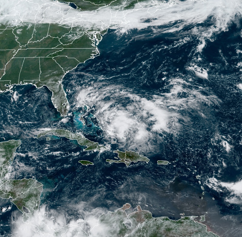
Tropical cyclone organizing over the Bahamas, heavy rainfall and gusty winds in region affected by Hurricane “Dorian”

Image credit: NOAA/GOES-East. Acquired 14:40 UTC on September 12, 2019
Satellite images indicate that the area of disturbed weather over the central and southeastern Bahamas is gradually becoming better organized while surface pressures are falling in the area, NWS NHC warned at 12:00 UTC on September 12, 2019.
Conditions are becoming favorable for a tropical depression or a tropical storm to form within the next day or so as the system moves toward the northwest through the northwestern Bahamas and toward the Florida Peninsula at 8 to 16 km/h (5 – 10 mph).
"If this development trend continues Potential Tropical Cyclone advisories will likely be initiated later today," NWS forecaster Avila noted.
"This disturbance will bring heavy rainfall and gusty winds across portions of the Bahamas through Friday, especially in portions of the northwestern Bahamas affected by Hurricane Dorian."
NOAA/GOES-East image acquired 14:40 UTC on September 12, 2019
An Air Force Reserve reconnaissance aircraft is scheduled to investigate the system this afternoon, if necessary.
Formation chance through 48 hours: high…70%
Formation chance through 5 days: high…80%
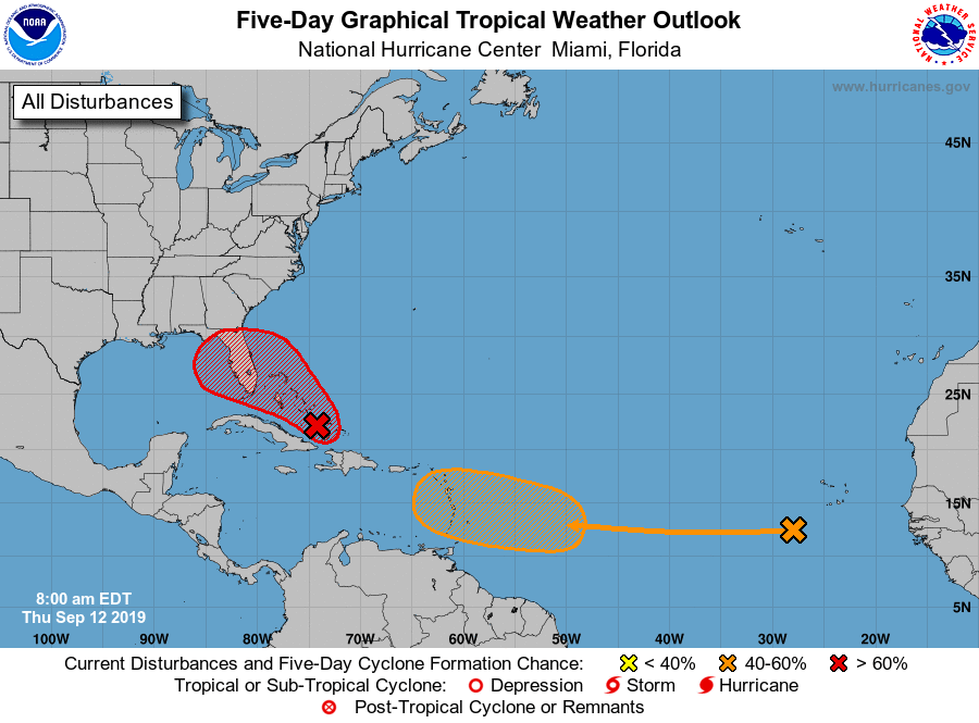
In addition, a tropical wave located several hundred miles west of the Cabo Verde Islands is producing disorganized showers and thunderstorms. Conditions appear conducive for development, and a tropical depression could form early next week while the system moves westward over the tropical Atlantic.
I'm a dedicated researcher, journalist, and editor at The Watchers. With over 20 years of experience in the media industry, I specialize in hard science news, focusing on extreme weather, seismic and volcanic activity, space weather, and astronomy, including near-Earth objects and planetary defense strategies. You can reach me at teo /at/ watchers.news.
Commenting rules and guidelines
We value the thoughts and opinions of our readers and welcome healthy discussions on our website. In order to maintain a respectful and positive community, we ask that all commenters follow these rules.