
Typhoon “Faxai” underwent extreme rapid intensification, closing in on Tokyo, Japan
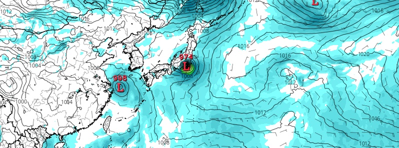
Image credit: GFS, TropicalTidbits
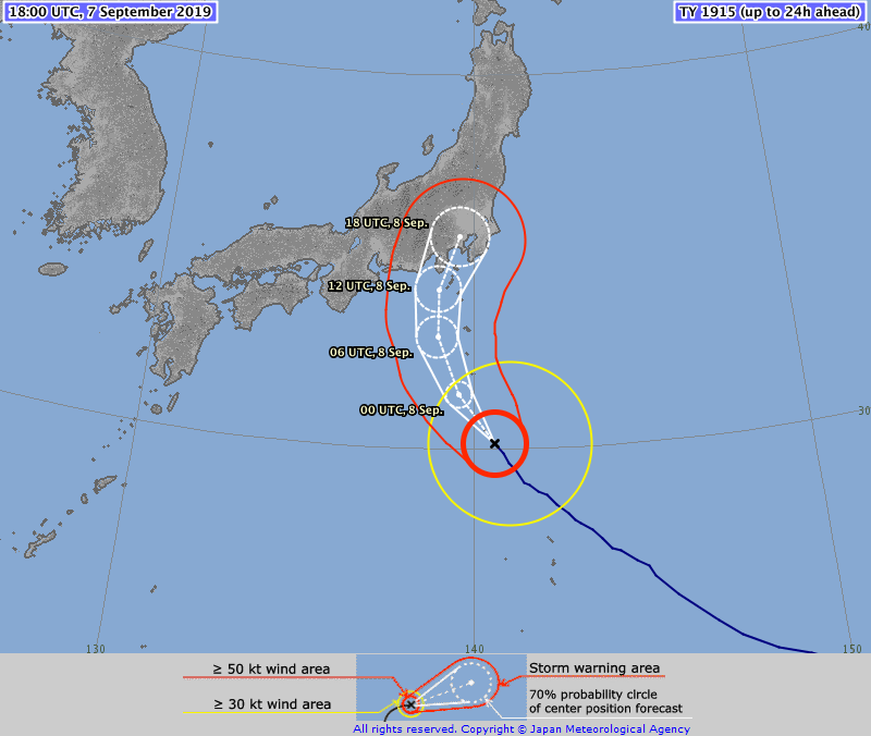
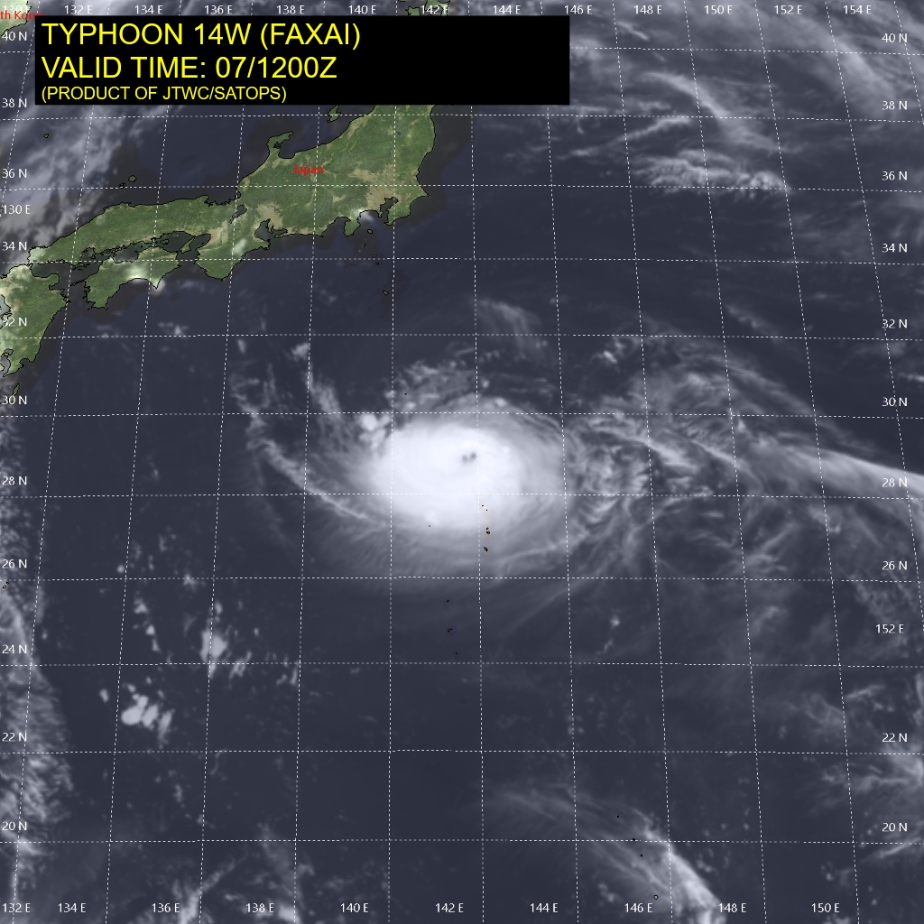
Tropical Storm "Faxai" formed in the Pacific Ocean on September 5, 2019, as the 15th named storm of the 2019 Pacific typhoon season. The system is now closing in on Japan. Landfall is expected near Tokyo on September 8, 2019.
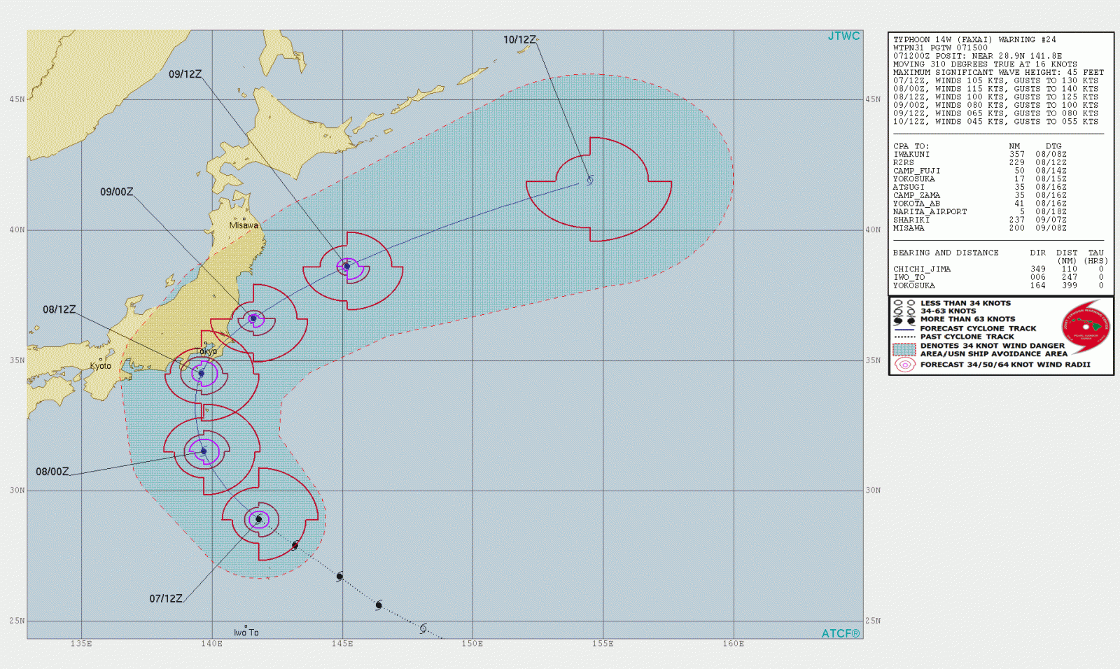
Faxai has undergone extreme rapid intensification over the past 24 hours, from 101 km/h (63 mph) to 194 km/h (120 mph), JTWC said 15:00 UTC on September 7, 2019.
Animated enhanced infrared satellite imagery depicts an oblong area of core convection surrounding a 27 km (17 miles) eye.
The environmental analysis depicts favorable conditions of low vertical wind shear and warm sea surface temperatures. However, these are offset slightly by fair poleward outflow which is being limited by the development of a transient upper-level anticyclone to the northwest.
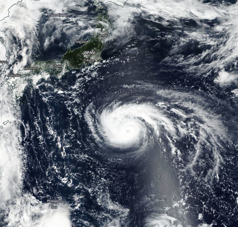
Typhoon "Faxai" on September 7, 2019. Credit: NASA/NOAA Suomi NPP/VIIRS
Faxai will maintain its northwestward track over the next 12 hours and slow down as it turns northward prior to landfall southeast of Tokyo around 15:00 UTC on September 8. It will then shift to a NE track, accelerating after transiting back over water.
There is significant uncertainty in the peak intensity with the high potential for a prolonged period of rapid intensification over the next 12 hours, JTWC said.
After landfall, the system will exit back over the Pacific where it will encounter cooler sea surface temperatures and increasing vertical wind shear which will gradually weaken the system until it dissipates.
The Japan Meteorological Agency (JMA) is warning of high waves, landslides and swollen rivers.
Damp air is expected to blow into areas in eastern Japan along the Pacific coast from the south between September 8 and 9 as the typhoon approaches the region, destabilizing atmospheric conditions and bringing thunderstorms to some areas, JMA said, as reported by The Mainichi.
The amount of rain over a 24-hour period up to 06:00 JST on September 8 is estimated at 100 mm (3.93 inches) in the Tokai region in central Japan.
In 24 hours to 06:00 JST on September 9, Tokai is expected to receive 300 – 400 mm (11.8 – 15.7 inches), Kanto-Koshin region 200 – 300 mm (7.8 – 11.8 inches), Izu Islands south of Tokyo 200 – 300 mm (7.8 – 11.8 inches) and the Tohoku region in northeastern Japan 100 – 150 mm (3.93 – 5.90 inches).
.png)
Forecast models
I'm a dedicated researcher, journalist, and editor at The Watchers. With over 20 years of experience in the media industry, I specialize in hard science news, focusing on extreme weather, seismic and volcanic activity, space weather, and astronomy, including near-Earth objects and planetary defense strategies. You can reach me at teo /at/ watchers.news.
Commenting rules and guidelines
We value the thoughts and opinions of our readers and welcome healthy discussions on our website. In order to maintain a respectful and positive community, we ask that all commenters follow these rules.