
Veniaminof volcano alerts raised, Alaska
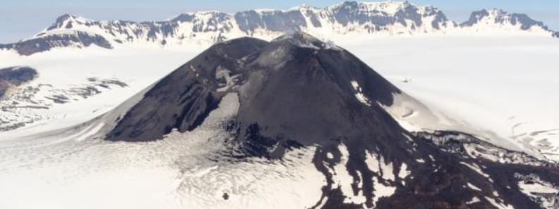
Featured image: Aerial oblique view of Veniaminof summit cone and 2018 lava flow. Credit: Matt Loewen, USGS/AVO
The Alaska Volcano Observatory (AVO) raised alerts for Veniaminof volcano after pilot reports of steaming coincided with low-level tremor recorded at the volcano at 20:30 UTC (12:30 AKDT).
These observations mark a departure from recent background activity – the Aviation Color Code was raised to YELLOW and the Volcano Alert Level to ADVISORY.
The volcano has a known history of VEI 1 – 3 eruptions with significant VEI 6 eruption in ~1750 BCE.
The last eruption of this volcano took place in December 2018.
Ash emissions at the volcano increased significantly on November 21, 2018, forcing AVO to raise the Aviation Color Code to Red and Volcano Alert Level to Warning.
Veniaminof was generating a plume of ash up to 4.6 km (15 000 feet) above sea level, extending for more than 240 km (150 miles) to the SE, AVO said 19:15 UTC, November 21.
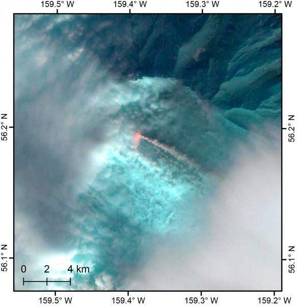
Landsat 8 false color image (short-wave infrared, near infrared, and red bands) of the Veniaminof eruption from November 19, 2018, showing the active lava flow through low clouds within the caldera and the steam and ash plume drifting to the southeast. Credit: Hannah Dietterich
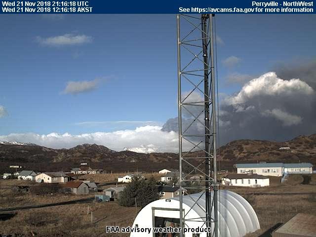
The November 21, 2018 eruption of Veniaminof volcano as seen from the FAA Perryville webcam, located ~21 miles (~33km) south-southeast of the active vent. Credit: Janet Schaefer
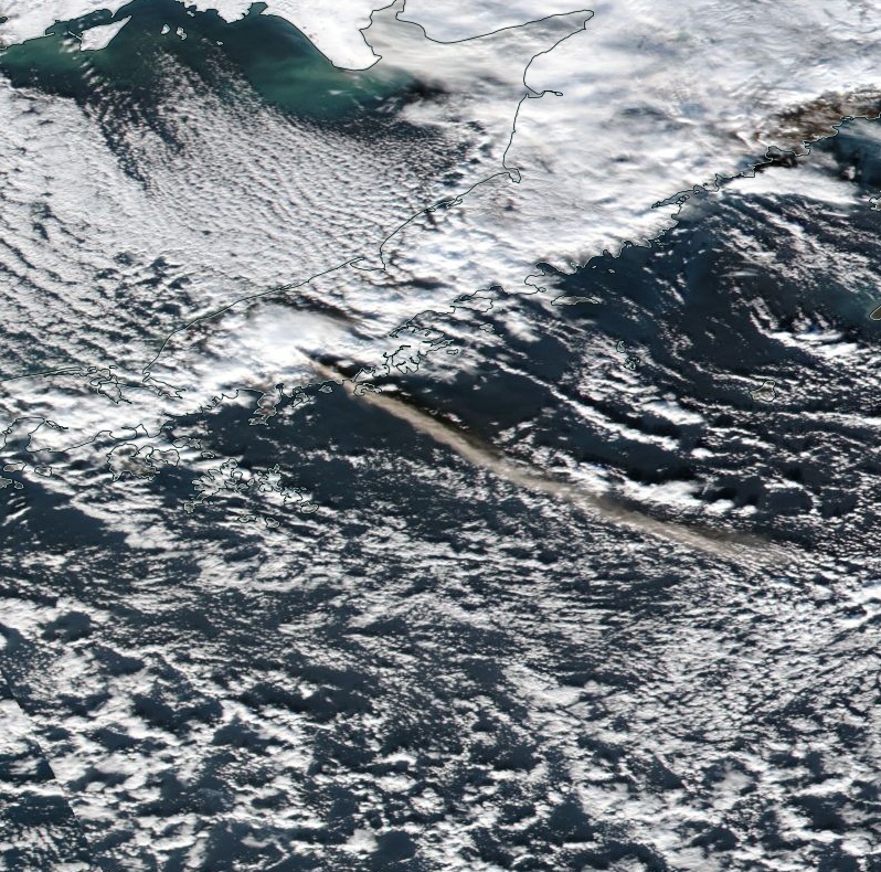
Image credit: NASA/NOAA Suomi NPP/VIIRS. Acquired November 21, 2018
Ash emissions at Veniaminof have decreased but continued at lower levels by 20:05 UTC, November 22 when AVO lowered the Aviation Color Code to ORANGE and the Volcano Alert Level to WATCH.
Geological summary
Veniaminof, on the Alaska Peninsula, is truncated by a steep-walled, 8 x 11 km (5 x 6.8 miles), glacier-filled caldera that formed around 3 700 years ago. The caldera rim is up to 520 m (1 706 feet) high on the north, is deeply notched on the west by Cone Glacier, and is covered by an ice sheet on the south.
Post-caldera vents are located along a NW-SE zone bisecting the caldera that extends 55 km (34 miles) from near the Bering Sea coast, across the caldera, and down the Pacific flank.
Historical eruptions probably all originated from the westernmost and most prominent of two intra-caldera cones, which rises about 300 m (984 feet) above the surrounding icefield. The other cone is larger, and has a summit crater or caldera that may reach 2.5 km (1.5 miles) in diameter, but is more subdued and barely rises above the glacier surface.
I'm a dedicated researcher, journalist, and editor at The Watchers. With over 20 years of experience in the media industry, I specialize in hard science news, focusing on extreme weather, seismic and volcanic activity, space weather, and astronomy, including near-Earth objects and planetary defense strategies. You can reach me at teo /at/ watchers.news.
Commenting rules and guidelines
We value the thoughts and opinions of our readers and welcome healthy discussions on our website. In order to maintain a respectful and positive community, we ask that all commenters follow these rules.