
Pavlof volcano alert raised after rise in long-period earthquakes, Alaska
A notable increase in seismic activity was detected at Pavlof volcano on the Alaska Peninsula on January 14, 2026, prompting the Alaska Volcano Observatory (AVO) to raise the alert level to Advisory and the Aviation Color Code to Yellow. No surface activity or eruptive changes were observed, and seismicity has since declined to background levels.
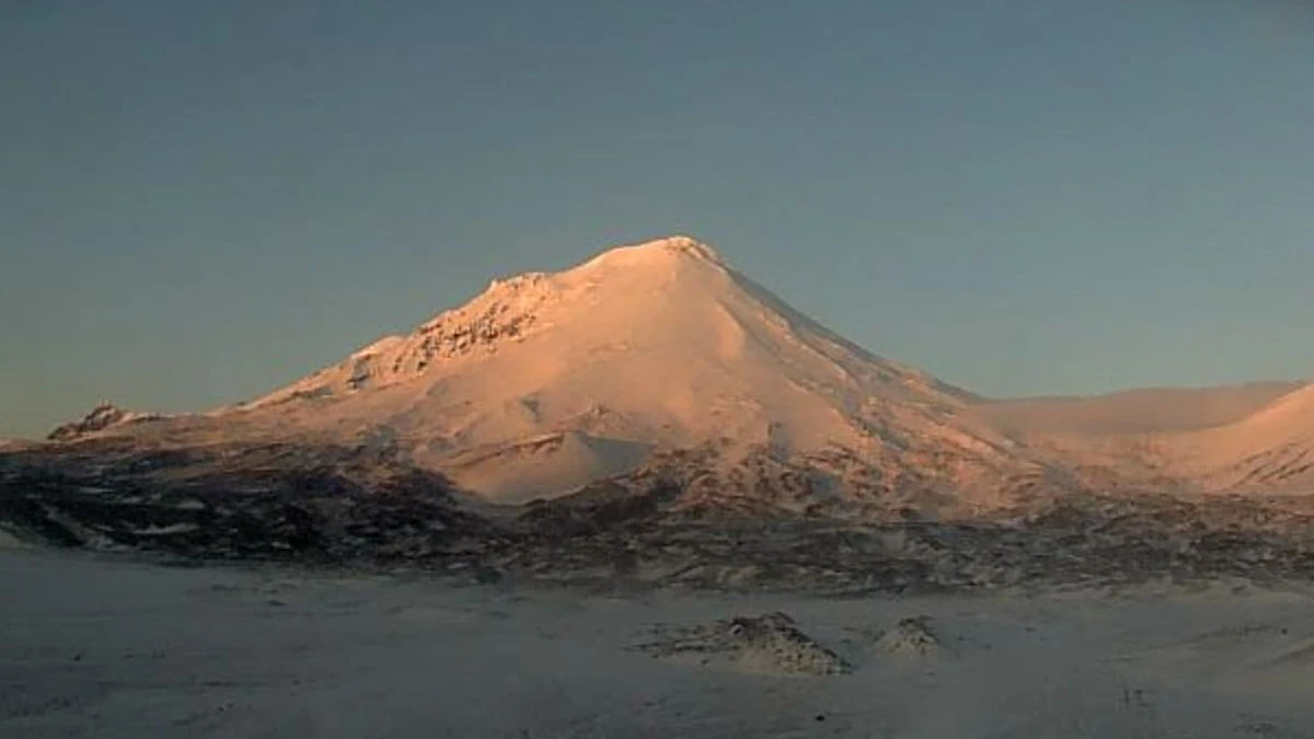
Pavlof volcano, Alaska on January 14, 2026. Credit: USGS/AVO, Matthew Loewen
A brief but notable increase in the rate of long-period earthquakes began beneath Pavlof Volcano at 00:45 AKST (09:45 UTC) on January 14, prompting the Alaska Volcano Observatory (AVO) to raise the Aviation Color Code and Volcano Alert Level to Yellow/Advisory.
Satellite and webcam imagery in the following days showed no signs of surface change, thermal anomalies, or new deposits. By January 16, earthquake activity had decreased to background levels, but AVO volcanologists stated that monitoring would continue to confirm that the period of elevated seismicity had ended.
AVO noted that similar increases in long-period earthquakes at Pavlof have, in some past cases, preceded eruptions, though others have subsided without eruptive activity. It’s worth noting that this volcano is known for eruptions that begin with little or no clear precursor signals.
Pavlof is a snow- and ice-covered stratovolcano located near the southwestern end of the Alaska Peninsula, about 950 km (590 miles) southwest of Anchorage. The volcano rises to 2 518 m (8 261 feet) above sea level and measures roughly 7 km (4.4 miles) in diameter. Its historically active vents are near the summit on the north and east flanks.
It is among the most consistently active volcanoes in the Aleutian Arc, with more than 40 recorded eruptions since the late 18th century. Activity at Pavlof is typically Strombolian, producing intermittent lava fountaining and ash emissions that can last for several months.
Past eruptions have generated ash plumes reaching 15 000 m (49 000 feet) above sea level. During the March 2016 eruption, ash plumes rose to 12 000 m (40 000 feet) and were tracked in satellite data as far east as eastern Canada.
The nearest community is King Cove, located 48 km (30 miles) southwest of the volcano. The volcano is continuously monitored through a network of local seismic and infrasound sensors, satellite observations, web cameras, and regional infrasound and lightning detection systems operated by the Alaska Volcano Observatory.
References:
1 Alaska Volcano Observatory Weekly Update – USGS/AVO – Issued at 20:06 UTC on January 16, 2026
I'm a dedicated researcher, journalist, and editor at The Watchers. With over 20 years of experience in the media industry, I specialize in hard science news, focusing on extreme weather, seismic and volcanic activity, space weather, and astronomy, including near-Earth objects and planetary defense strategies. You can reach me at teo /at/ watchers.news.
Commenting rules and guidelines
We value the thoughts and opinions of our readers and welcome healthy discussions on our website. In order to maintain a respectful and positive community, we ask that all commenters follow these rules.