
Typhoon “Shanshan” to pass very close to Tokyo, Japan on August 8
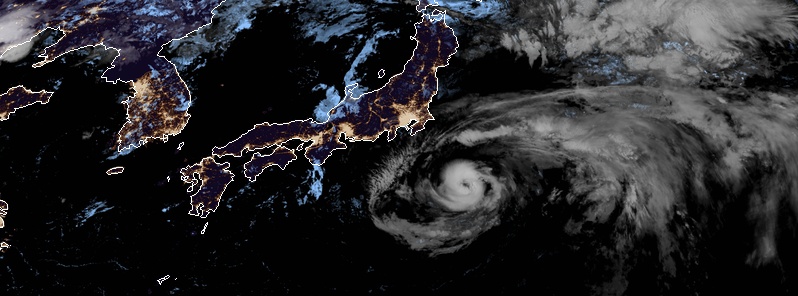
Image credit: JMA/Himawari-8, RAMMB/CIRA
Typhoon "Shanshan" is expected to pass very close to Tokyo, Japan on August 8, 2018 as a Category 1 hurricane equivalent, bringing heavy rain and damaging winds to the region. The Japan Meteorological Agency (JMA) warned residents living on the Pacific side of eastern and northeastern Japan to expect intense rain.
Rain and wind will move into the Greater Tokyo Area by Wednesday morning (local time) but rough seas and surf are already affecting the eastern coastline.
The worst and most widespread impacts to land will occur from Wednesday afternoon into Thursday.
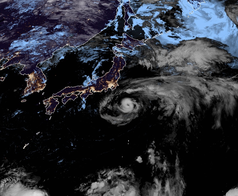
Typhoon "Shanshan" at 17:50 UTC on August 7, 2018. Credit: JMA/Himawari-8, RAMMB/CIRA
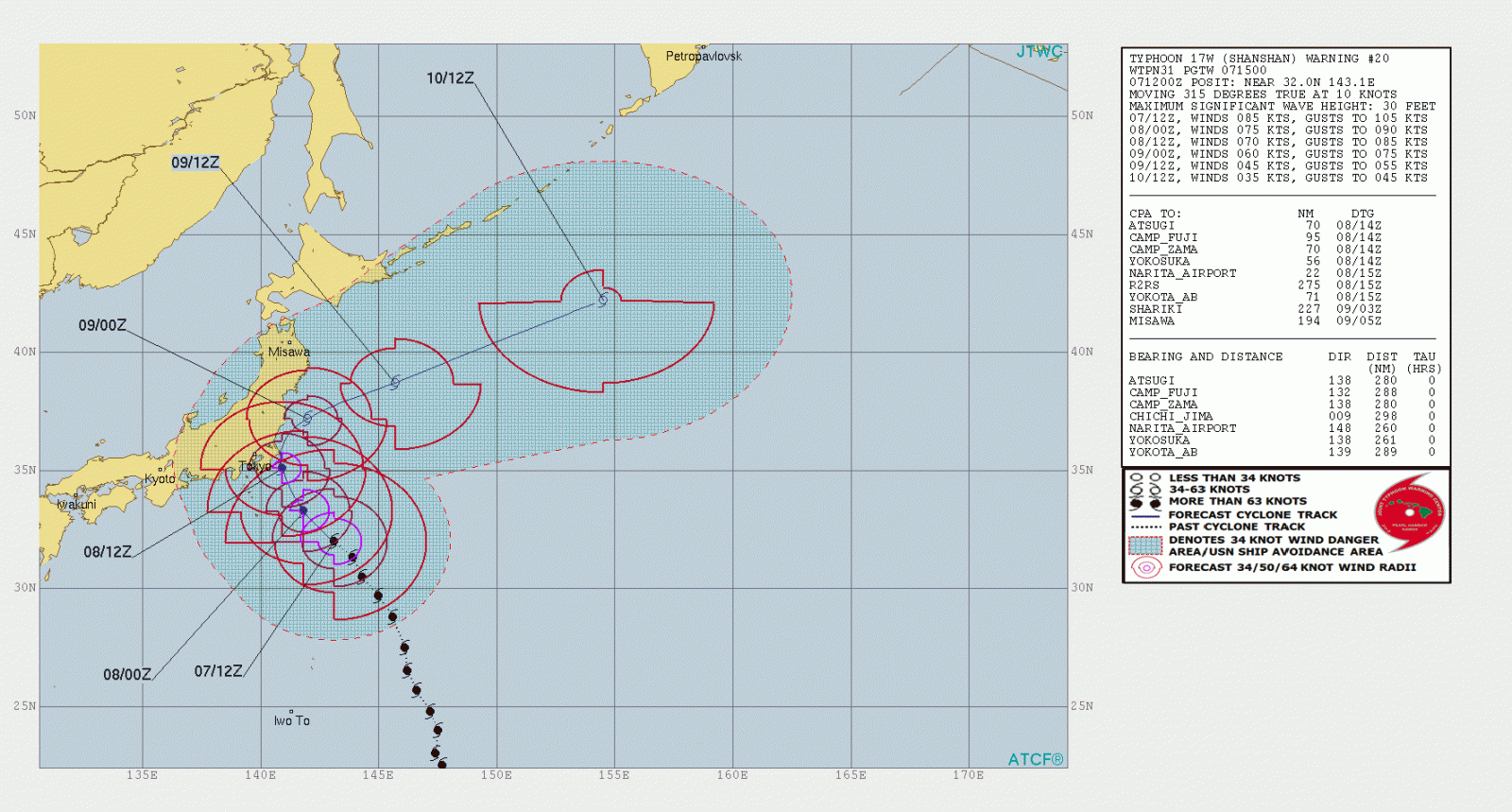
In the 24-hour period through Wednesday afternoon, 150 mm (5.9 inches) of rain may fall in eastern and central Japan, with a further downpour of up to 400 mm (15.7 inches) predicted in the following 24 hours, JMA said.
All Nippon Airways Co. canceled six flights scheduled for Wednesday between Tokyo’s Haneda airport and Hachijo Island while Jetstar Japan canceled 19 flights across the country.
At 12:00 UTC on August 7, Typhoon "Shanshan" had maximum sustained winds of 157 km/h (98 mph) and gusts to 194 km/h (120 mph), according to the JTWC. It was tracking northwestward at 18 km/h (11 mph).
I'm a dedicated researcher, journalist, and editor at The Watchers. With over 20 years of experience in the media industry, I specialize in hard science news, focusing on extreme weather, seismic and volcanic activity, space weather, and astronomy, including near-Earth objects and planetary defense strategies. You can reach me at teo /at/ watchers.news.
Commenting rules and guidelines
We value the thoughts and opinions of our readers and welcome healthy discussions on our website. In order to maintain a respectful and positive community, we ask that all commenters follow these rules.