
Typhoon “Chaba” about to hit Okinawa, turn toward Kyushu, Japan
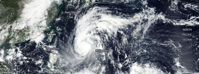
Featured image: Typhoon "Chaba" on October 2, 2016. Credit: NASA/NOAA/DoD Suomi NPP/VIIRS
Typhoon "Chaba" is moving toward Okinawa Islands, Japan and is expected to pass right over them around 12:00 UTC on Monday, October 3, 2016, as a Category 4 hurricane equivalent.
At 15:00 UTC on Sunday, October 2, the center of Typhoon "Chaba" was located about 535 km (332 miles) S of Okinawa and 800 km (500 miles) NW of Taipei, Taiwan.
Chaba had maximum sustained winds of 203 km/h (126 mph) and gusts to 250 km/h (155 mph). This placed Chaba at the upper edge of Category 3 hurricane equivalent. It was tracking northwestward at 26 km/h (16 mph) over the past six hours, according to the JTWC.
At 18:00 UTC, it had estimated central pressure of 935 hPa, according to the JMA.
Environmental conditions are still favorable for intensification and Chaba is expected to become a Category 4 hurricane equivalent over the next 12 hours. Wind gusts to 268 km/h (166 mph) are possible as Chaba tracks over Okinawa. 125 – 250 mm (5 – 10 inches) of rain is expected.
Chaba is expected to turn toward Kyushu around 12:00 UTC on Tuesday, October 4 and make landfall around 18:00 UTC. Chaba will then move over Japan, dumping heavy rain.
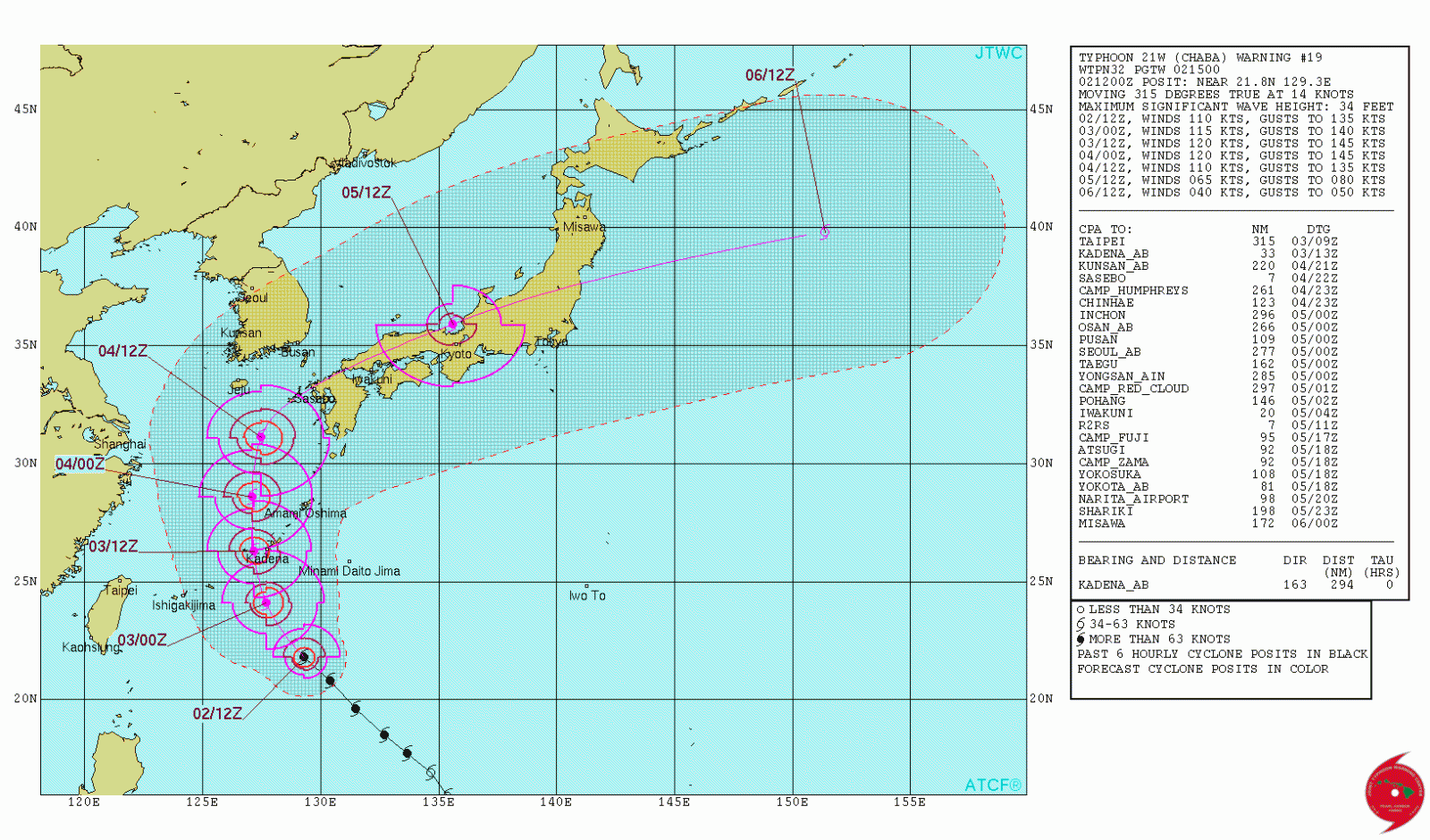
Typhoon "Chaba" JTWC forecast track at 15:00 UTC on October 2, 2016
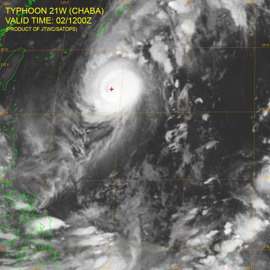
Typhoon "Chaba" at 12:00 UTC on October 2, 2016. Credit: JTWC
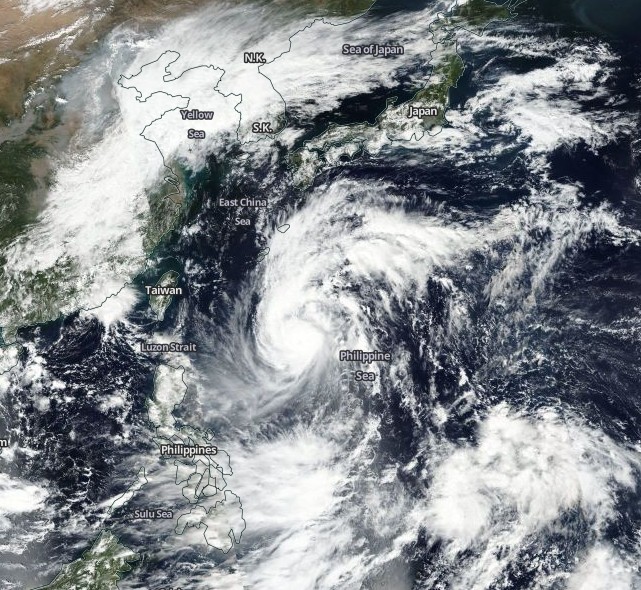
Typhoon "Chaba" on October 2, 2016. Credit: NASA/NOAA/DoD Suomi NPP/VIIRS
The Watchers team and our contributors bring the latest on extreme weather, earthquakes, volcanic eruptions, space weather, and all things science. We're all about making sense of the natural world and keeping you informed on what’s happening. Got a tip or a question? Hit us up using the form at newstips!
Commenting rules and guidelines
We value the thoughts and opinions of our readers and welcome healthy discussions on our website. In order to maintain a respectful and positive community, we ask that all commenters follow these rules.