
Tropical Cyclone 02S threatens Mauritius and Reunion Islands
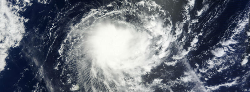
Featured image: Terra/MODIS satellite image of TS02S on November 28, 2014. (Credit: LANCE Rapid Response/MODIS)
Second tropical cyclone of Southern Indian Ocean season formed in the Southern Indian Ocean early on November 28, 2014. The system is still designated as Tropical Cyclone 02S but it should be soon named as Tropical Cyclone Bansi. The new tropical storm is moving to the southwest Mauritius and Reunion Islands at speed of 12 km/h.
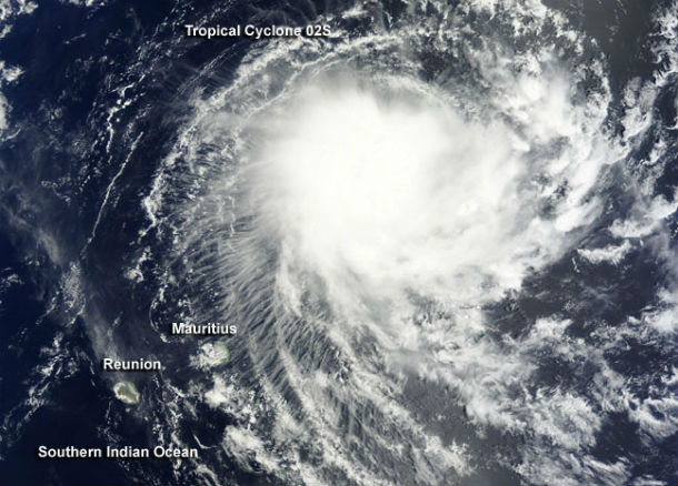
The Moderate Resolution Imaging Spectroradiometer or MODIS instrument aboard NASA's Terra satellite captured a visible image of newborn Tropical Cyclone 02S northeast of the islands of Mauritius and Reunion on November 28, 2014. The MODIS image showed that thunderstorms were mostly west of the low-level center of circulation and bands of thunderstorms were wrapping into the center. A microwave image also showed that wind shear pushed the bulk of the deep convection and strong thunderstorms west of the defined low-level center. (Credit: LANCE Rapid Response/MODIS/NASA GSFC)
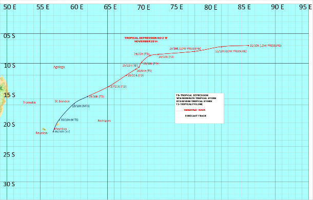
Cyclone track (Credit: Mauritius Meteorological Services)
Mauritius and Rodrigues Islands are expected to receive gusty winds, showers and rough seas as Tropical Cyclone 02S moves closer over the next couple of days. After that, vertical wind shear is expected to increase as the tropical cyclone track over the cooler waters, which will weaken the system. It is expected to pass close to Mauritius by late November 30, probably as a tropical depression.
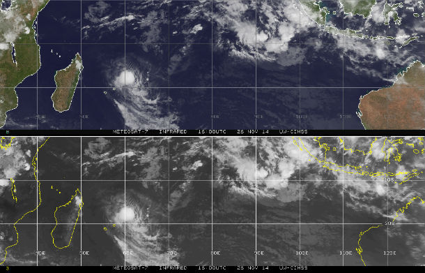
METEOSAT-7 IR satellite images of TC 02S taken at 18:00 UTC on November 28, 2014. (Credit: NOAA/UW-CIMSS)
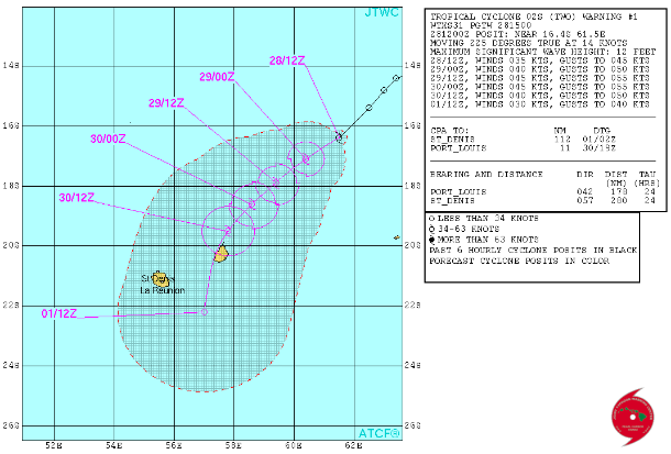
JTWC forecast track (Credit: Joint Typhoon Warning Center)
Satellite Animations
- Storm-Centered Infrared (Meteosat 7; NOAA/SSD)
- Storm-Centered Infrared (Aviation Color Enhancement) (Meteosat 7; NOAA/SSD)
- Storm-Centered Water Vapor (Meteosat 7; NOAA/SSD)
- Storm-Centered Visible (Meteosat 7; NOAA/SSD)
- Storm-Centered Visible (Colorized) (Meteosat 7; NOAA/SSD)
- Storm-Centered Infrared (Meteosat 7; CIMSS)
- Storm-Centered Enhanced Infrared (Meteosat 7; CIMSS)
- Storm-Centered Water Vapor (Meteosat 7; CIMSS)
- Storm-Centered Visible (Meteosat 7; CIMSS)
- Meteosat 7 Infrared (Meteosat 7; CIMSS)
- Meteosat 7 Infrared (Color Background) (Meteosat 7; CIMSS)
- Meteosat 7 Infrared (NHC Color Enhancement) (Meteosat 7; CIMSS)
- Meteosat 7 Water Vapor (Meteosat 7; CIMSS)
- Meteosat 7 Water Vapor (Color Background) (Meteosat 7; CIMSS)
Commenting rules and guidelines
We value the thoughts and opinions of our readers and welcome healthy discussions on our website. In order to maintain a respectful and positive community, we ask that all commenters follow these rules.