
Tropical Cyclone “Bheki” passes close to Réunion and Mauritius
Tropical Cyclone “Bheki” passed near Mauritius and Réunion on November 21, 2024. It brought moderate rain, with sustained winds of 74 km/h (46 mph), and uncertain predictions about its future strength.
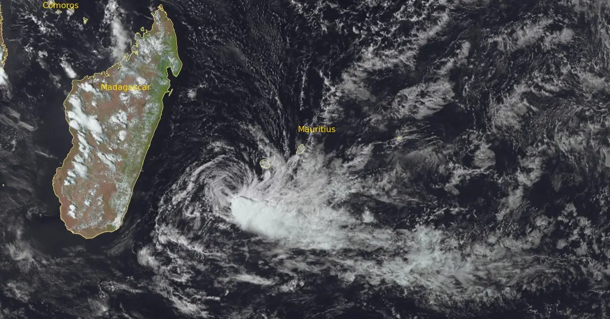
Satellite image of Tropical Cyclone "Bheki" at 11:00 UTC on November 22, 2024. Image credit: EUMETSAT/Meteosat-9, RAMMB/CIRA, The Watchers
Tropical Cyclone “Bheki” passed close to Mauritius’ main island and Réunion on November 21, with maximum sustained winds of 74 km/h (46 mph).
Although the system has tropical features, including a warm core, the warm air is limited to below 700 hPa in depth. Sea surface temperatures are around 26 °C (78.8 °F), which is marginal for supporting tropical cyclone development. The system is also influenced by strong westward winds aloft.
As of 09:00 UTC on November 22, Bheki had slowed and stalled southwest of La Réunion Island due to local terrain affecting its movement. However, it is now moving southwest and is expected to accelerate as it moves away from the island and continues west of the Mascarene High, a high-pressure system.
Satellite images suggest that convective activity (thunderstorm formation) is beginning again to the southeast of the storm’s center, similar to a previous occurrence at around 09:00 UTC on November 21. The system is positioned near a jet stream feature that could provide energy for further development. Numerical weather models indicate it could maintain or slightly increase its strength within 12 hours from 09:00 UTC on November 22.
Later, the jet stream will move further away, and the storm will encounter drier air. Under these unfavorable conditions, Bheki is projected to weaken to below 65 km/h (40 mph) within 24 hours.

The system is expected to begin moving southwest soon and will maintain that direction in the short term. Predictions about its intensity vary: the HWRF model indicates the cyclone will strengthen to 83 km/h (52 mph) within 6 to 12 hours from 09:00 UTC on November 22 before weakening. The HAFS-A model, however, shows it remaining steady for 12 hours before quickly losing strength afterward.
The system is forecast to bring moderate rains over Mauritius through November 22. Similar rainfall is expected over Réunion between November 22 and 25.
Bheki is the second named storm of the 2024/25 South-West Indian Ocean Cyclone season.
Bheki formed on November 14 and strengthened rapidly, peaking as an Intense Tropical Cyclone on November 18 and becoming the strongest November tropical cyclone on record in the basin based on sustained wind speeds.
It was also the third-strongest November tropical cyclone in the basin based on minimum central pressure.
1 Echo Flash – DG ECHO – November 22, 2024
2 PROGNOSTIC REASONING FOR TROPICAL CYCLONE 02S (BHEKI) WARNING NR
017 – JTWC – Issued at 09:00 UTC on November 22, 2024

I am an Assistant Editor and Severe Weather & Science Journalist at The Watchers, specializing in real-time severe weather coverage, geophysical event reporting, and research-driven scientific analysis. You can reach me at rishav(at)watchers(.)news.
Commenting rules and guidelines
We value the thoughts and opinions of our readers and welcome healthy discussions on our website. In order to maintain a respectful and positive community, we ask that all commenters follow these rules.