
Hurricane Henriette moving away from Hawaii

Featured image: GOES West satellite image taken at 18:30 UTC on August 7, 2013. (Credit: NOAA/NHC)
Hurricane Henriette continues moving through the Eastern Pacific Ocean as Category 1 hurricane.
According to latest public advisory issued by US National Hurricane Center (NHC), the center of Hurricane Henriette was located about 1285 miles (2065 km) E of Hilo, Hawaii. Henriette is moving toward the west-northwest near 12 mph (19 km/h). The estimated minimum central pressure is 983 mb (29.03 inches).
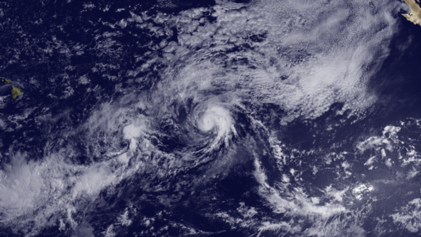
GOES West satellite image taken at 18:30 UTC on August 7, 2013. (Credit: NOAA/NHC)
Maximum sustained winds are near 85 mph (140 km/h) with higher gusts. Hurricane force winds extend outward up to 25 miles (35 km) from the center and tropical storm force winds extend outward up to 80 miles (130 km).
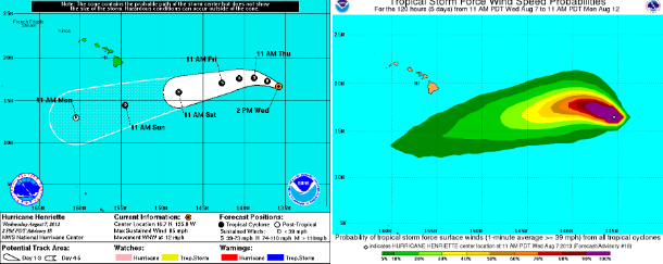
NHC forecast track and tropical storm force wind speed probabilities map (Credit: NOAA/NHC)
A turn toward the west and then the west-southwest is expected during the next couple of days. Henriette is moving into an area of colder sea surface temperatures and less favorable upper-level winds and weakening is forecast during the next 48 hours.
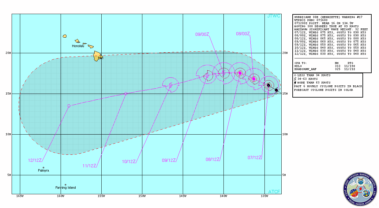
Hurricane Henriette forecast track (Credit: JTWC)
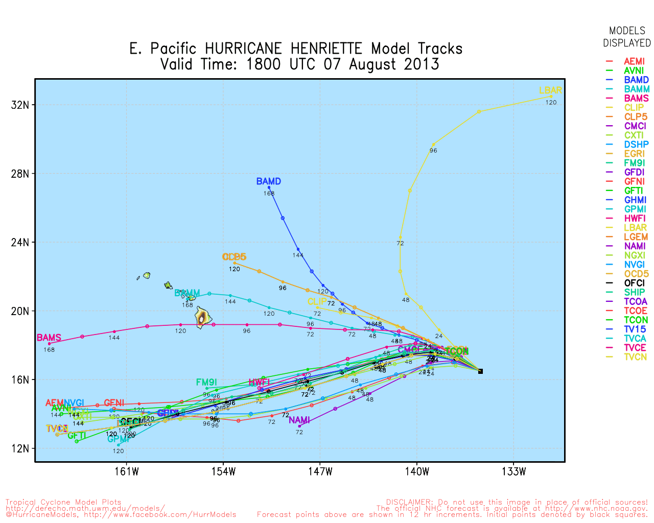
Hurricane Henriette forecast track models (Credit: UWM/Spaghetti)
After 48 hours, the system is expected to move over warmer sea surface temperatures and decreased shear.
This 3-D image above (looking toward the east) from TRMM PR data reveals that towering storms in the northeastern side of Henriette's eye were reaching height of almost 16.75km (~10.41 miles). (Credit: SSAI/NASA, Hal Pierce)
Satellite Animations
- Storm-Centered Infrared (GOES 15; NOAA/SSD)
- Storm-Centered Infrared (Aviation Color Enhancement) (GOES 15; NOAA/SSD)
- Storm-Centered Water Vapor (GOES 15; NOAA/SSD)
- Storm-Centered Visible (GOES 15; NOAA/SSD)
- Storm-Centered Visible (Colorized) (GOES 15; NOAA/SSD)
- East Pacific Infrared (GOES 15; NOAA/SSD)
- East Pacific (Aviation Color Enhancement) (GOES 15; NOAA/SSD)
- East Pacific Water Vapor (GOES 15; NOAA/SSD)
- East Pacific Visible (GOES 15; NOAA/SSD)
- East Pacific Visible (Colorized) (GOES 15; NOAA/SSD)
Commenting rules and guidelines
We value the thoughts and opinions of our readers and welcome healthy discussions on our website. In order to maintain a respectful and positive community, we ask that all commenters follow these rules.