
Hurricane Kiko forecast to bring dangerous surf and rip currents to Hawaii
Hurricane Kiko remains a strong category 3 system with maximum sustained winds of 205 km/h (125 mph), moving west at 15 km/h (9 mph). Swells from the storm are expected to reach the Hawaiian Islands late this weekend, producing life-threatening surf and rip currents.
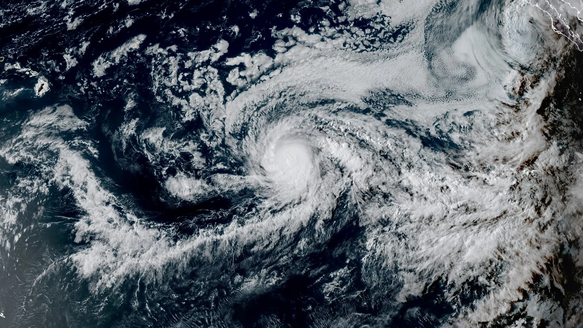
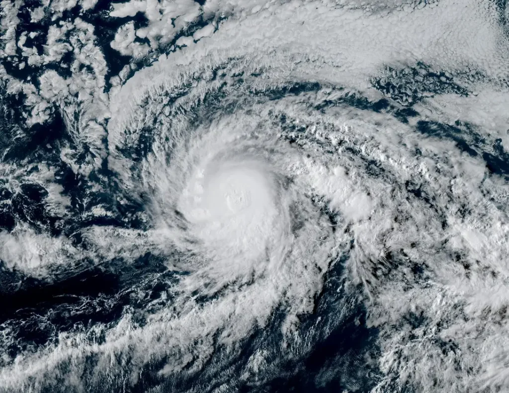
Satellite image of Hurricane Kiko at 01:10 UTC on September 5, 2025. Credit: NOAA/GOES-East, RAMMB/CIRA, The Watchers
The cyclone is forecast to gradually turn west-northwest and approach Hawaii early next week. While some short-term strengthening is possible, Kiko is expected to weaken as it encounters cooler waters and increasing wind shear. Direct impacts from wind and rainfall in Hawaii remain possible, but the magnitude and exact location are still uncertain.
Hurricane Kiko continues to move westward in the eastern Pacific Ocean, with forecasts indicating a gradual turn toward the west-northwest on September 5.
While the system may strengthen slightly in the short term, gradual weakening is expected through the weekend as it traverses cooler waters and a drier mid-level environment.
At 09:00 UTC on September 5 (23:00 HST on September 4), Kiko was a category 3 hurricane with maximum sustained winds of 205 km/h (125 mph) and a minimum central pressure of 955 hPa. The center of the system was located about 2 110 km (1 310 miles) ESE of Hilo, Hawaii and was moving west at 15 km/h (9 mph).
Hurricane-force winds extended outward up to 35 km (25 miles) from the center, while tropical-storm-force winds extended outward up to 110 km (70 miles).
Although the cyclone is forecast to weaken, it will remain a significant hazard to Hawaii. Swells generated by Kiko are expected to arrive along exposed shores late this weekend, causing dangerous surf and rip currents.
The National Weather Service (NWS) in Honolulu advises that conditions could become life-threatening for swimmers and small craft.
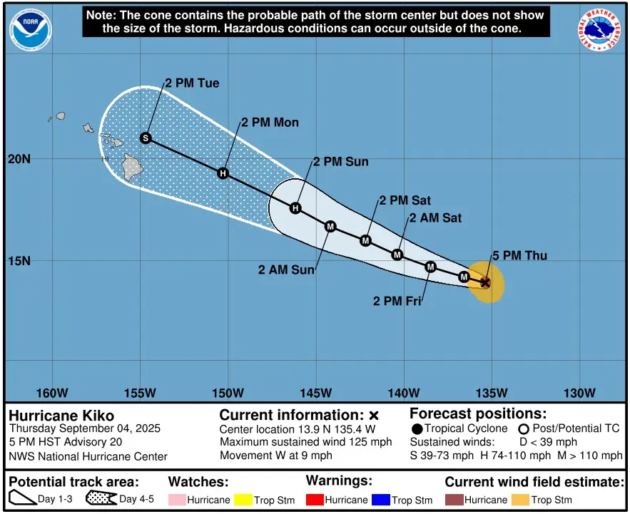
Forecast guidance indicates that Kiko will approach the eastern end of the Hawaiian Islands early to mid-next week. While confidence is increasing that direct impacts from wind and rainfall are possible, the exact magnitude and location remain uncertain.
By that time, the system is expected to weaken to tropical storm strength as it encounters cooler waters near 26°C (78°F), strong vertical wind shear exceeding 30 km/h (20 mph), and low mid-level moisture.

The NHC noted that Kiko’s satellite structure suggested a possible eyewall replacement cycle, with an eye intermittently redeveloping. Such cycles can cause short-term fluctuations in intensity, though environmental conditions beyond the weekend favor weakening.
No coastal watches or warnings are currently in effect but residents and officials in Hawaii are advised to monitor updates from the NHC and NWS as Kiko progresses.
I'm a dedicated researcher, journalist, and editor at The Watchers. With over 20 years of experience in the media industry, I specialize in hard science news, focusing on extreme weather, seismic and volcanic activity, space weather, and astronomy, including near-Earth objects and planetary defense strategies. You can reach me at teo /at/ watchers.news.
Commenting rules and guidelines
We value the thoughts and opinions of our readers and welcome healthy discussions on our website. In order to maintain a respectful and positive community, we ask that all commenters follow these rules.