
6.2 magnitude earthquake struck Papua, Indonesia
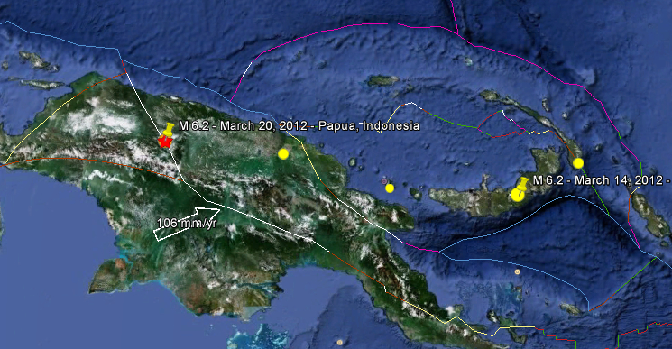
Image credit: Google Earth + USGS
Magnitude 6.2 earthquake struck Papua, Indonesia at 17:56:19 UTC on March 20, 2012 according to USGS. The epicenter was located 46.02 km (28.60 miles) S of Kiveh, 153 km (95 miles) SSW of Jayapura, Papua, Indonesia (3.830°S, 140.220°E). The depth of epicenter was at 66.9 km (41.6 miles).
This was 173 km (107 miles) SW of Vanimo, New Guinea, PNG, 1407 km (874 miles) NE of DARWIN, Northern Territory, Australia and 3711 km (2305 miles) E of JAKARTA, Java, Indonesia.
There are no nuclear facilities or airports nearby, and there is no volcano within the 100 km radius.
| Magnitude | 6.2 |
|---|---|
| Date-Time |
|
| Location | 3.830°S, 140.220°E |
| Depth | 66.9 km (41.6 miles) |
| Region | PAPUA, INDONESIA |
| Distances | 153 km (95 miles) SSW of Jayapura, Papua, Indonesia 173 km (107 miles) SW of Vanimo, New Guinea, PNG 1407 km (874 miles) NE of DARWIN, Northern Territory, Australia 3711 km (2305 miles) E of JAKARTA, Java, Indonesia |
| Location Uncertainty | horizontal +/- 14 km (8.7 miles); depth +/- 8.8 km (5.5 miles) |
| Parameters | NST=180, Nph=180, Dmin=818.2 km, Rmss=0.92 sec, Gp= 22°, M-type=body wave magnitude (Mb), Version=6 |
| Source |
|
| Event ID | usc0008m6b |

I'm a dedicated researcher, journalist, and editor at The Watchers. With over 20 years of experience in the media industry, I specialize in hard science news, focusing on extreme weather, seismic and volcanic activity, space weather, and astronomy, including near-Earth objects and planetary defense strategies. You can reach me at teo /at/ watchers.news.
Commenting rules and guidelines
We value the thoughts and opinions of our readers and welcome healthy discussions on our website. In order to maintain a respectful and positive community, we ask that all commenters follow these rules.