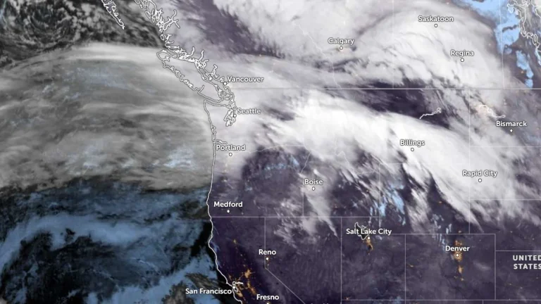
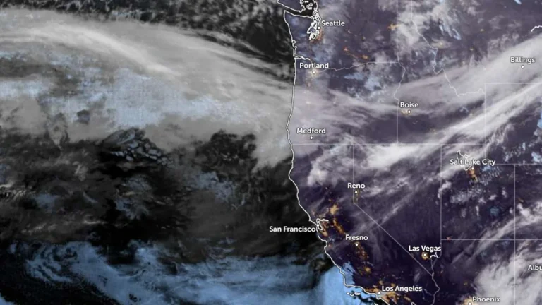
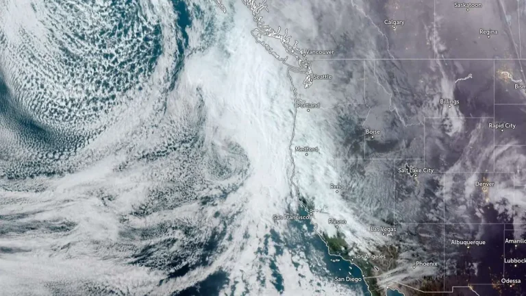
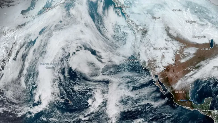
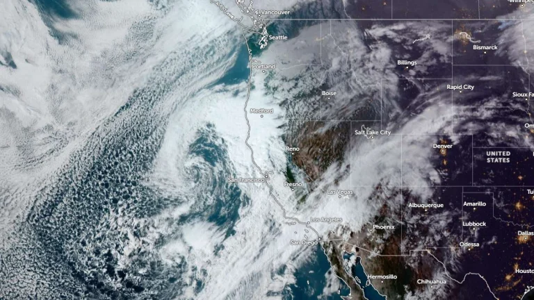
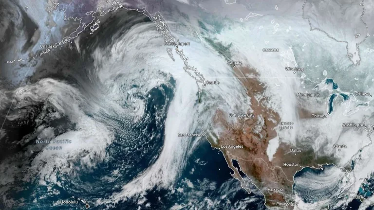
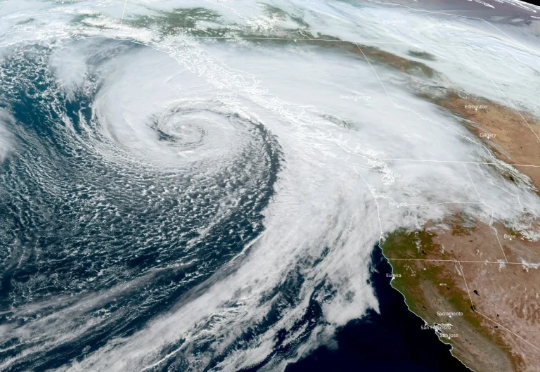
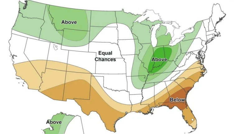
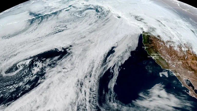
• Atmospheric river forecast to stall over Washington, raising flood risk through March 20

    A stalled atmospheric river over the Pacific Northwest is forecast to deliver 127–254 mm (5–10 inches) of precipitation to parts of Washington between March 17 and 20, 2026. High freezing levels above 2 100 m (7 000 feet) will result in rainfall across most elevations, accelerating snowmelt and increasing the likelihood of riverine flooding.

  • Long-duration atmospheric river impacts Washington and Oregon with heavy rain, snow and flood risk, U.S.

    An atmospheric river made landfall in the Pacific Northwest during the morning of March 11, 2026, bringing heavy rain and snow across portions of Washington and Oregon. Forecasts show that the event will continue affecting the region through early March 14, producing significant precipitation totals, flooding concerns, and major winter weather impacts in mountainous terrain.

  • Atmospheric rivers forecast to bring heavy rain and snow to the Pacific Northwest through mid-March

    Two atmospheric rivers are forecast to hit the Pacific Northwest beginning late March 10, 2026, bringing heavy rainfall to coastal areas and significant snowfall to higher elevations in Washington and Oregon. Precipitation totals of 180–380 mm (7–15 inches) are forecast in mountainous regions, with the potential for river rises and localized flooding through the week.

  • Persistent slab avalanche danger expected across the Cascades this weekend

    Persistent slab avalanche hazards will be the main concern across the Cascade Range this weekend, according to the Northwest Avalanche Center. Forecasters say buried weak layers and recent wind loading have brought several zones close to a “tipping point,” warning that human-triggered avalanches remain possible even under clear skies.

  • Coastal storm and long-duration atmospheric river to bring heavy precipitation to Pacific Northwest and California

    A slow-moving low-pressure system is forecast to bring long-duration atmospheric river conditions to the U.S. West Coast between Saturday, February 21, and Wednesday, February 25, 2026, delivering heavy precipitation from Washington to California. The strongest impacts are expected across southern Oregon and northern California Coast Ranges and the Klamath Mountains, where 5-10 inches (125-250 mm) of rain is forecast.

  • Atmospheric river forecast to bring another round of heavy precipitation to California

    Atmospheric river associated with a slow-moving low-pressure system is forecast to impact California between February 21 and 26, 2026, bringing another round of heavy precipitation to the state. The Center for Western Weather and Water Extremes (CW3E) indicates very high confidence (>90%) in atmospheric river conditions along northern California through February 23, with moderate-to-high confidence of the AR conditions shifting south along the coast by February 24.

  • Extreme winter storm impacts expected in Sierra Nevada as Pacific storms bring up to 2.4 m (8 feet) of snow through February 18

    Multiple storms are forecast to bring heavy snowfall to California through February 18, 2026, with snowfall rates exceeding 76 mm (3 inches) per hour in parts of the Sierra Nevada. Extreme impacts are possible across higher elevations, with travel conditions dangerous to impossible, and 1.2–2.4 m (4–8 feet) of snow forecast above pass level.

  • Cascades snowpack remains below 50 percent following late January storms

    Four atmospheric rivers affected the Pacific Northwest between January 27 and February 1, 2026, producing 150–300 mm (6–12 inches) of rain in the Olympic Mountains and 100–200 mm (4–8 inches) in the North Cascades. Snowfall reached up to 900 mm (36 inches) in high elevations near Mount Rainier, while snowpack remains below 50% of normal.

  • Series of atmospheric rivers forecast to bring heavy rain to the Pacific Northwest this week

    Four atmospheric rivers (ARs) are forecast to impact the Pacific Northwest from Tuesday, January 28 through January 31, 2026, bringing several days of moderate to heavy precipitation, with rainfall totals reaching 125–250 mm (5–10 inches) over the Olympic Peninsula and 50–125 mm (2–5 inches) across the Willapa Hills, northern Oregon Coast Ranges, and Washington Cascades.

  • Weak La Niña supports wet north-dry south pattern across the western U.S. through March 2026

    Experimental seasonal forecasts from the Center for Western Weather and Water Extremes (CW3E) suggest that a weak La Niña is reinforcing a wet–north, dry–south precipitation pattern across the western United States during January–March 2026. The outlook shows high-confidence signals for below-normal precipitation in Southern California, while model uncertainty remains higher across central and northern California.