
Cascades snowpack remains below 50 percent following late January storms
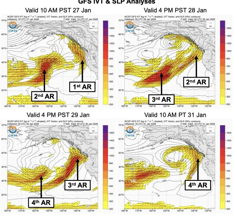
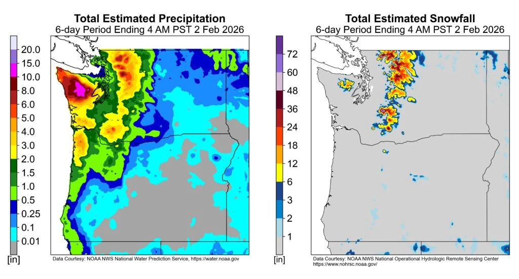
Four atmospheric rivers affected the Pacific Northwest between January 27 and February 1, 2026, producing 150–300 mm (6–12 inches) of rain in the Olympic Mountains and 100–200 mm (4–8 inches) in the North Cascades. While snowfall reached up to 900 mm (36 inches) in high elevations near Mount Rainier, the snowpack remains below 50% of normal across much of the Cascades.

Atmospheric river impacting Pacific Northwest at 19:10 UTC on January 31, 2026. Credit: NOAA/GOES-West, Zoom Earth, The Watchers
Snowpack across the Cascade Range remains below 50 percent of normal following a sequence of four atmospheric rivers that made landfall between January 27 and February 1, 2026.
Although none of the individual systems were particularly strong, their close succession produced an extended period of moisture transport toward the Pacific Northwest.
Analyses from the Global Ensemble Forecast System (GEFS) identified four intervals of integrated vapor transport (IVT) exceeding 250 kg m⁻¹ s⁻¹ over the Olympic Peninsula. The third event reached moderate strength, with IVT near 500 kg m⁻¹ s⁻¹ on January 30, and was classified as an AR 2 on the Ralph et al. (2019) AR Scale.
The second and fourth events were rated AR 1, while in Pacific County, Washington, a longer duration of continuous AR conditions exceeding 48 hours qualified locally as AR 3.
Combined precipitation from all four systems totaled 150–300 mm (6–12 inches) in the Olympic Mountains and 100–200 mm (4–8 inches) in the North Cascades, while lower basins such as the Green River Basin received 25–75 mm (1–3 inches).
Hydrologic impacts were limited despite the high rainfall totals, as very dry antecedent conditions during the preceding two weeks increased soil infiltration capacity and reduced immediate runoff.
Higher terrain areas, such as the North Cascades and the vicinity of Mount Rainier, received 30–90 cm (12–36 inches) of new snow, but even with these totals, overall snowpack across the region remains below 50% of normal.
Snowpack in the Cascades is a primary water reservoir for the Pacific Northwest, storing winter precipitation that sustains streamflow and reservoir levels through spring and summer. It usually reaches its annual peak in late March or early April, leaving roughly six to eight weeks of potential accumulation at the beginning of February.
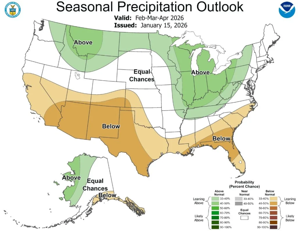
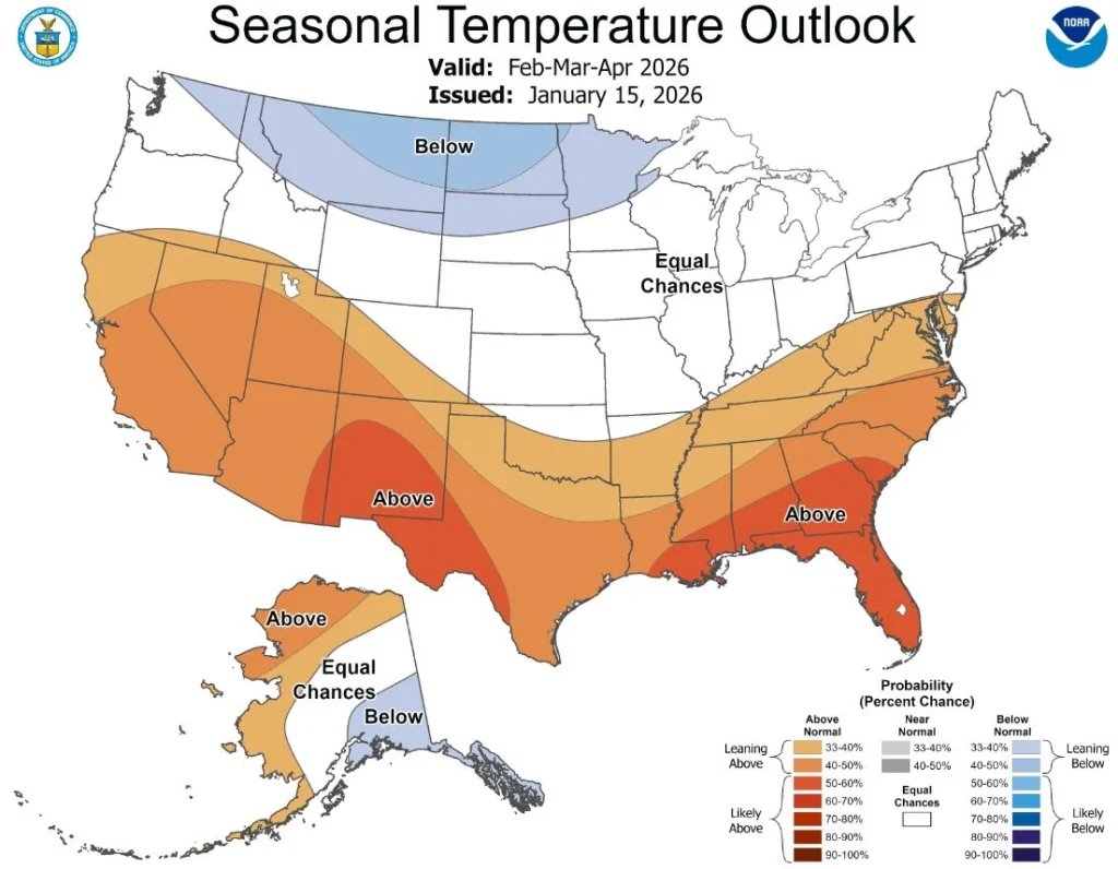
As of early February 2026, seasonal outlooks indicate slightly increased odds of above-normal precipitation in the Cascades during the February–April period, while temperatures show no strong deviation from climatological averages.
References:
1 Quick Summary of the Atmospheric Rivers Impacting the Pacific Northwest During 27 January – 1 February – CW3E – February 3, 2026
I'm a dedicated researcher, journalist, and editor at The Watchers. With over 20 years of experience in the media industry, I specialize in hard science news, focusing on extreme weather, seismic and volcanic activity, space weather, and astronomy, including near-Earth objects and planetary defense strategies. You can reach me at teo /at/ watchers.news.
Commenting rules and guidelines
We value the thoughts and opinions of our readers and welcome healthy discussions on our website. In order to maintain a respectful and positive community, we ask that all commenters follow these rules.