• Red Flag Warnings issued from the Plains to the Southeast under critical fire weather conditions

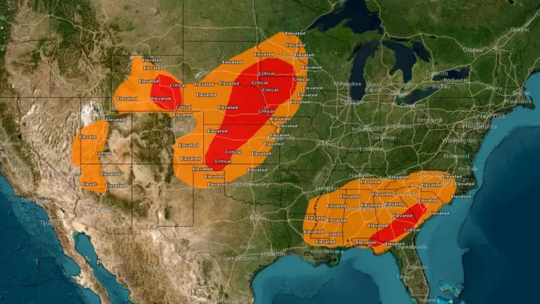
    Red Flag Warnings are in effect across the Central Plains and Southeast United States on March 28, 2026, as the National Weather Service (NWS) warns of critical fire weather conditions driven by strong winds, low relative humidity, and dry fuels. Wind gusts up to 80 km/h (50 mph) and humidity levels as low as 10–20% are expected to promote rapid fire ignition and spread. Outdoor burning is strongly discouraged across all warned regions.
  • Cross-country storm to bring heavy rain to the South and snow to the West and Great Lakes

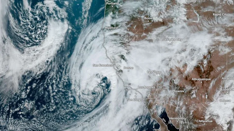
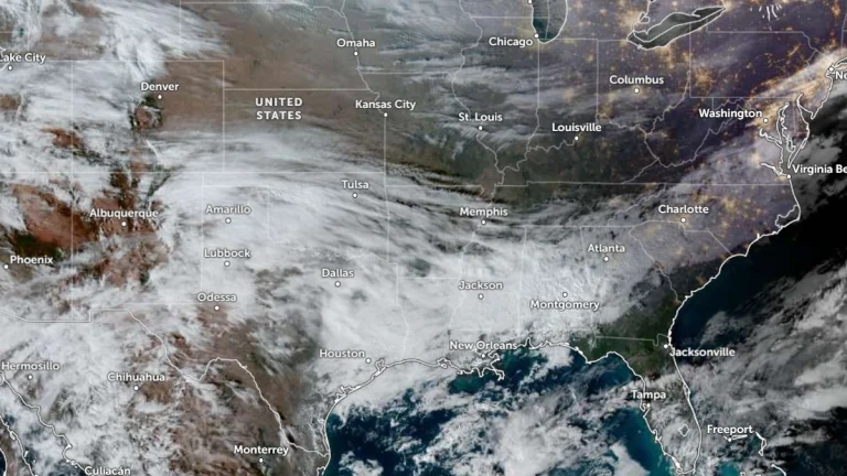
    An atmospheric river affecting California on February 11, 2026, is forecast to evolve into a cross-country storm moving across the southern U.S. through February 13–14, 2026. Widespread rainfall totals of 25 to 75 mm (1–3 inches), with locally higher amounts, are possible across Texas to Georgia. Heavy snow is ongoing in the Sierra Nevada, with additional accumulations expected in the Wasatch and central Rockies.

  • Ice storm warnings in effect across Mississippi, Alabama, Tennessee, and Georgia

    Ice storm warnings are in effect for parts of Mississippi, Alabama, Tennessee, and Georgia between January 24 and 26, 2026. Ice accumulations of 6 mm to 25 mm (0.25 to 1 inch) and wind gusts up to 30 mph (48 km/h) are forecast across the regions. The combination of freezing rain, sleet, and gusty winds is expected to cause widespread power outages, tree damage, and extremely hazardous travel conditions.

  • Freeze warnings issued across Florida Panhandle and parts of the southeast U.S.

    Freeze warnings are in effect across the Florida Panhandle, northern and central counties, and parts of southeast Georgia from 23:00 EST Thursday, January 15, 2026, through 09:00 EST Friday, January 16. Temperatures are forecast to drop as low as −6°C (22°F) in inland areas, producing frost capable of damaging unprotected crops and causing water pipes to freeze and burst.

  • Florida and Georgia brace for severe thunderstorms and heavy rainfall

    Strong to severe thunderstorms are expected to move east on May 14, 2024, affecting northern Florida and southern Georgia with damaging winds and heavy rainfall. Additionally, heavy to excessive rainfall is expected over northern Florida, potentially leading to flash flooding. Another wave of heavy rainfall is forecast to impact parts of eastern Texas and the Lower Mississippi Valley later this week, and rain falling on saturated soils will likely cause additional flash flooding.