• Tornado threat forecast as Hurricane Isaias strengthens ahead of northern Gulf Coast landfall, United States

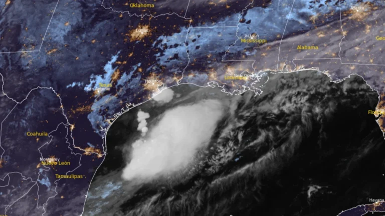
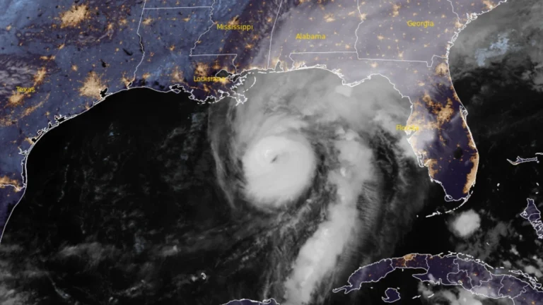
    The Storm Prediction Center (SPC) issued a Slight Risk of severe thunderstorms for parts of the Florida Panhandle, southeastern Alabama, and southwestern Georgia on October 9, 2026, as rainbands from Hurricane Isaias were forecast to bring a tornado threat from the afternoon into the overnight hours. At 09:00 UTC, the National Hurricane Center (NHC) said Isaias had strengthened to 175 km/h (110 mph), with a minimum central pressure of 963 hPa, ahead of an expected northern Gulf Coast landfall Friday night or early Saturday.

  • Flood Watch issued for northeastern Florida as AL92 raises late-week Gulf Coast rainfall threat, U.S.

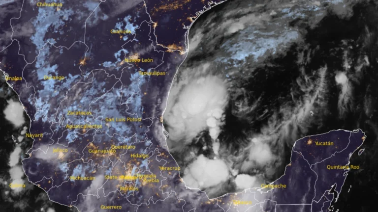
    A Flood Watch is in effect for northeastern Florida and Camden County, Georgia, from 10:00 to 20:00 EDT (14:00 UTC October 6 to 00:00 UTC October 7), with the National Weather Service (NWS) forecasting locally 76–127 mm (3–5 inches) of rain. The Weather Prediction Center (WPC) maintains a Marginal Risk of excessive rainfall across much of Florida through Thursday, while a broader heavy-rain threat is forecast along the northern Gulf Coast from Friday as disturbance AL92 moves northeastward and interacts with an upper-level trough.

  • Flash flooding prompts rescues and state of emergency in Georgia, emergency issued in North Carolina

    Flash flooding struck McCaysville, Georgia, and northeastern Surry County, North Carolina, from late August 1 into August 2, 2026, prompting water rescues and emergency declarations in both states. The NWS issued a Flash Flood Emergency for the Mount Airy area, while flooding in McCaysville impaired the municipal drinking-water system and inundated homes, businesses and public buildings.

  • Extreme heat alerts cover portions of 31 U.S. states, heat index up to 46°C (115°F)

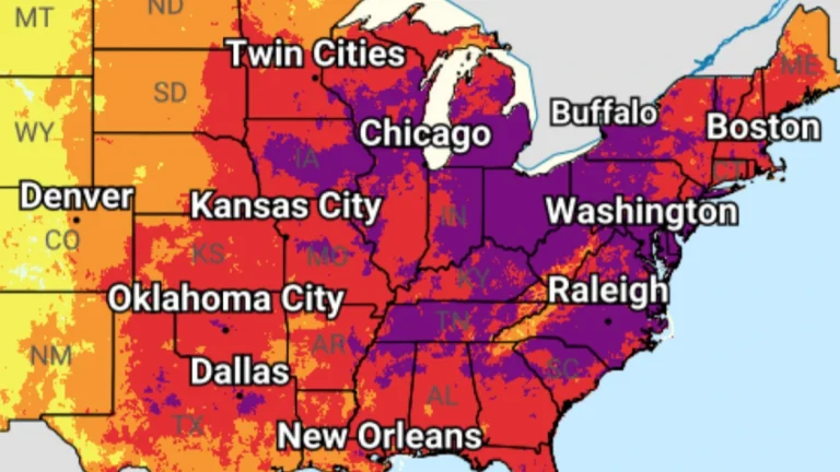
    Extreme Heat Warnings, Extreme Heat Watches, and Heat Advisories are in effect across 31 U.S. states after the National Weather Service (NWS) issued a series of heat alerts on June 29, 2026. Peak heat index values are forecast to reach 46°C (115°F), with dangerous heat and humidity expected to persist into early July across parts of the Midwest, Northeast, Southeast, and central United States.

  • Flood threat expands along Gulf Coast as Potential Tropical Cyclone One nears Louisiana

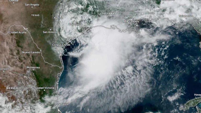
    Heavy rainfall, flash flooding, storm surge, and isolated tornadoes are expected across portions of the Gulf Coast as Potential Tropical Cyclone One tracks along the Texas coast on June 17, 2026. While the system is unlikely to develop into a tropical cyclone, it could bring rainfall totals of up to 500 mm (20 inches) to some areas along with the severe weather.

  • Major Georgia wildfires destroy 143 structures amid severe drought

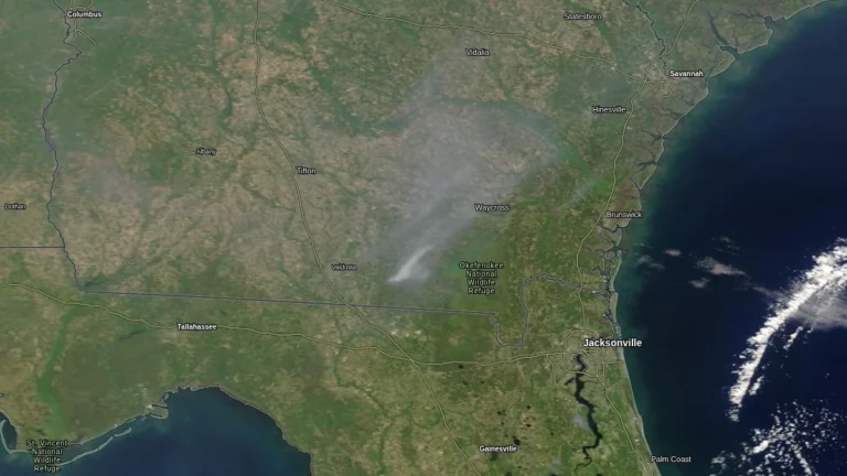
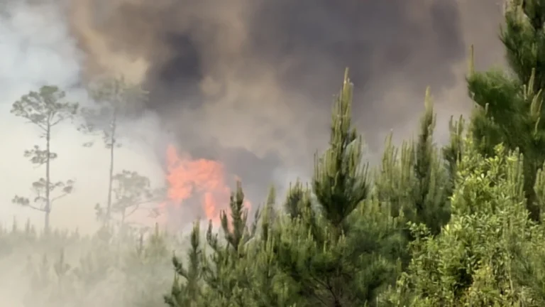
    Two major wildfires in southeast Georgia have burned over 16 000 ha (40 000 acres) and destroyed 143 structures by April 25, 2026, with federal fire officials reporting extreme fire behavior near the Florida line. The Highway 82 Fire in Brantley County and the Pineland Road Fire in Clinch and Echols counties remained 10% contained, with evacuations and road closures in effect.

  • Wildfire destroys more than 80 homes in Brantley County, Georgia

    More than 80 homes have been destroyed by a wildfire in Brantley County, Georgia, as of April 24, 2026, prompting evacuation orders in multiple communities. Approximately 1 000 structures remain under threat as the fire continues to spread under dry and windy conditions, with containment still limited.