
Flash flooding prompts rescues and state of emergency in Georgia, emergency issued in North Carolina
Flash flooding struck McCaysville, Georgia, and northeastern Surry County, North Carolina, from late August 1 into August 2, 2026, prompting municipal states of emergency in McCaysville and Mount Airy. The flooding also triggered water rescues, road closures and infrastructure damage, while the NWS issued a Flash Flood Emergency for areas around Mount Airy and Pilot Mountain.
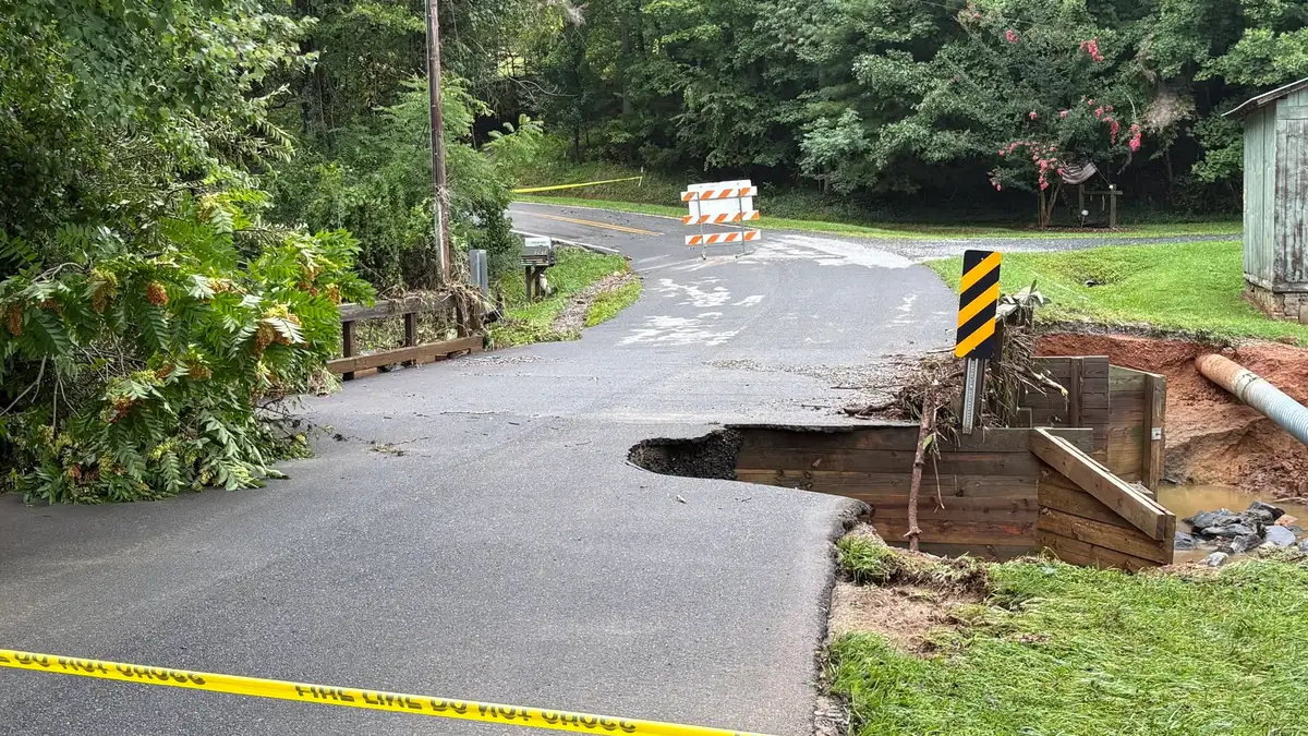
Road damage across Surry County, North Carolina, following flash flooding on August 2, 2026. Credit: Surry County Emergency Services
The NWS office in Blacksburg issued the Flash Flood Emergency after 102–178 mm (4–7 inches) of rain fell across parts of northeastern Surry County. The emergency remained in effect until 08:30 LT on August 2 and covered areas surrounding Mount Airy and Pilot Mountain.
Emergency managers and law-enforcement agencies reported life-threatening flooding as rivers and creeks left their banks. Numerous roads became impassable or washed out, and responders conducted water rescues across the affected area.
NWS described conditions as a particularly dangerous situation and urged residents to avoid flooded roads. Flooding affected Mount Airy, Pilot Mountain and surrounding communities and drainage basins in northeastern Surry County.
 Road damage across Surry County, North Carolina, following flash flooding on August 2, 2026. Credit: Surry County Emergency Services
- Road damage across Surry County, North Carolina, following flash flooding on August 2, 2026. Credit: Surry County Emergency Services
- Road damage across Surry County, North Carolina, following flash flooding on August 2, 2026. Credit: Surry County Emergency Services
- Road damage across Surry County, North Carolina, following flash flooding on August 2, 2026. Credit: Surry County Emergency Services
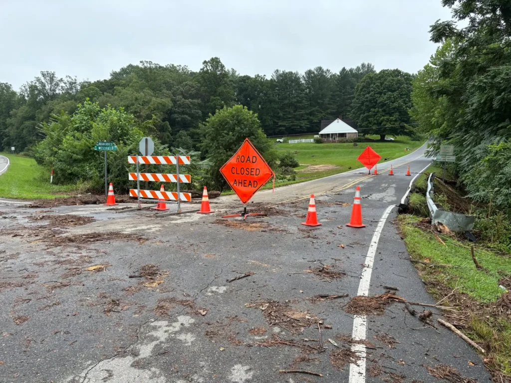
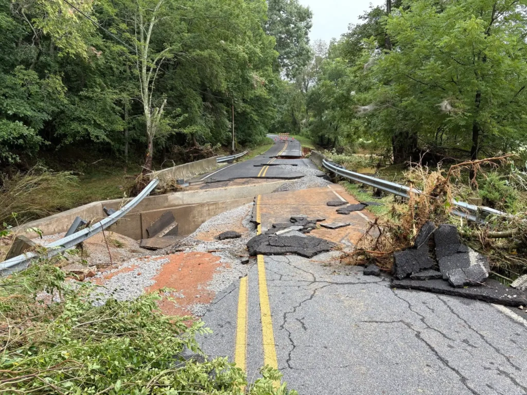
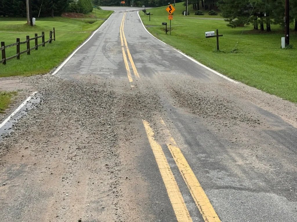
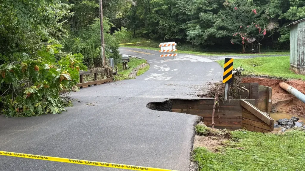
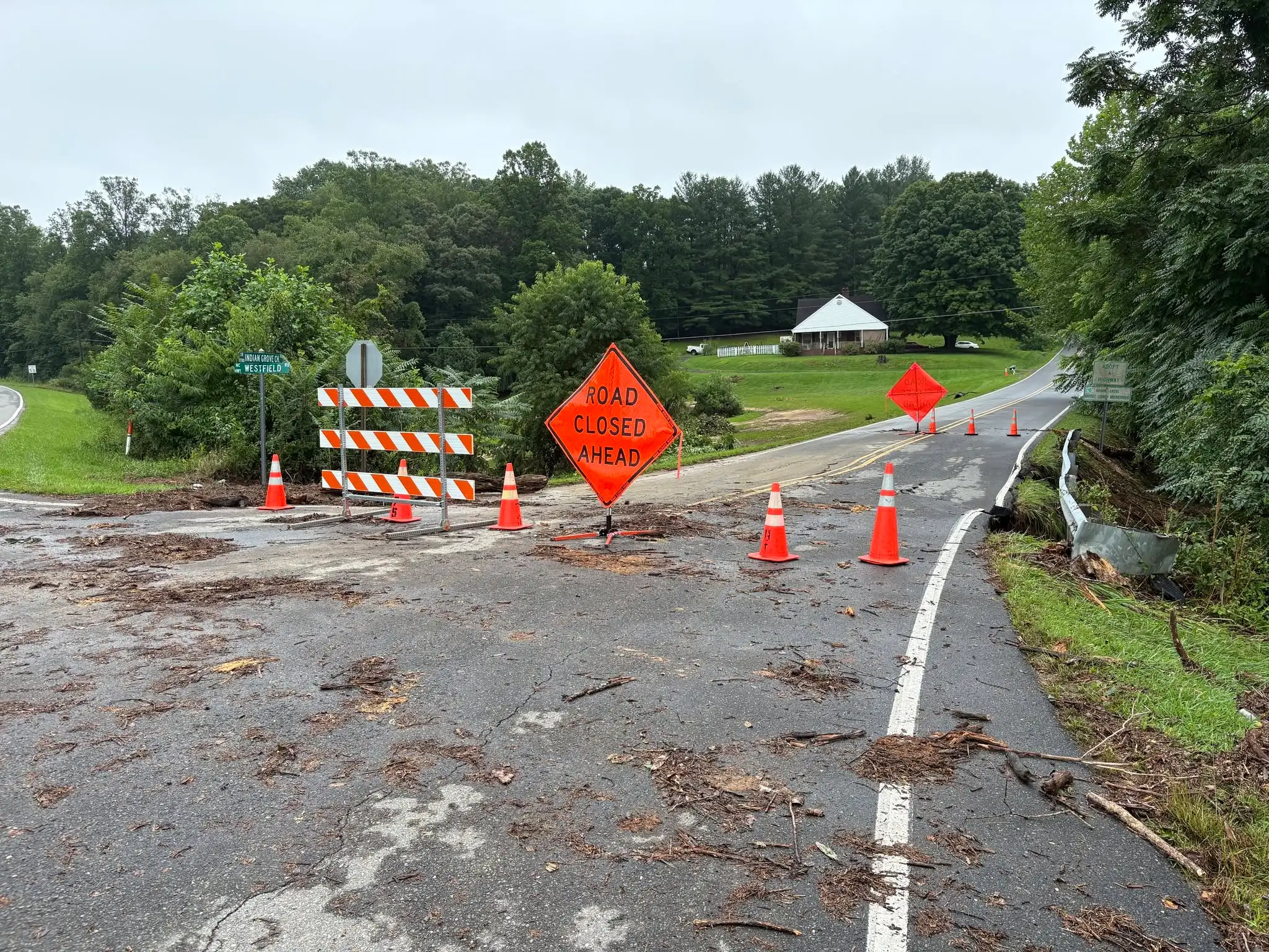
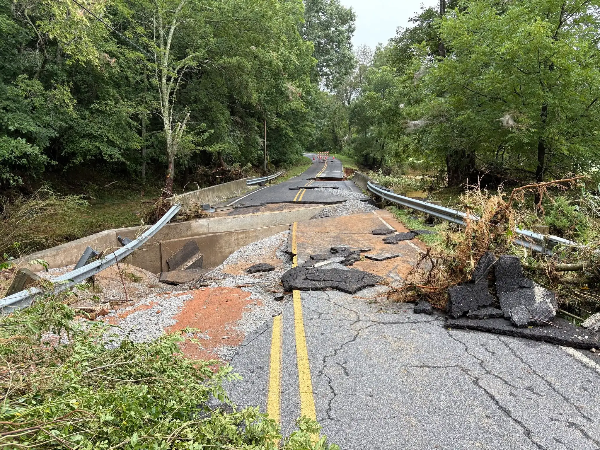
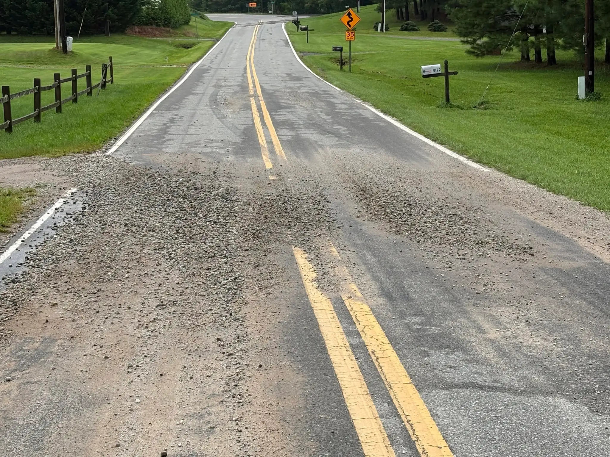
The City of Mount Airy declared a municipal state of emergency after the overnight rainfall damaged roads and other infrastructure. The localized declaration applied to Mount Airy and was not a statewide North Carolina emergency declaration.
Response crews spent August 2 clearing debris and assessing damage, while officials warned that municipal services could be disrupted during the recovery period.
The North Carolina flooding developed after an initial Flash Flood Warning was issued late on August 1. Conditions worsened during the night as repeated heavy rainfall moved across the same watersheds, causing water levels to rise rapidly around Mount Airy.
Flash-flood potential had decreased by the morning of August 3, but the NWS said additional thunderstorms could still produce localized heavy rainfall. An outlook issued at 03:54 LT placed northwestern North Carolina under a Marginal Risk, Level 1 of 4, for excessive rainfall.
Separate thunderstorms caused flooding in McCaysville, Georgia, and neighboring Copperhill, Tennessee, near the Georgia–Tennessee state line.
The NWS office in Peachtree City reported that 76–102 mm (3–4 inches) of rain had fallen near McCaysville and State Highway 5 when it issued a Flash Flood Warning early on August 2.
McCaysville Mayor Terry Arp, Vice Mayor Jason Woody and Public Safety Director and Police Chief Michael Earley declared a municipal state of emergency after flooding inundated the downtown district. The localized declaration applied only to McCaysville and was not a statewide Georgia emergency declaration.
Floodwater entered the McCaysville Police Department, the post office, businesses along the Riverwalk, other downtown properties and several homes. Earley said water reached chest depth at one location.
City officials attributed much of the downtown flooding to drainage problems associated with the State Highway 5 widening project. Earley said gravel and silt from the construction area entered storm drains and obstructed runoff.
The explanation remained a preliminary assessment by municipal officials rather than a completed engineering determination. The nearby river was heavily discolored by sediment, but officials said the downtown flooding was linked mainly to blocked drainage rather than direct river overflow.
Flooding cut power to McCaysville’s water-treatment plant for several hours and caused a substantial loss of treated water. Officials instructed customers to stop nonessential water use while crews worked to restore power, repair leaks and stabilize the distribution system.
Residents were asked to avoid drinking water from the municipal system while treatment operations were impaired. Major leaks caused by the flooding could not immediately be contained, increasing pressure on the remaining treated-water supply.
Blue Ridge Drive was closed between Pat’s Country Kitchen and the IGA intersection because of mud, debris and standing water. Crews later cleared the main road and reopened it to traffic on the afternoon of August 2.
Contractors working on the highway project, the Georgia Department of Transportation and members of the Georgia State Defense Force assisted with cleanup and recovery operations.
Fannin County Fire Rescue worked with mutual-aid agencies from Copperhill through the night to clear mud and maintain access for emergency vehicles. Road damage and utility disruption were also reported across neighboring communities in Polk County, Tennessee.
Thirteen visitors were rescued from rising floodwaters near the Polk–Fannin county line on the morning of August 2, according to Copper Basin Fire and Rescue. The group became stranded near the Ocoee River and included visitors from Florida, Puerto Rico and Middle Tennessee.
Crews from several surrounding agencies participated in the operation. The rescued visitors were taken to a fire station for shelter, and no injuries were identified in the report.
Flooding closed or damaged roads in Copperhill and surrounding Polk County. Green Drive was closed after a structure supporting the roadway washed out, Belltown Road was restricted to residents and West Main Street was closed.
Copperhill utility officials instructed customers to conserve water and boil water for at least one minute before drinking, cooking or brushing their teeth while crews repaired flood damage.
Several businesses in McCaysville and Copperhill remained closed during cleanup operations. The Blue Ridge Scenic Railway also suspended train and rail-bike services because of the municipal state of emergency in McCaysville and conditions along the affected corridor.
No consolidated official totals for damaged homes, businesses or infrastructure were available on August 3. Damage assessments, water-system repairs and debris removal continued across the affected communities.
References:
1 Flash Flood Watch – NWS – August 3, 2026

I’m a science journalist and researcher at The Watchers, contributing to the Epicenter edition, where I cover peer-reviewed scientific research and emerging discoveries across Earth and space sciences. With a background in astronomy and a passion for environmental science, I’ve worked in shark and coral conservation in Fiji, conducting reef and shark-behavior research, contributing to mangrove restoration, and earning PADI Open Water and Coral Reef Certifications. I bring a blend of scientific rigor and storytelling to illuminate the discoveries shaping our planet and beyond.
Published in the last 24 hours
- 2 atmospheric rivers to bring heavy Sierra snow and California flood risk
- El Niño floods kill 2 in Guayaquil as 172.8 mm of rain swamps Milagro, Ecuador's toll rises to 14
- Southern Thailand braces for heavy rain, 15 provinces on flood and landslide alert for November 18-22
- Paraná River floods force 4 547 from homes as water tops evacuation levels in 10 Argentine towns
