15 rescued as storms bring flooding and lightning fire to Cherokee County, Oklahoma
15 campers were rescued in Oklahoma after getting stranded by floodwaters near Littlefields in Cherokee County on Sunday, June 14, 2026.


15 campers were rescued in Oklahoma after getting stranded by floodwaters near Littlefields in Cherokee County on Sunday, June 14, 2026.
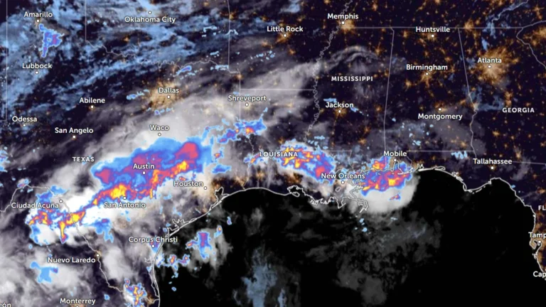
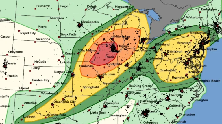
Heavy rainfall is forecast from South Texas into the lower Mississippi Valley this week. Moderate Risk excessive rainfall outlooks remain in effect across parts of the Gulf Coast as multiple rounds of thunderstorms develop within an unusually moist tropical air mass. Rainfall totals could reach 100 to 150 mm (4 to 6 inches) in some areas, with locally higher amounts possible from June 15 to 17, 2026.

At least one person was killed, and 22 others were injured after damaging winds caused a tent to collapse at a church south of Moneta on June 12, 2026.
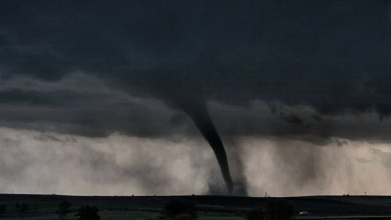
Seven tornadoes, including two rated EF3, struck parts of Illinois and Indiana on June 11, 2026. The storms injured at least seven people, severely damaged 44 homes in Streator, caused minor damage to 35 others, and damaged at least 200 buildings in Merrillville.
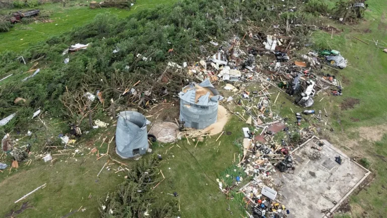
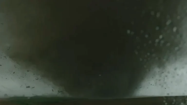
Saskatchewan’s first EF3 tornado since 2010 struck near Oxbow on June 9, 2026. The tornado tracked 32 km (20 miles) on the Canadian side of the border, producing estimated peak winds of 245 km/h (152 mph). It claimed the life of a pet animal, destroyed buildings at a farm property, and caused damage that extended into North Dakota, United States.
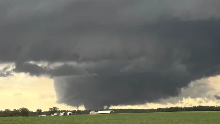
An EF3 tornado struck the Washburn area of central Illinois on June 10. 2026. The tornado reached a maximum width of 777 m (2 550 feet) and produced winds of up to 249 km/h (155 mph). Three EF1 tornadoes were confirmed near Lincoln’s New Salem, Athens, and Springfield. An EF0 tornado was also reported near Ipava.
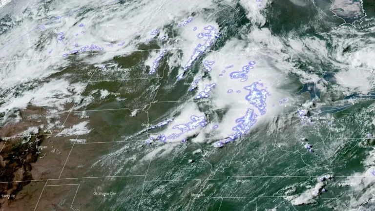
The Storm Prediction Center (SPC) said a fast-moving convective system that crossed parts of the Midwest and Great Lakes on June 10, 2026, has been preliminarily classified as a derecho after producing widespread wind damage, downed power lines, and measured gusts exceeding 145 km/h (90 mph).
Severe storms that produced damaging tornadoes outside Chicago killed one person in Iowa, damaged communities in Illinois and Indiana, and left hundreds of thousands without power across the Midwest and Northeast on Thursday, June 11, 2026. As of 03:00 CDT (08:00 UTC) on Friday, more than 650 000 customers were without power across 8 states, including at least 250 000 in Illinois and 170 000 in Indiana.
A severe thunderstorm outbreak is forecast across parts of the Midwest and Great Lakes this afternoon and evening, with the highest risk focused on northern Illinois, far eastern Iowa, and far southern Wisconsin.
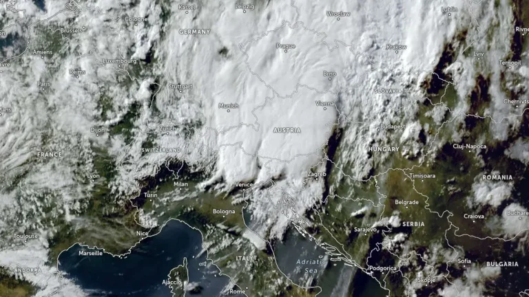
Severe thunderstorms damaged more than 150 buildings in Slovenia on June 10, 2026, before the same weather system moved into northern Croatia overnight into June 11, bringing damaging wind, hail, and heavy rainfall.