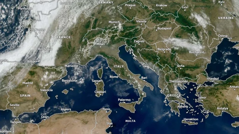
• Thunderstorms, heavy rainfall and flash flood risk forecast across northern Italy, Slovenia and Croatia, ending late-summer heat

    Widespread thunderstorms and locally heavy rainfall are forecast across northern Italy, Slovenia and Croatia on September 9, 2026, with intense rainfall posing a risk of rapid rises in torrential watercourses and localized flash flooding. A marked temperature drop is also forecast behind the system, bringing substantially cooler conditions to northern Italy and parts of the Alpine and northern Adriatic region after the recent late-summer heat.

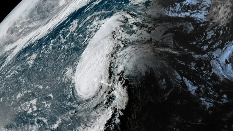
  • First-ever Tornado Watch reported for Hawaii as Hurricane Lowell passes west of Niʻihau

    The National Weather Service (NWS) issued a Tornado Watch 1 for Kauaʻi County, including Kauaʻi and Niʻihau, and adjacent coastal waters at 16:13 HST on September 7, 2026 (02:13 UTC on September 8), as Hurricane Lowell approached the western Hawaiian Islands. The watch, an exceptionally rare issuance for Hawaiʻi, remains in effect until 04:00 HST (14:00 UTC) on September 8, with several tornadoes possible near Kauaʻi and Niʻihau and a few possible elsewhere across the state.

  • Hurricane Lowell approaches Kauaʻi County with destructive winds, flooding, storm surge and tornado threat, Hawaii

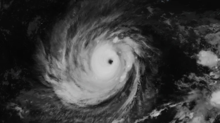
    Flooding and transportation disruptions were already affecting Kauaʻi late September 7, 2026, as Hurricane Lowell moved toward the island with maximum sustained winds of 175 km/h (110 mph). The hurricane was about 215 km (135 miles) southwest of Līhuʻe at 20:00 HST (06:00 UTC on September 8), with its core forecast to pass near or just west of Niʻihau overnight.

  • Level 5 Emergency Warnings for landslides issued for Niijima, record rain lashes Oshima and Toshima, Japan

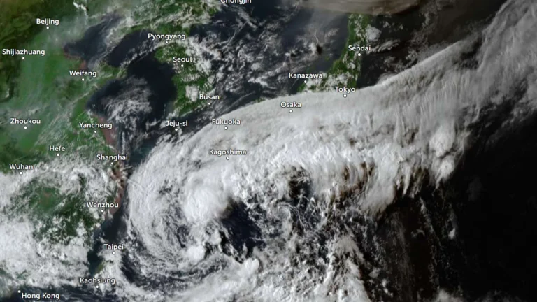
    The Japan Meteorological Agency (JMA) issued Level 5 Emergency Warnings for landslides in Niijima Village, Oshima Town and Toshima Village in Tokyo’s Izu Islands on September 7, 2026, after 24-hour rainfall totals broke records at multiple stations. Niijima recorded 485 mm (19.1 inches), while the main Oshima station received 581.5 mm (22.9 inches), its highest September total on record. Separately, Iwaki City in Fukushima Prefecture issued a citywide Level 4 Evacuation Instruction and listed one death in its final disaster report, according to the Fire and Disaster Management Agency (FDMA).

  • Record rainfall brings landslides and infrastructure disruption to Yakushima, Japan

    Record rainfall associated with Typhoon No. 24 and an autumn-rain front affected Yakushima Town, Kagoshima Prefecture, from September 4 to September 5, 2026, with 24-hour rainfall at Onoaida reaching 490.5 mm (19.31 inches) by 05:30 JST. The Japan Meteorological Agency issued a Level 5 Landslide Disaster Special Warning at 05:10 before replacing it with a Level 4 warning at 11:30, while authorities reported landslides, water outages affecting as many as 289 households, and large amounts of driftwood at Miyanoura Port.

  • Hurricane Lowell weakens to Category 4 after briefly regaining Category 5, Hawaii under State of Emergency

    Hurricane Lowell reached Category 5 strength with winds of 260 km/h (160 mph) before weakening slightly to Category 4 south of Hawaii late on September 4. Heavy rainfall, life-threatening surf and possible wind and storm-surge impacts remained forecast for portions of the state through early next week, particularly around Kauaʻi County.

  • Severe storms damage trees and power lines from Michigan to Pennsylvania, damaging wind risk continues

    Severe thunderstorms damaged trees and power infrastructure from Michigan to Pennsylvania on September 2 and 3, 2026 while a gust of 103 km/h (64 mph) was recorded at Ronald Reagan Washington National Airport late September 3. DTE Energy reported 145 000 customers restored by early September 4, while the Storm Prediction Center maintained a Slight Risk from the southern Great Lakes into the Mid-Atlantic, with damaging wind gusts the primary hazard

  • Multiple people missing, more than 100 houses collapse in Putian as Typhoon Saudel floods Fujian, China

    Multiple people were missing, and more than 100 houses had collapsed in Huating Town, Putian, after Typhoon Saudel brought heavy rain and severe flooding across Fujian on September 3, 2026. Authorities had evacuated 83 700 people from risk areas, while NMC recorded local rainfall totals reaching 565.5 mm (22.26 inches) in some areas. Fifty rivers in Fujian exceeded warning levels at 74 hydrological stations between September 3 and 4.

  • Atmospheric river targets Pacific Northwest as Tropical Storm Marie boosts California rainfall risk

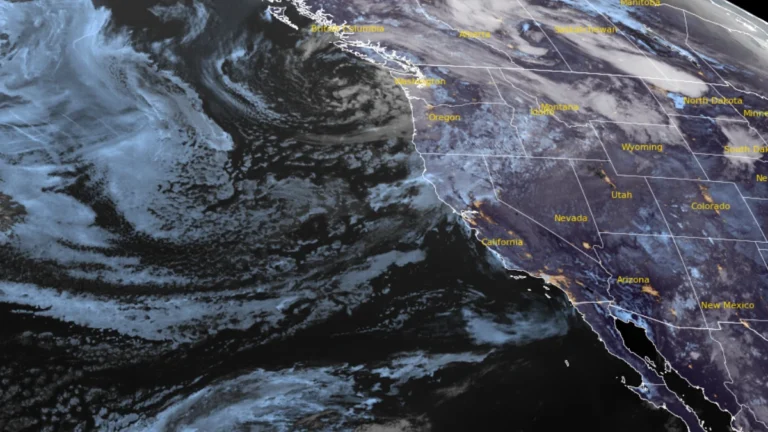
    An early-season atmospheric river associated with a potent upper-level closed low is forecast to bring 25–75 mm (1–3 inches) of precipitation to parts of the western United States through 05:00 PT (12:00 UTC) on September 5, 2026. The Weather Prediction Center (WPC) placed interior northern California, eastern Oregon, and western Idaho under a Marginal Risk of excessive rainfall for September 3–4, while Marie-related moisture raised a separate, more uncertain California rainfall risk later in the forecast period.

  • Edouard weakens to tropical depression over Texas, WPC warns of significant flash flooding

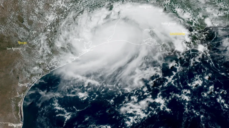
    Tropical Storm Edouard made landfall near Johnson Bayou, Louisiana, at 14:20 CDT (19:20 UTC) on September 1 with winds of 95 km/h (60 mph), then weakened to a tropical depression over southeastern Texas. The Weather Prediction Center forecast storm-total rainfall of 102–203 mm (4–8 inches), with localized totals near 305 mm (12 inches), while Flood Watches remained in effect and approximately 70 000 Entergy Texas customers were without power late September 1.