
First-ever Tornado Watch reported for Hawaii as Hurricane Lowell passes west of Niʻihau
The National Weather Service (NWS) issued a Tornado Watch 1 for Kauaʻi County, including Kauaʻi and Niʻihau, and adjacent coastal waters at 16:13 HST on September 7, 2026 (02:13 UTC on September 8), as Hurricane Lowell approached the western Hawaiian Islands. The watch, an exceptionally rare issuance for Hawaiʻi, remains in effect until 04:00 HST (14:00 UTC) on September 8, with several tornadoes possible near Kauaʻi and Niʻihau and a few possible elsewhere across the state.
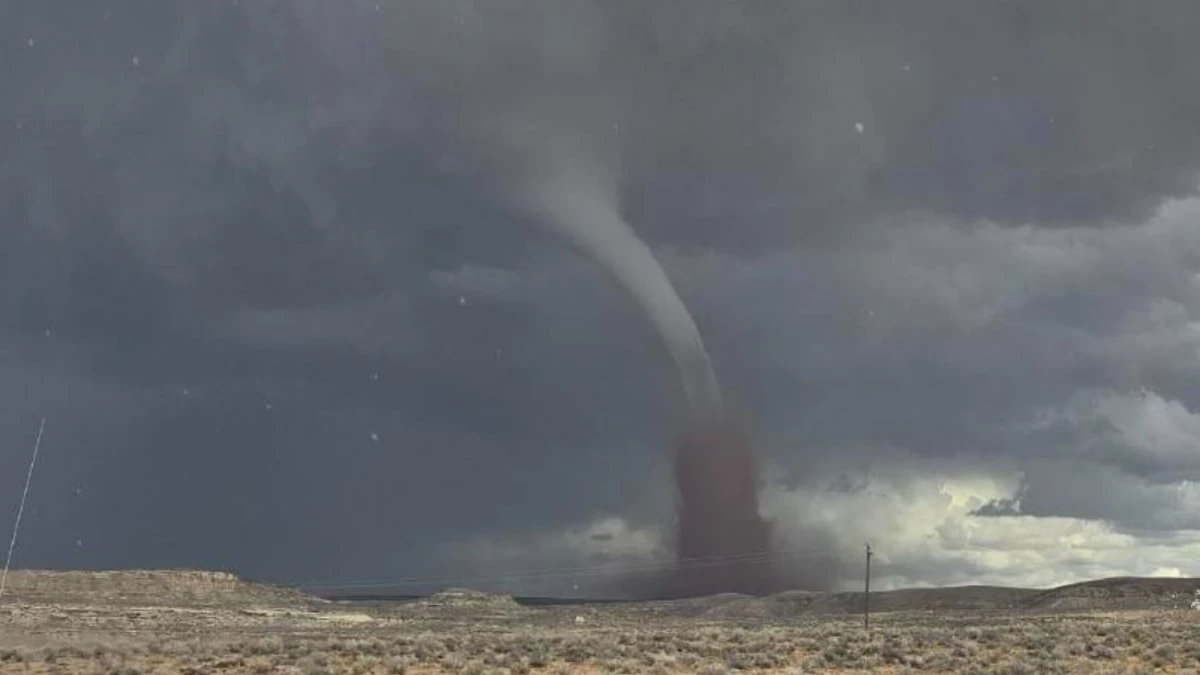
Long-track tornado near Montezuma Creek, Utah on September 13, 2025. Credit: Navajo Police Department
Tornado Watch 1 covers Kauaʻi County, including the islands of Kauaʻi and Niʻihau, as well as the Kauaʻi Northwest Waters, Kauaʻi Windward Waters, Kauaʻi Leeward Waters and Kauaʻi Channel.
NWS said conditions were favorable for tornadoes in and near the watch area and advised residents to remain alert for threatening weather and possible subsequent warnings.
The National Hurricane Center (NHC) said several tornadoes were possible near Kauaʻi and Niʻihau through the overnight period, with a few also possible across the remainder of the Hawaiian Islands.
A tornado watch means conditions are favorable for tornadoes in and near the designated area. A tornado warning is issued when a tornado has been sighted or indicated by weather radar and represents an imminent threat to life and property.
The issuance is exceptionally unusual for Hawaiʻi and is being described by meteorologists and media reports as the first Tornado Watch issued for the state. Meteorologist Matthew Cappucci of MyRadar described it as the first such watch in Hawaiʻi and noted that severe thunderstorm and tornado watches in the contiguous United States are generally issued by the Storm Prediction Center, while local NWS offices are responsible for issuing comparable products outside the Lower 48.
“For the Contiguous United States, the Storm Prediction Center, headquartered in Norman, Oklahoma, issues all convective (severe thunderstorm/tornado) watches. Outside the Lower 48, it’s up to local offices. Tornado watches will probably never be issued in Alaska or Puerto Rico or Guam; this is an absolute first for the agency, Cappucci said in a post on social media.
“In fact, it’s so unusual that the automated National Weather Service social media accounts weren’t “wired up” to tweet the tornado watch; presumably, it’s encoded slightly differently,” he added.
“During Kona lows we have had localized Tornado Warnings in the past. This is the first time a watch has been issued for an entire county in Hawai’i,” a local commented on Cappuci’s post. “This is the 3rd tornado watch Kauai has had,” commented another user under the post.
Hawaiʻi has, however, experienced tornadoes before. NWS Honolulu’s historical tornado database includes numerous confirmed events, including an F0 tornado at Anahola, Kauaʻi, on March 24, 2002.
One of the state’s most significant tornadoes struck Kailua-Kona on January 28, 1971. A NOAA/NWS study classified the tornado as F2 and said it developed over Kailua Bay as a large tornadic waterspout before moving approximately 1.6 km (1 mile) inland and damaging or destroying numerous structures. It was part of a rare outbreak in which four tornadoes were reported across the Hawaiian Islands.

At 20:00 HST on September 7 (06:00 UTC on September 8), NHC placed Hurricane Lowell approximately 215 km (135 miles) southwest of Līhuʻe and 335 km (210 miles) west of Honolulu.
Maximum sustained winds were 175 km/h (110 mph), and Lowell was moving north-northeast at 30 km/h (18 mph). Its estimated minimum central pressure was 961 hPa.
A Hurricane Warning remained in effect for Kauaʻi County, including Kauaʻi and Niʻihau, while Oʻahu remained under a Tropical Storm Warning. Lowell’s core was forecast to pass near or just west of Niʻihau during the night and early September 8.
NHC reported that tropical-storm-force winds were already affecting Kauaʻi. A weather station at Waimea on the south-central coast recorded sustained winds of 79 km/h (49 mph) with a gust to 109 km/h (68 mph). Meanwhile, Līhuʻe Airport recorded sustained winds of 64 km/h (40 mph) with a gust to 84 km/h (52 mph). Hurricane conditions are expected to begin in Kauaʻi County during the following several hours.
NWS Honolulu estimated at 16:25 HST on September 7 (02:25 UTC on September 8) that approximately 150–250 mm (6–10 inches) of rain had already fallen across Kauaʻi.
Lowell was forecast to produce an additional 100–200 mm (4–8 inches) over Kauaʻi, with maximum storm totals reaching approximately 610 mm (24 inches). NHC said the rainfall could produce significant flash flooding and mudslides, particularly across Kauaʻi County and portions of the Big Island.
NHC said the combination of storm surge and high tide could flood normally dry coastal areas of Kauaʻi County. Water could reach 0.6–1.2 m (2–4 feet) above ground level if the peak surge coincided with high tide, with the highest inundation expected along the southern coast of Kauaʻi and around Niʻihau.
The deepest water was expected along the immediate coast near and to the right of Lowell’s center, where the surge would be accompanied by large and destructive waves. Swells generated by Lowell were also producing life-threatening surf and rip-current conditions across many of the Hawaiian Islands.
References:
1 Tornado Watch 1 — NOAA/NWS — September 8, 2026
2 Area Forecast Discussion for Hawaiʻi — NOAA/NWS — September 8, 2026

I am an Assistant Editor and Severe Weather & Science Journalist at The Watchers, specializing in real-time severe weather coverage, geophysical event reporting, and research-driven scientific analysis. You can reach me at rishav(at)watchers(.)news.

Commenting rules and guidelines
We value the thoughts and opinions of our readers and welcome healthy discussions on our website. In order to maintain a respectful and positive community, we ask that all commenters follow these rules.