
In 1903, 17 coal miners in Frank, Alberta, dug their own way out of a mountain after a rockslide sealed the mine, and came up 13 hours later to find part of their town buried
Seventeen coal miners trapped beneath Turtle Mountain during the April 29, 1903, Frank Slide in Alberta dug their way back to the surface about 13 hours later. All 17 escaped, but the rock avalanche had destroyed homes on the town’s edge, and at least one of the men had lost his wife and children.
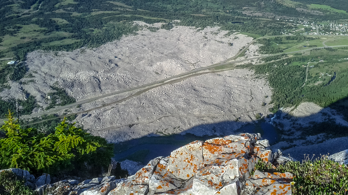
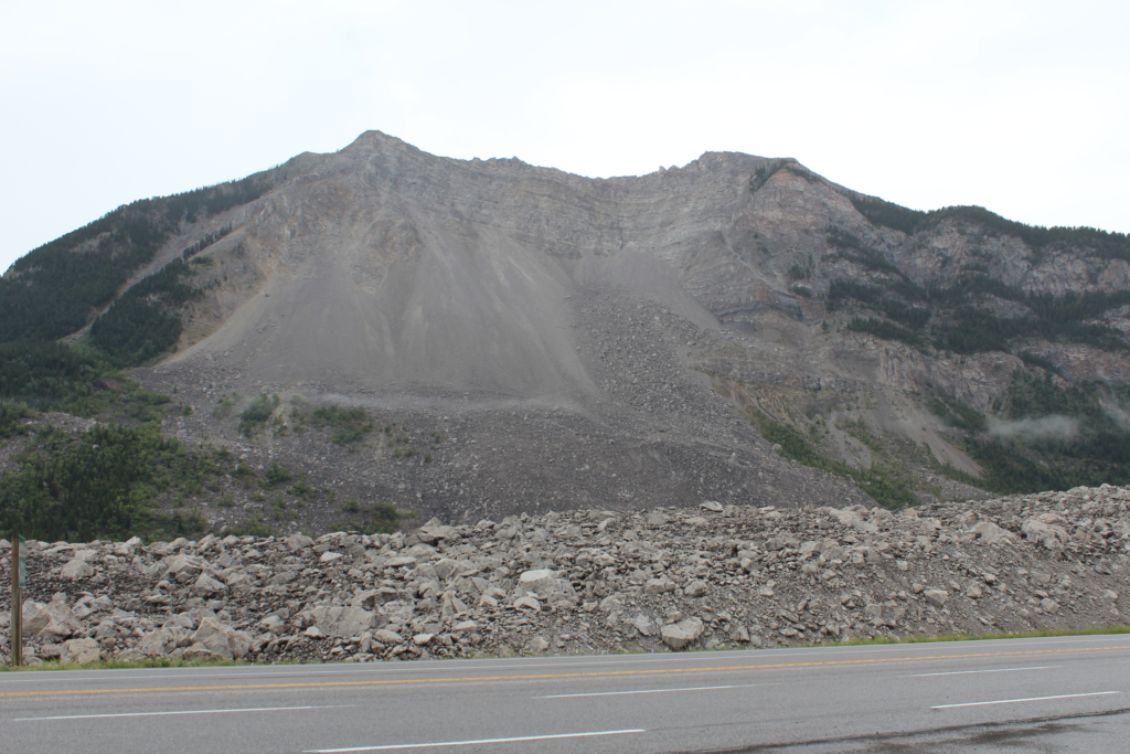
Highway 3 crosses the Frank Slide debris field in this July 4, 2012, view. The 1903 rock avalanche buried part of Frank and spread across the valley floor. Credit: Luke Ratzlaff, via Wikimedia Commons.
The disaster began before dawn in the Crowsnest Pass, in what is now southwestern Alberta. Turtle Mountain’s eastern slope collapsed onto the mine entrance and part of Frank.
Below ground, the collapse blocked the miners’ way out without destroying the workings. They could still move through the mine, but the passages they tried toward the surface were obstructed.
Blocked passages left the miners to dig an exit
Consulting engineer Walton E. Dowlen recorded the miners’ account in The Engineering and Mining Journal on July 4, 1903, just over two months after the disaster.
They described a loud rumbling, followed by air rushing through the workings and putting out their lights. Fragments of limestone and dirt then fell into the narrow passages leading toward the surface.
After relighting their lamps, the men investigated an upward passage and found it obstructed. They went down to the main entry, but that route was blocked too. Dowlen described them clearing material from a manway, a passage for workers, near the main entrance and reaching daylight 13 hours after the slide.
A later account from the Frank Slide Interpretive Center describes the escape as digging through coal. In a 2023 interview with the Lethbridge Herald, then-facility supervisor Joey Ambrosi said the men checked their normal exits and air shafts before one suggested digging another route.
The early and later descriptions differ in their explanation of the passage the men opened. Both place their emergence about 13 hours after the collapse. The centre’s own factsheet confirms that all 17 trapped workers dug their way to freedom.
Ambrosi placed their emergence at about 17:00 local time, late that afternoon, by which point people outside had assumed they were dead. “And they were all alive,” he told the newspaper.
Reaching the surface brought news of families lost
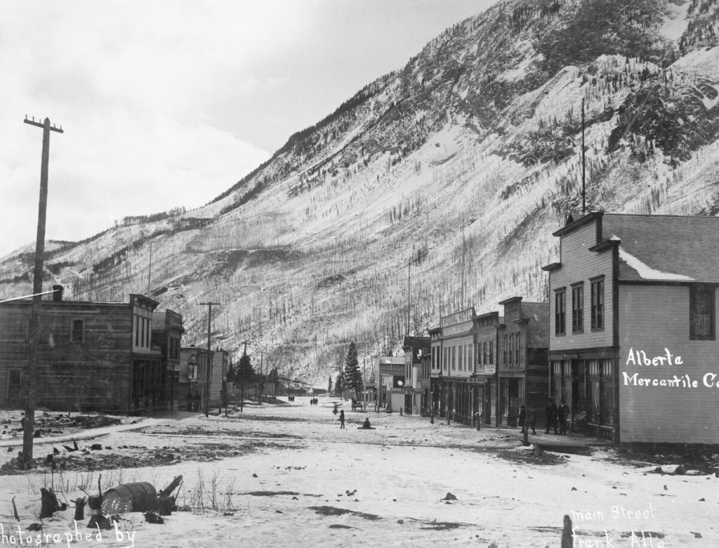
The men’s survival did not mean their households had escaped. The Interpretive Center records that one trapped worker emerged to find his home destroyed and his wife, children, and brother-in-law dead.
Other families survived homes being struck. The same factsheet records that Alexander Leitch, his wife, and four sons died, while three daughters survived their partly destroyed house. Members of the Bansemer and Ennis families also survived the destruction of their homes.
Those accounts describe separate groups of survivors: workers escaping from underground and residents who lived through the impact at the surface. Neither supports the familiar story that a single baby was the disaster’s only survivor.
The avalanche struck the edge of Frank
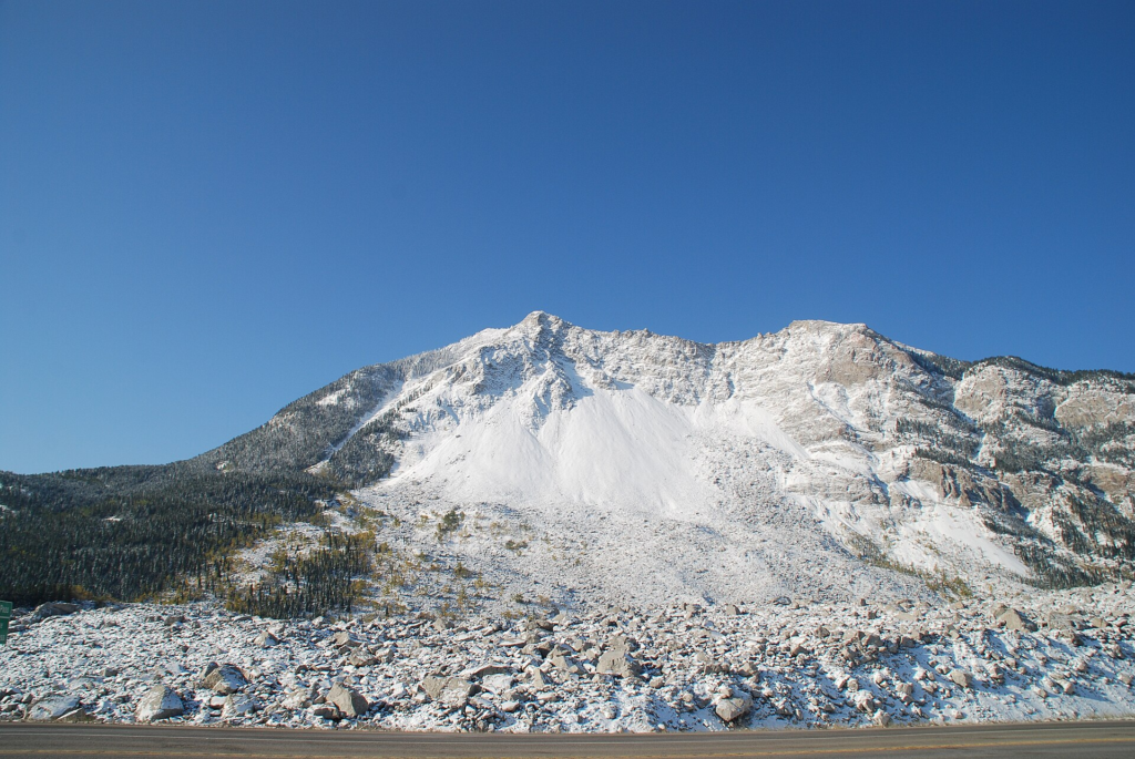
Credit: Paul Jerry, via Wikimedia Commons.
The center estimates that Frank had about 600 residents and that roughly 500 were outside the slide’s path. The destruction included miners’ cottages on the southeastern edge, mine buildings and a construction camp. Twenty-three people in the cottages survived.
The Frank Sentinel reported 70 deaths at the time, while the Interpretive Center’s current account estimates more than 90. Most victims’ bodies were never recovered, preventing an exact count.
The town’s later relocation helped sustain the impression that it had disappeared beneath the rocks. Ambrosi told the Lethbridge Herald that buildings were subsequently moved because of concern about another slide. Later travelers saw the debris and an absent townsite, reinforcing the mistaken account.
The slide covered 3 km² of valley floor
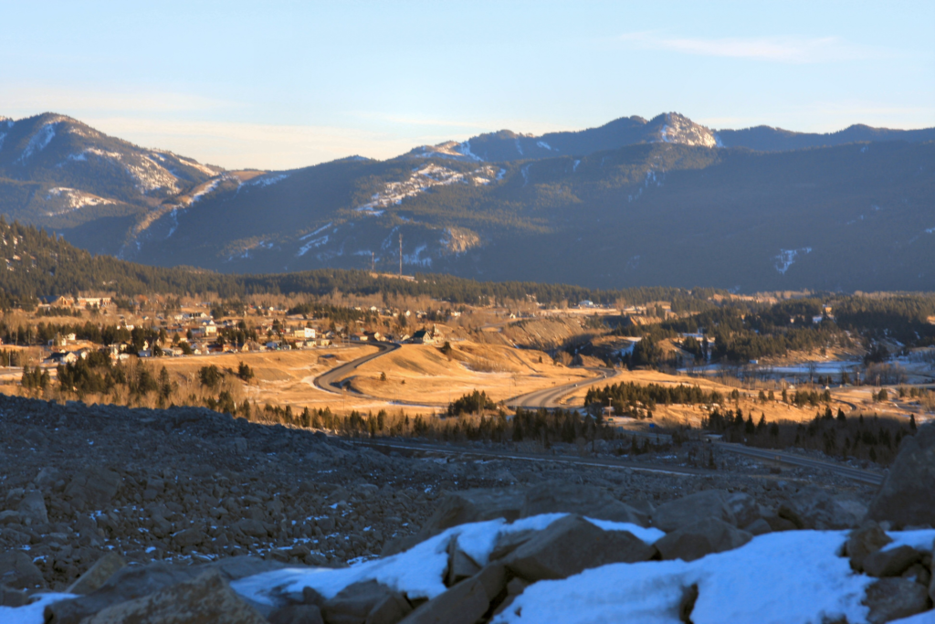
The Interpretive Center describes about 3 km² (1.2 miles2) of valley floor buried beneath rock averaging 14 m (46 feet) deep, with deposits reaching 45 m (about 150 feet). Accounts put the avalanche’s duration at roughly 90 to 100 seconds.
Published estimates of the total material differ. The center gives approximately 44 million m³ and 110 million metric tonnes. The Alberta Geological Survey gives approximately 30 million m³ and more than 82 million tonnes. These remain different estimates in the agencies’ public accounts; neither is a settled exact measurement.
An unstable mountain stood above the coal workings
Turtle Mountain’s rock layers had been folded and broken during the formation of the Rocky Mountains. On its eastern side, the layers stood steeply tilted. A major thrust fault, a fracture along which rock had been pushed over neighboring rock, further divided the mountain.
Weaker sandstone and shale beneath the limestone had eroded, leaving an overhang. Water entering deep cracks could weaken the rock, while freezing and thawing widened fractures. These processes prepared the slope for failure long before its final collapse.
In a 2006 review, University of Alberta researchers D. M. Cruden and C. D. Martin reassessed the evidence. Curved mature trees visible in a pre-slide photograph indicated slope movement that predated the mining. Later mine maps also showed that the slide extended well beyond the excavated area.
The researchers concluded that mining’s contribution had not been precisely evaluated and was unlikely to have been large. They also challenged an early explanation involving recent earthquake tremors: the available seismic evidence did not substantiate that claim.
Water pressure and freezing remain possible influences on the final failure. They do not establish a single, directly observed trigger for the moment the mountain gave way.
Radar tracks movement; models map possible runout
The Alberta Geological Survey took responsibility for Turtle Mountain monitoring in 2005. Its program combines remote sensing, including laser-based terrain measurements and ground-based radar, to investigate movement on the remaining slopes.
The radar repeatedly scans the mountain from across the valley. Comparing the returning signals allows analysts to detect changes on the scale of millimeters across a broad area. Movement beyond defined thresholds generates notifications for assessment.
Separate studies estimate runout: how far debris could travel if a particular part of the mountain failed. These models test different source volumes and failure conditions against the terrain. They inform emergency plans, including procedures for notifying the Alberta Emergency Management Agency.
A movement record and a runout map answer different questions. One shows how the slope is changing; the other estimates where a specified collapse could carry rock. Neither, by itself, supplies a date for the next failure. Together they help authorities assess which changes require attention and which areas could be exposed.
References:
1 Frank Slide – Alberta Geological Survey
2 Frank Slide facts – Frank Slide Interpretive Center, Government of Alberta
3 Learn – Frank Slide Interpretive Center, Government of Alberta
4 Dowlen, W. E. The Turtle Mountain Rock Slide – The Engineering and Mining Journal, 76(1), 10–12 – July 4, 1903.
5 Beeber, A. Myths surround Frank Slide tragedy 120 years later – Lethbridge Herald – April 29, 2023.
6 Cruden, D. M., and Martin, C. D. A century of risk management at the Frank Slide, Canada – IAEG2006, paper 772, Geological Society of London – 2006.
7 Turtle Mountain – Alberta Geological Survey
8 Turtle Mountain Monitoring – Alberta Geological Survey
9 Turtle Mountain Studies and Research – Alberta Geological Survey

Rishav Kothari is Editor-in-Chief of The Watchers, where he runs the newsroom and covers earthquakes, volcanoes, severe weather and space weather.
Published in the last 24 hours
- A dam above Los Angeles collapsed just before midnight on March 12, 1928, and the flood killed more than 400 people, hours after the engineer who built it had spent two hours looking at a new leak and decided there was no danger Epicenter
- Brownsville, Texas, on the Mexican border, had not seen measurable snow since 1895, until it fell on Christmas Eve 2004 Epicenter
- China's giant sinkholes shelter endangered Magnolia but leave isolated populations genetically vulnerable Epicenter
- How did one flash of lightning, lasting about seven seconds, stretch 829 km across five US states, beat the previous record by 61 km, and only be recognized as the longest ever measured nearly eight years later?
