
Flood Watch issued across Hawaii as kona low system brings risk of heavy rain and flood
The National Weather Service has issued a Flood Watch for all Hawaiian islands as a developing low-pressure system, described as a kona low, brings increasing moisture and instability to the region from Wednesday, April 8, through Friday, April 10, 2026. Excessive rainfall may lead to flash flooding, runoff impacts, and landslides across all major islands.
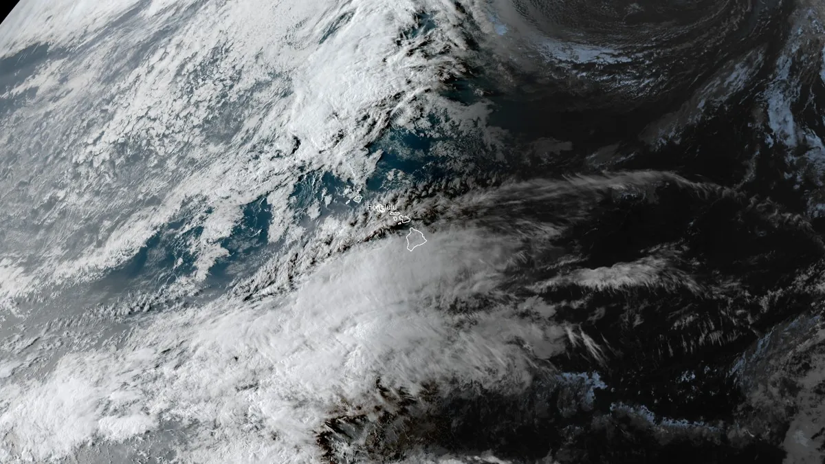
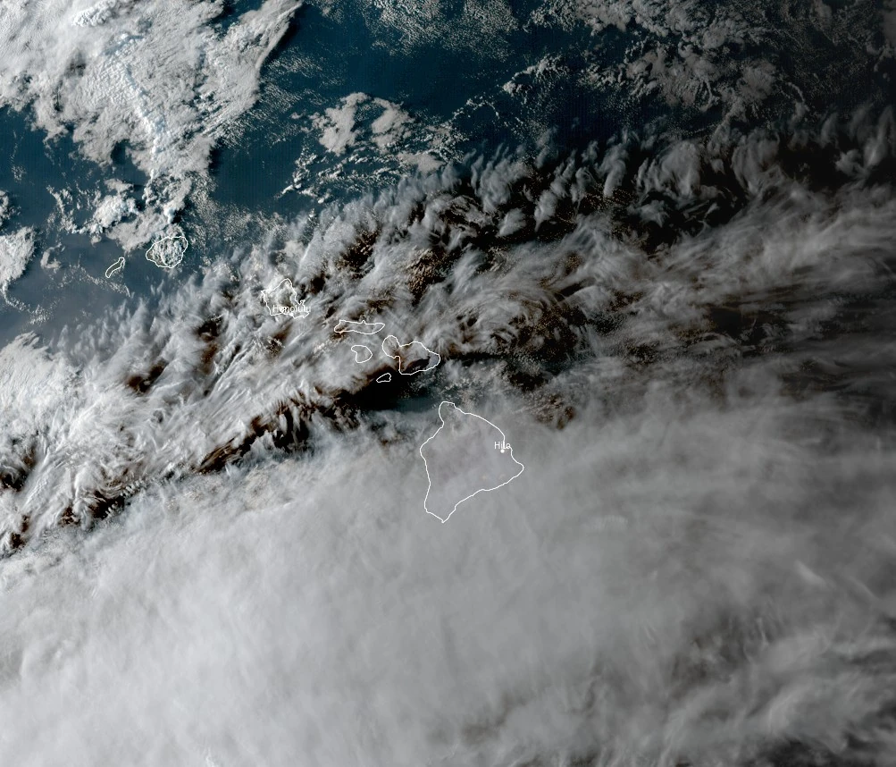
Satellite image acquired at 04:00 UTC on April 7, 2026. Credit: NOAA/GOES-West, Zoom Earth, The Watchers
The NWS office in Honolulu warns that a deep layered trough will develop west of the islands and draw abundant moisture northward as it strengthens on Tuesday, April 7. Instability and upward forcing will enhance the available moisture and bring the potential for heavy rain and thunderstorms leading to flash flooding across all islands in the state of Hawaii.
A statewide Flood Watch is in effect across Hawaii from Wednesday morning, April 8, through Friday afternoon, April 10, as a developing low-pressure system northwest of the islands, described by the National Weather Service (NWS) public guidance as a kona low, is forecast to bring prolonged heavy rainfall and elevated flood risk.
The NWS office in Honolulu reports that the system will draw deep tropical moisture northward across the state, creating conditions favorable for widespread showers and thunderstorms. Excessive rainfall may lead to flash flooding in urban areas, low-lying locations, and regions with poor drainage, while steep terrain remains susceptible to landslides.
All major islands, including Kauai, Oahu, Maui, Molokai, Lanai, Kahoolawe, and the Big Island, are included in the Flood Watch. Forecasters note that antecedent wet conditions from recent rainfall events have left soils saturated, increasing runoff efficiency and the likelihood of rapid stream rises under heavier rainfall rates.
Multiple kona low systems affected the islands between March 10 and March 22, producing extreme rainfall totals, including more than 330 mm (13 inches) in about 12 hours on Oʻahu’s North Shore and multi-day accumulations reaching approximately 1 170 mm (46 inches) on Maui.
The events triggered widespread flooding, landslides, evacuations, and infrastructure stress, including emergency warnings tied to Wahiawā Dam and power outages affecting more than 130 000 customers statewide.
Despite several days of drier trade wind conditions, soil moisture remains elevated, allowing new rainfall to convert more efficiently into surface runoff, increasing the likelihood of rapid stream rises and flash flooding under the current forecast system.
The heaviest rainfall associated with the new system is forecast to develop during the midweek period, with conditions deteriorating from Wednesday into Thursday as the low-pressure system strengthens west of the state. Forecast guidance indicates that the western islands may experience the initial phase of heavier rainfall before activity gradually shifts eastward later in the event.
In addition to heavy rain, the system is expected to generate strong southerly winds, with gusts of 64–80 km/h (40–50 mph) possible across many areas and locally stronger gusts exceeding 93 km/h (58 mph) in exposed locations or near convective activity. A Wind Advisory may be issued as conditions develop.
Winter weather conditions are also possible at higher elevations on the Big Island, resulting in a Winter Storm Watch in effect for summits above 3 810 m (12 500 feet), where a combination of snow and freezing rain is forecast during the same period.
Heavy rainfall is likely to persist into Thursday and Friday, with the flash-flood threat remaining elevated into the weekend, but periods of heavy rain may continue beyond the initial peak as moisture remains in place around the system.
The setup reflects a kona low pattern, characterized by a low-pressure system northwest of the islands producing southerly flow and transporting deep tropical moisture into the region over multiple days.
References:
1 Area Forecast Discussion for Hawaii – NWS Honolulu – April 7, 2026
2 Flood Watch – NWS Honolulu – April 7, 2026
I'm a dedicated researcher, journalist, and editor at The Watchers. With over 20 years of experience in the media industry, I specialize in hard science news, focusing on extreme weather, seismic and volcanic activity, space weather, and astronomy, including near-Earth objects and planetary defense strategies. You can reach me at teo /at/ watchers.news.
Commenting rules and guidelines
We value the thoughts and opinions of our readers and welcome healthy discussions on our website. In order to maintain a respectful and positive community, we ask that all commenters follow these rules.