
Kona low prompts statewide closures as severe weather threat intensifies across Hawaii
A powerful Kona low prompted statewide school and state office closures in Hawaii on Friday, March 13, 2026, as forecasters warned of flash flooding, damaging winds, severe thunderstorms, and winter weather on the Big Island summits.
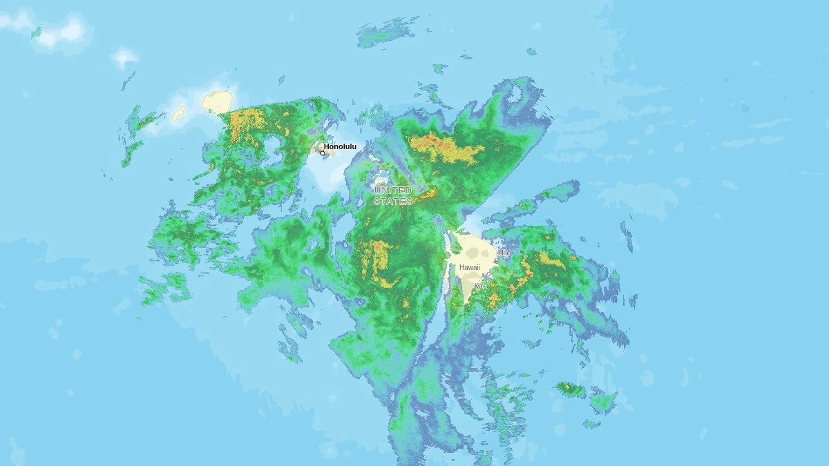
Rainfall radar over Hawai'i at 19:37 UTC on March 13, 2026. Credit: NWS, The Watchers
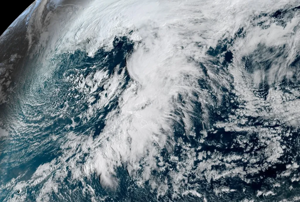
A powerful Kona low affecting the Hawaiian Islands prompted closures of public and charter schools, state offices, and Judiciary operations on Friday, March 13, as the storm brought heavy rain, thunderstorms, strong winds, and winter weather to higher elevations
Governor Josh Green ordered closures of state offices and other non-essential operations to reduce travel during worsening weather conditions. The initial closure announcement covered Kauaʻi, Oʻahu, and Maui County, and Hawaiʻi Island was added later the same day. Essential personnel and emergency response workers remained active.
The Hawaiʻi State Department of Education said all public schools and HIDOE offices statewide would remain closed on Friday, March 13, in anticipation of severe weather. The University of Hawaiʻi also said all campuses statewide would be closed that day.
Kona lows are slow-moving low-pressure systems that develop west or southwest of Hawaii and are among the most significant severe weather patterns affecting the islands outside of tropical cyclones. They can produce prolonged heavy rainfall, thunderstorms, strong winds, and hazardous marine conditions, while colder air associated with the circulation can generate snow and ice on the highest volcanic summits of the Big Island.
The current storm system remained northwest of the islands on Friday morning and was producing multiple hazards simultaneously, including flash flooding, damaging winds, severe thunderstorms, and winter weather over high elevations.
Rain bands and embedded thunderstorms within the storm were expected to produce intense rainfall rates capable of triggering rapid flooding, particularly in areas with saturated soils. Flood Watches remained in effect across all Hawaiian Islands, but expiration times varied by island and forecast zone, with some areas extending beyond Saturday.
NWS Honolulu warned that stronger thunderstorm cells could produce wind gusts of 80 to 115 km/h (50 to 70 mph), adding to the damaging wind threat across parts of the islands.
The strongest wind impacts are expected along north and east-facing mountain slopes, where terrain can enhance southerly and southwesterly winds. Strong winds may bring down trees and power lines, potentially blocking roads and causing localized power outages.
A High Wind Warning is in effect for much of the state through early Sunday, while a Wind Advisory remains in effect for lower elevations of the Big Island. Gusty winds are expected to peak from Friday through Saturday as the storm intensifies.
Heavy snowfall and icing are occurring on the summits of Mauna Kea and Mauna Loa as colder air interacts with the storm’s moisture. A Winter Storm Warning remains in effect for the Big Island summits, where snow, ice, and strong winds are creating extremely hazardous conditions at elevations above approximately 3 350 m (11 000 feet). The Mauna Kea summit access road remains closed due to dangerous conditions.
The storm is expected to continue producing unsettled weather through the weekend as upper-level disturbances rotate through the storm system, periodically increasing rainfall and thunderstorm activity across the islands.
Another surge of heavy showers and thunderstorms may develop late Saturday into Sunday as an additional upper-level trough moves across the region, increasing flooding potential even as damaging wind threats gradually decrease.
The storm system is forecast to slowly weaken and drift northward early next week. Rainfall and wind intensity should gradually decrease from Monday into Tuesday, although unsettled weather may persist across the islands.
Forecast models show that high pressure may rebuild north of the state by midweek, allowing trade winds to return across the island chain from north to south by Wednesday and Thursday.
Kona lows usually occur during the cooler-season months and can remain nearly stationary for several days, directing deep moisture toward the islands and producing prolonged rainfall events capable of causing flooding and infrastructure disruptions.
Authorities urged residents to monitor official forecasts and avoid flooded roadways as hazardous weather conditions continue across the Hawaiian Islands.
References:
1 Area Forecast Discussion – NWS Honolulu – March 13, 2026
2 All public schools, HIDOE offices statewide will be closed March 13, in anticipation of severe weather conditions – HIDOE – March 12, 2026

I am an Assistant Editor and Severe Weather & Science Journalist at The Watchers, specializing in real-time severe weather coverage, geophysical event reporting, and research-driven scientific analysis. You can reach me at rishav(at)watchers(.)news.
Commenting rules and guidelines
We value the thoughts and opinions of our readers and welcome healthy discussions on our website. In order to maintain a respectful and positive community, we ask that all commenters follow these rules.