
Rapidly strengthening nor’easter to impact the Carolinas and Virginia with heavy snow and strong onshore winds
A powerful nor’easter is forecast to impact the U.S. Southeast coast late on January 30, 2026, bringing heavy snow to the Carolinas and Virginia, with accumulations reaching up to 30 cm (12 inches), along with strong winds and coastal flooding persisting through February 2.
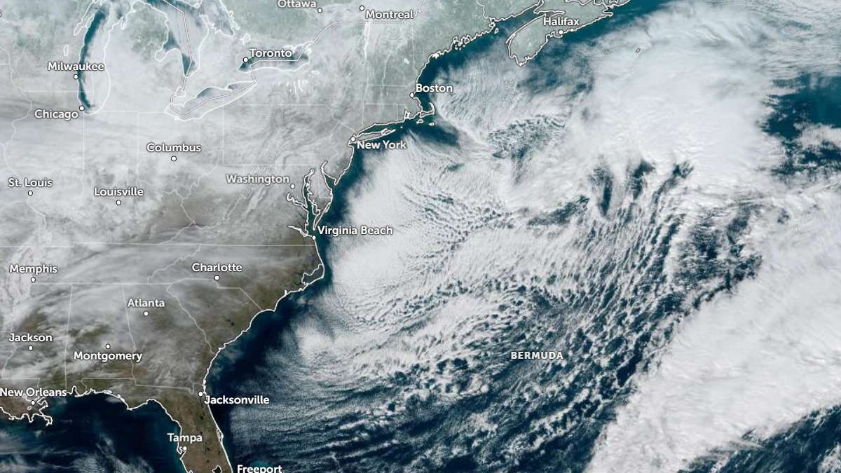
Satellite image of the U.S. East Coast at 17:00 UTC on January 29, 2026. Credit: NOAA/GOES-19, Zoom Earth, The Watchers
A rapidly strengthening coastal storm is forecast to develop off the southeastern United States on January 30 before tracking northeastward along the Atlantic coast.
Heavy snow is forecast across inland areas of North Carolina and Virginia, with accumulations locally reaching 150–300 mm (6–12 inches).
Areas near the coast will see a mix of snow and rain due to marine air intrusion. Strong winds of 97–113 km/h (60–70 mph) are forecast across much of the region. The highest wind threat is expected around the Outer Banks and coastal plains, where sustained gales may persist through Sunday.
Blowing snow and reduced visibility are expected to create hazardous travel conditions across inland regions, along with widespread power outages
“This rapidly deepening storm system will produce powerful onshore winds along the Mid-Atlantic Coast from the North Carolina Outer Banks northward,” NWS forecaster Ziegenfelder said on January 29.
“Wind gusts near hurricane-force will coincide with astronomical high tides, producing moderate to locally significant coastal flooding. In addition, near-blizzard conditions are expected across northeastern North Carolina and Southeastern Virginia, with sharply reduced visibilities due to snow and blowing snow, making travel extremely treacherous.”
Winter Storm Watches are issued for the whole of North and South Carolina and southeastern Virginia. Coastal flooding and beach erosion are likely due to prolonged onshore flow and coinciding astronomical high tides.

Temperatures during the event will remain near freezing across much of the inland Southeast, enhancing the risk of mixed precipitation and ice accumulation near the snow-rain transition zone.
The nor’easter is forecast to track toward the Mid-Atlantic and New England by Sunday, gradually weakening as it moves over cooler waters and drier continental air. Residual snow bands and high winds may continue into early Monday across parts of Virginia and Maryland.

I am an Assistant Editor and Severe Weather & Science Journalist at The Watchers, specializing in real-time severe weather coverage, geophysical event reporting, and research-driven scientific analysis. You can reach me at rishav(at)watchers(.)news.
Commenting rules and guidelines
We value the thoughts and opinions of our readers and welcome healthy discussions on our website. In order to maintain a respectful and positive community, we ask that all commenters follow these rules.