
Tropical Storm Kajiki to make landfall in central Vietnam on August 25
Tropical Storm Kajiki formed rapidly over the northeastern South China Sea on August 23, 2025, and is forecast to make landfall in central Vietnam on August 25, bringing violent winds and extreme rainfall. Forecast models indicate rainfall totals of 150–300 mm (6–12 inches) across central provinces, with some areas expected to receive more than 600 mm (24 inches) between August 24 and 26.
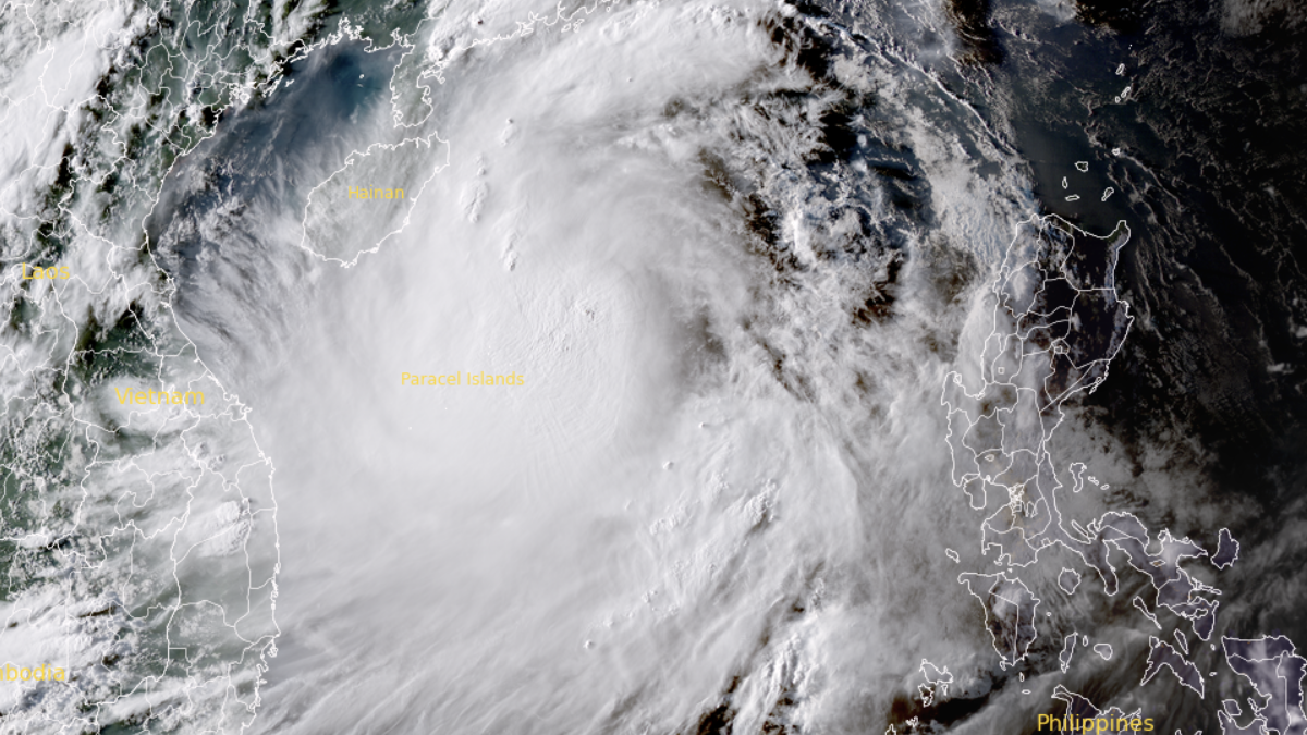
Satellite image of Tropical Storm Kajiki as of August 23, 2025. Credit: JMA/Himawari-9, RAMMB/CIRA, The Watchers.
According to the Joint Typhoon Warning Center (JTWC), at 06:00 UTC on August 23, Kajiki’s center was located near latitude 17.6° N and longitude 115.0° E, approximately 735 km (457 miles) east-northeast of Da Nang.
At that time, Kajiki had maximum sustained winds of 93 km/h (58 mph), gusting up to 120 km/h (76 mph), and a minimum central pressure of 995 hPa. The storm was moving westward at about 28 km/h (17 mph), generating maximum wave heights of 6.4 m (21 feet).
Forecasts indicate the system will make landfall in central Vietnam on August 25, impacting provinces from Thanh Hóa to Thừa Thiên–Huế. The most intense effects are expected in Nghệ An, Hà Tĩnh, and Quảng Bình.
Heavy to very heavy rainfall is forecast from August 24 to 26. Totals of 150–300 mm (6–12 inches) are likely across the affected region, with isolated totals exceeding 600 mm (24 inches).
Additional rainfall of 100–150 mm (4–6 inches) is expected in the Red River Delta, Hanoi, and Da Nang, with maxima exceeding 250 mm (10 inches). Short-duration rain rates could exceed 200 mm (8 inches) within three hours in some areas.
Storm surge projections range from 0.5 to 1.0 m (1.6–3.3 feet), with water levels expected to reach 3.2–3.6 m (10.5–11.8 feet) at Sam Son (Thanh Hóa), and 3.3–3.7 m (10.8–12.1 feet) at Hon Ngu (Nghệ An). Offshore wave heights may reach 6 m (19.7 feet), and up to 8 m (26.2 feet) near the storm’s center.
According to the China Meteorological Administration and the World Meteorological Centre in Beijing, additional rainfall is expected in the northern provinces from August 24 to 25. These include Yên Bái, Phú Thọ, Hòa Bình, Hà Nam, Thái Bình, Nam Định, Ninh Bình, and Hà Tây.

Authorities are implementing emergency response measures, including evacuation of at-risk communities, securing infrastructure, suspending maritime operations, and ensuring readiness of emergency services.
Kajiki is expected to weaken after landfall but will likely continue producing heavy rainfall and hydrological hazards as it moves inland.

I am an Assistant Editor and Severe Weather & Science Journalist at The Watchers, specializing in real-time severe weather coverage, geophysical event reporting, and research-driven scientific analysis. You can reach me at rishav(at)watchers(.)news.
Commenting rules and guidelines
We value the thoughts and opinions of our readers and welcome healthy discussions on our website. In order to maintain a respectful and positive community, we ask that all commenters follow these rules.