
Glacier outburst flood begins in Hafrafellslón, west of Langjökull, Iceland
The Icelandic Meteorological Office reported a glacier flood in Hafrafellslón, west of Langjökull glacier, on August 22, 2025, with rising water levels measured in Hvítá River above Húsafell.
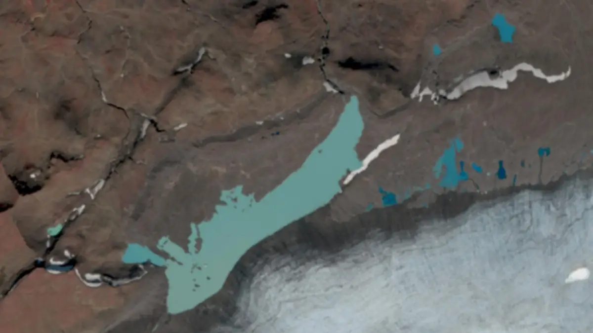
Satellite image from August 20 showing Hafrafellslón at the edge of the glacier. Image credit: IMO
A glacier outburst flood (jökulhlaup) has begun in Hafrafellslón, a marginal glacial lake on the western edge of Langjökull glacier, Iceland, on August 22.
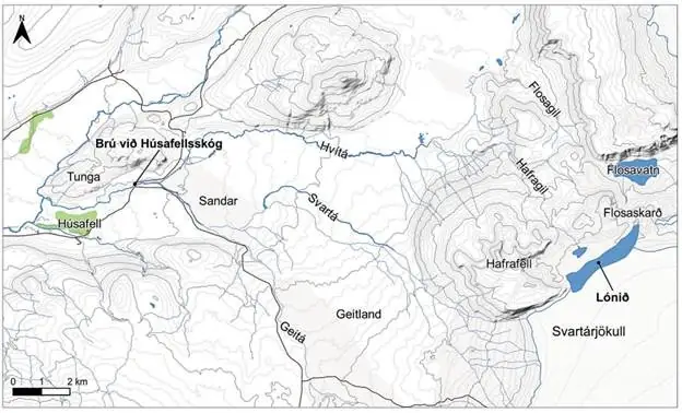
According to the Icelandic Meteorological Office (IMO), water is draining into the Svartá River and from there into the Hvítá River near Húsafell, Borgarfjörður.
Hydrological measurements show that the water level in Hvítá River above Húsafell has been rising rapidly since last night, breaking the usual diurnal cycle and confirming the onset of flooding. At present, the water level remains within ranges previously measured during heavy rainfall, but further increases are expected in the coming days.
Satellite images taken on August 20 indicated that Hafrafellslón had begun to empty. On August 21, residents near the glacier reported visible water flow over the glacier margin into the Svartá River.
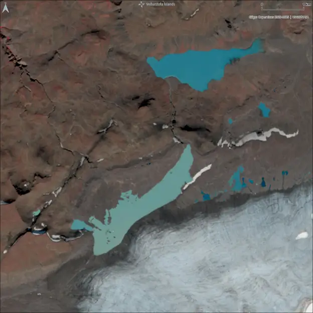
IMO noted that the water level in Hafrafellslón was higher than ever before, suggesting that this flood may exceed the outburst that occurred in August 2020, when a bridge on Hálsasveitarvegur was inundated and meadows at Brúarás were flooded. A smaller flood was recorded in 2021.
Hafrafellslón has expanded in recent years as Langjökull has retreated, allowing greater accumulation of meltwater during summer.
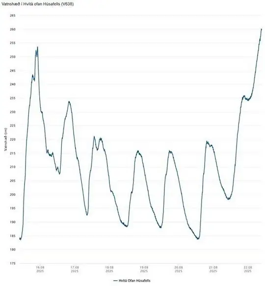
The size of the current flood remains uncertain and depends on how rapidly the reservoir continues to drain. The speed of outflow will largely determine the peak discharge and downstream spread.
Authorities advise residents along Hvítá River to consider possible effects on property and livestock near the riverbanks.
The term jökulhlaup (literally “glacial run” in Icelandic) refers to a type of glacial outburst flood. While it originally described subglacial floods from Vatnajökull triggered by geothermal or volcanic activity, it is now used in glaciology to denote any sudden release of water from a subglacial or proglacial lake or reservoir.
Internationally, such events are also known as Glacial Lake Outburst Floods (GLOFs). The flood now underway from Hafrafellslón, a marginal lake at the edge of Langjökull glacier, falls into this category.

Teo Blašković founded The Watchers in 2011 and edited it until 2026, covering seismic and volcanic activity, extreme weather, space weather and near-Earth objects. Articles on this page are his archive.
Published in the last 24 hours
- Second nationwide US flight halt since 9/11: how the November 13 FAA ground stop compares with September 2001 and January 2023 Epicenter
- FAA grounds all departing flights across the US after communications outage hits air traffic control centers nationwide
- In September 1859, a solar storm lit up the night sky so brightly that gold miners in the Rocky Mountains woke up after midnight and started cooking breakfast, convinced the aurora glowing over their camp was the sunrise Epicenter
- A patch of warm Pacific water that could become the strongest El Niño in more than 70 years sits thousands of miles from any American town, yet it is already the main reason NOAA expects a wetter winter across the South and a milder one across the North
