
Dragon Bravo Fire burns 50 000 ha (123 000 acres), becomes Arizona’s 10th largest wildfire on record
Dragon Bravo Fire has burned over 49 000 ha (123 000 acres) near the Grand Canyon’s North Rim as of August 3 , 2025, with containment at 12 % and more than 1 200 personnel engaged in suppression efforts.

Image credit: 2025 Dragon Bravo Fire Information
The Dragon Bravo Fire, a megafire ignited by lightning on July 4, in Grand Canyon National Park’s North Rim area, Arizona, has burned an estimated 49 845 ha (123 171 acres) as of August 3, according to the U.S. Forest Service (USFS). Containment is reported at 13 % under a full suppression strategy.
This is now the tenth-largest fire on record for Arizona, and the largest fire for the contiguous United States in 2025.
The fire has destroyed the historic Grand Canyon Lodge and at least 80 additional structures on July 12–13, including visitor cabins and park administrative buildings. No fatalities or injuries have been reported.
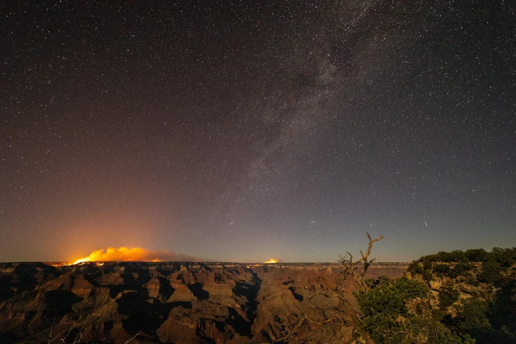
A haunting beauty. The Dragon Bravo Fire burning through the Grand Canyon as stars and meteors pass silently overhead. It’s hard to watch a place you love endure this, so I turned my lens to the sky and let it speak.#GrandCanyon #Astrophotography #Timelapse #DragonBravoFire pic.twitter.com/Tqn95blUHt
— Sean Parker (@seanparkerphoto) August 2, 2025
More than 1 200 personnel are assigned to the incident. Crews are reinforcing containment lines along the fire’s northern flank, conducting firing operations near Kaibab Lodge, and targeting unburned terrain in the northwest sector.
Fire managers report that low relative humidity, at times near 10 %, and gusts up to 56 km/h (35 mph) continue to challenge suppression efforts.
Nighttime humidity recovery above 50% and intermittent cloud cover have provided temporary relief; however, drying conditions are forecast into the coming week.
Arizona: The Dragon Bravo Fire is now 116,592 acres with 12% containment. Critical Fire weather has returned to the fire area with relative humidities dropping to 10% and 35 MPH winds.
— The Hotshot Wake Up (@HotshotWake) August 3, 2025
Crews are working on the North edge to keep the fire from flanking around the Kane Fire burn… pic.twitter.com/GWQe13yGWm
The Dragon Bravo Fire in Arizona and Monroe Fire in Utah grew under conducive conditions yesterday.
— CIRA (@CIRA_CSU) July 31, 2025
The Dragon Bravo Fire has exceeded 100,000 acres and is now the 10th largest fire in Arizona history. pic.twitter.com/Zuivx3L1O4
The initial “confine and contain” strategy, later shifted to full suppression, has drawn criticism from Arizona officials and prompted calls for a federal review of early incident management decisions.
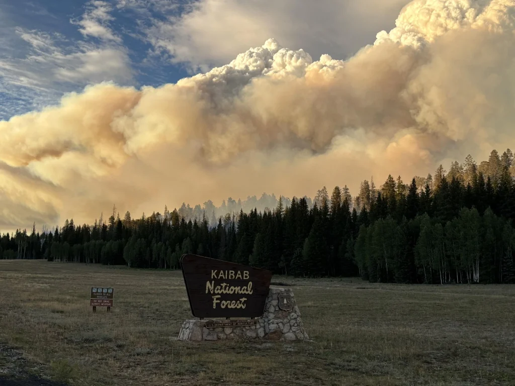
The entire North Rim of Grand Canyon National Park is closed for the 2025 season, including major trails and inner‑canyon facilities such as Phantom Ranch, the North Kaibab Trail, and the South Kaibab Trail.
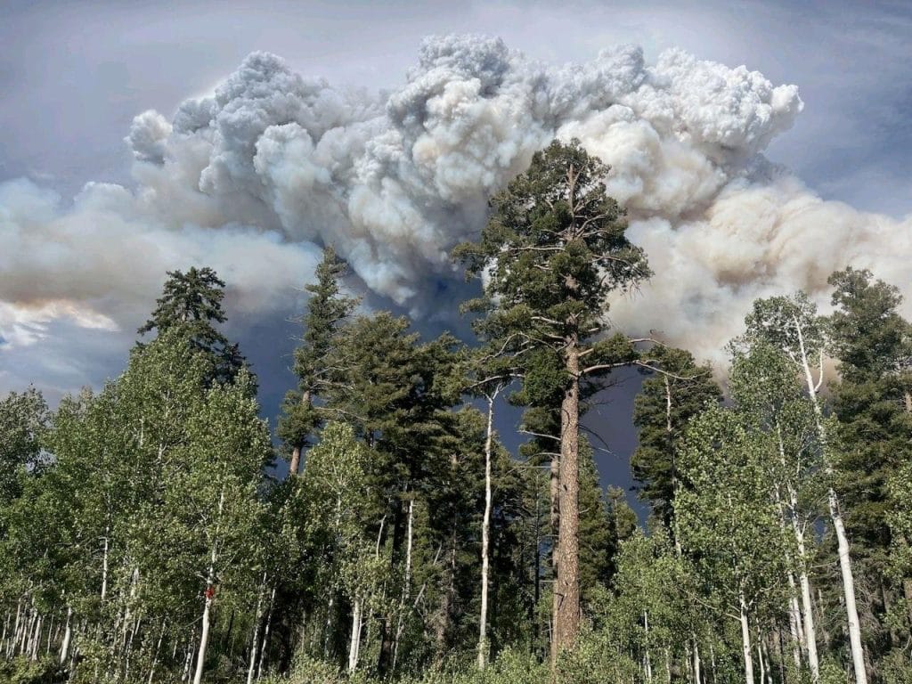
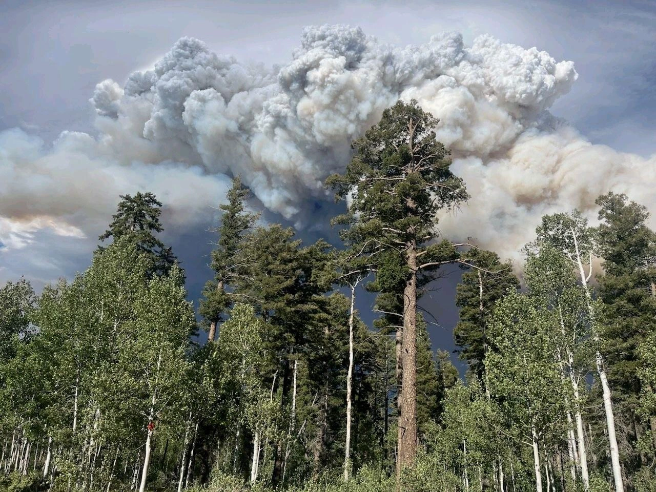
 Dragon fire on July 31, 2025. Credit 2025 Dragon Bravo Fire Information
- Dragon fire on July 31, 2025. Credit: 2025 Dragon Bravo Fire Information
- Dragon fire on July 31, 2025. Credit 2025 Dragon Bravo Fire Information
- Image credit: 2025 Dragon Bravo Fire Information
- Dragon fire on July 31, 2025. Credit 2025 Dragon Bravo Fire Information


#BREAKING | NEWS
— Todd Paron (@tparon) August 3, 2025
Update unbelievable Timelapse video from the Dragon Bravo Fire in the Grand Canyon the fire is now one of the largest wildfires in Arizona’s history.
The fire has burned 114K acres and is at 12% contained
the fire started on 4th of July.
Video LSM pic.twitter.com/69qlFTCxEF
State Route 67 remains closed while State Route 89A has reopened. Smoke from the fire continues to reduce air quality and visibility across the park and surrounding areas.
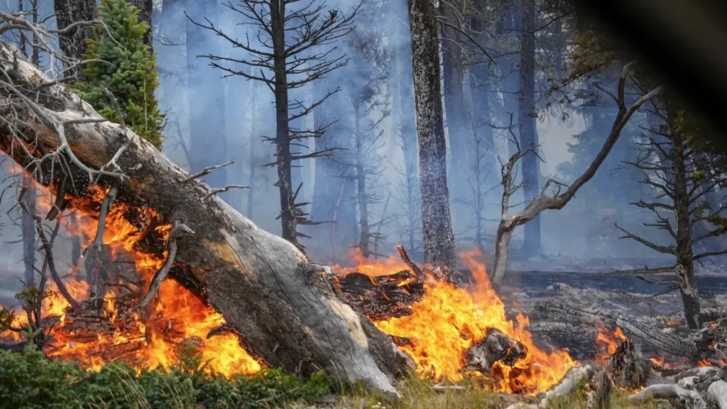
The extreme fire behavior has produced pyrocumulus and pyrocumulonimbus clouds, leading to erratic local weather and hazardous fire conditions.
The Dragon Bravo fire on the N Rim of the Grand Canyon. Started by lightning strike on July 4. Moved so fast some rangers, employees lost everything. Largest wildfire in the US now. Taken from Mather Point. Heartbroken. pic.twitter.com/iVMkiGnohl
— Candice (@Candice_AZ) August 2, 2025

I’m a science journalist and researcher at The Watchers, contributing to the Epicenter edition, where I cover peer-reviewed scientific research and emerging discoveries across Earth and space sciences. With a background in astronomy and a passion for environmental science, I’ve worked in shark and coral conservation in Fiji, conducting reef and shark-behavior research, contributing to mangrove restoration, and earning PADI Open Water and Coral Reef Certifications. I bring a blend of scientific rigor and storytelling to illuminate the discoveries shaping our planet and beyond.
Commenting rules and guidelines
We value the thoughts and opinions of our readers and welcome healthy discussions on our website. In order to maintain a respectful and positive community, we ask that all commenters follow these rules.