
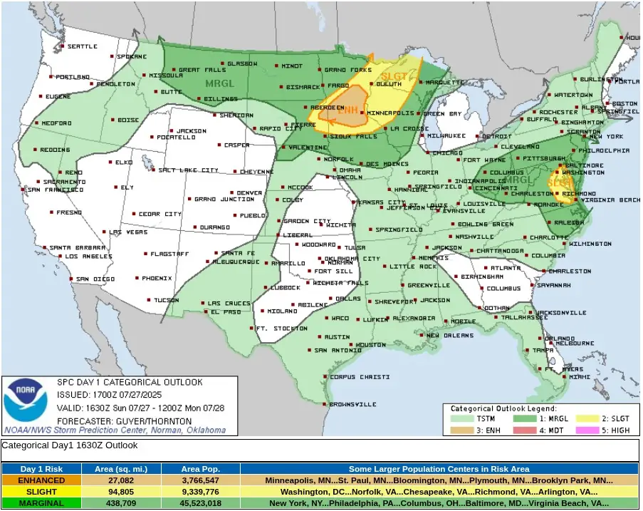
SPC issues level 3/5 severe weather threat for parts of Minnesota, South Dakota and Wisconsin
An Enhanced Risk (level 3/5) of severe thunderstorms is in effect across southern and eastern Minnesota, far eastern South Dakota and western Wisconsin, with a Slight Risk (level 2/5) extending into the Mid-Atlantic region, including parts of eastern Virginia, on Sunday, July 27, 2025.

Categorical Outlook for July 27, 2025. Credit: NWS/SPC
The U.S. National Weather Service (NWS) Storm Prediction Center (SPC) has issued an Enhanced Risk (level 3 of 5) for severe thunderstorms across southern and eastern Minnesota, far eastern South Dakota and western Wisconsin on Sunday, July 27.
The Enhanced Risk area covers approximately 70 140 km² (27 082 mi2) and includes a population of around 3.77 million. Larger population centers within this zone are located entirely in Minnesota and include Minneapolis, St. Paul, Bloomington, Plymouth and Brooklyn Park.
Thunderstorm activity is expected to intensify by mid to late afternoon, with initial discrete supercells likely to develop along a southeastward-advancing frontal boundary.
The storms will form in an environment characterized by steep mid-level lapse rates, an elevated mixed layer, strong surface heating, and moderate wind shear, all conducive to severe convective development.
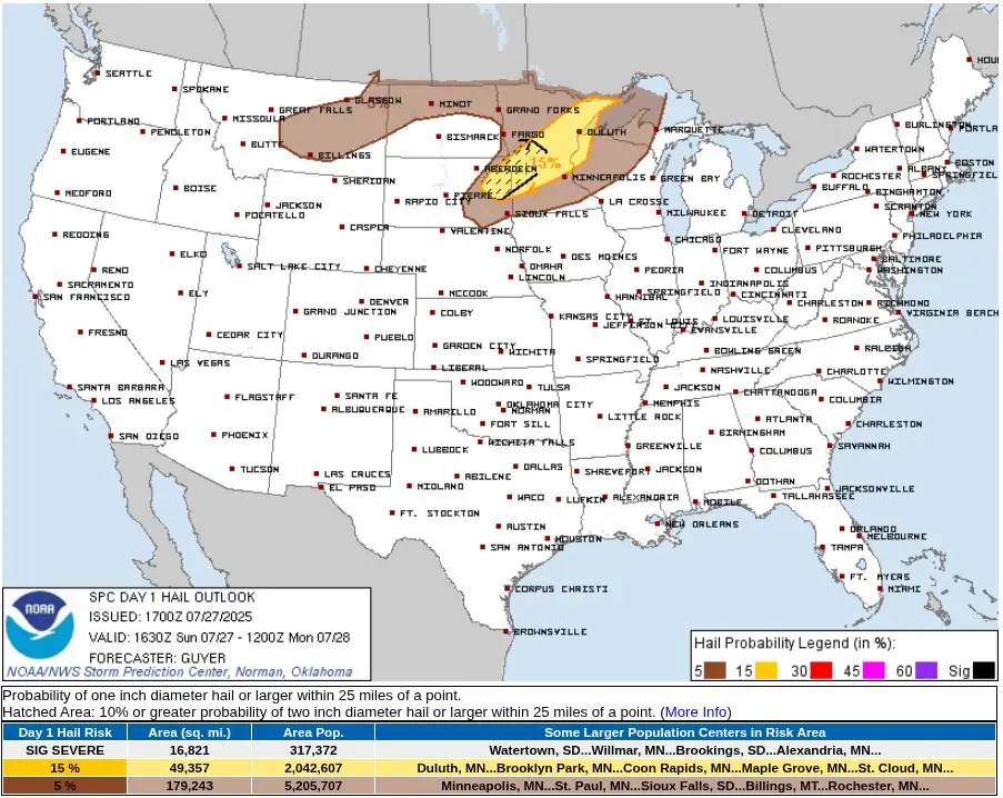
The strongest of them will be capable of producing very large hail, particularly across eastern South Dakota and southwestern Minnesota where lapse rates are steepest.
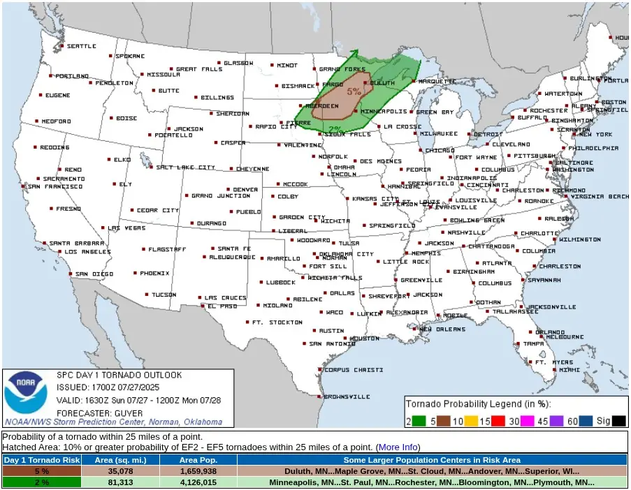
A tornado risk exists, especially with initial supercells, supported by low-level moisture, effective shear and potential localized boundaries created by differential heating or remnant mesoscale convective features.
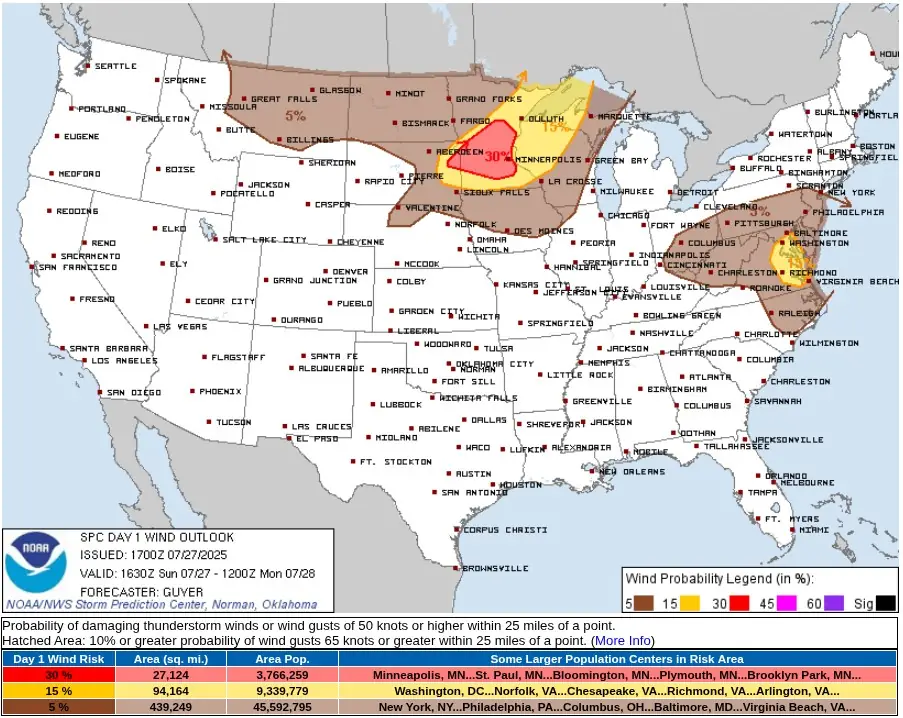
As evening approaches, storms are expected to organize into one or more forward-propagating mesoscale convective systems (MCS), increasing the risk of scattered damaging wind gusts across southern Minnesota and into western and northern Wisconsin.
The convective system is driven by a shortwave trough moving eastward across the northern Plains into northern Minnesota. A surface low pressure system is deepening over eastern South Dakota near the Minnesota border, enhancing convergence along the frontal boundary and contributing to storm initiation.
Farther east, across the central Appalachians and Mid-Atlantic, isolated strong to severe storms are also forecast, though the threat is limited by weak mid-level lapse rates and widespread moisture. In eastern Virginia, however, localized wind damage is possible where surface-based instability is stronger.
Strong heating this afternoon across central and eastern Montana will lead to deep boundary-layer mixing and inverted-V profiles, supporting the development of scattered high-based thunderstorms capable of producing a few severe wind gusts by late afternoon.
I'm a dedicated researcher, journalist, and editor at The Watchers. With over 20 years of experience in the media industry, I specialize in hard science news, focusing on extreme weather, seismic and volcanic activity, space weather, and astronomy, including near-Earth objects and planetary defense strategies. You can reach me at teo /at/ watchers.news.
Commenting rules and guidelines
We value the thoughts and opinions of our readers and welcome healthy discussions on our website. In order to maintain a respectful and positive community, we ask that all commenters follow these rules.