
Slow-moving storm triggers flood watches from North Carolina to Pennsylvania
Flood watches have been issued from North Carolina to Pennsylvania, including Washington, D.C., as a severe weather system brings heavy rains to the Northeast starting Tuesday, May 13, 2025. Heavy rainfall is expected to extend from the Southeast to the Great Lakes, with much of the Mid-Atlantic affected through Wednesday, May 14.
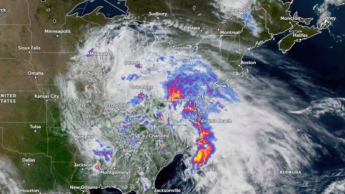
Satellite image with rainfall radar for northeastern United States, acquired at 16:40 UTC on May 13, 2025. Credit: NOAA/GOES-East, Zoom Earth, The Watchers
A slow-moving storm that brought severe weather across the Southeast is now tracking northeast through the Mid-Atlantic, bringing the threat of flash floods on Tuesday, May 13.
The system is forecast to bring heavy rains across the Northeast, with heavy rainfall forecast from North Carolina to parts of Pennsylvania. Rainfall is expected to last through Wednesday into Thursday for some areas, exacerbating the threat of flash floods.
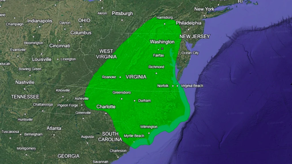
Millions from North Carolina to Pennsylvania have been put under flood watches, including cities like Washington, D.C., and Baltimore.
According to the Weather Prediction Center (WPC), the heaviest rainfall is forecast to remain concentrated over the Mid-Atlantic on Tuesday, bringing relief to parts of the region experiencing moderate to severe drought-like conditions. However, the threat of flash floods will persist in parts of the region due to continued heavy rainfall.
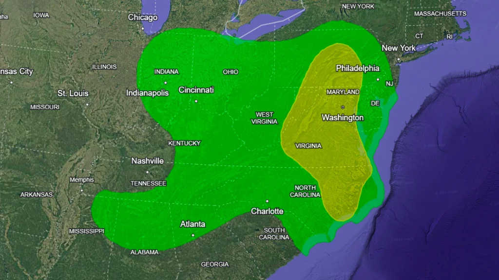
A deep stretch of Atlantic moisture will extend as far west as the Great Lakes and the Ohio and Tennessee Valleys, where widespread showers and storms are forecast on Tuesday. Isolated thunderstorms will continue to affect these regions through Wednesday.
Showers will move northeast through Tuesday night and into Wednesday. WPC maintains a Marginal Risk (threat level 1/4) in the Mid-Atlantic on Wednesday due to the threat of heavy rain and thunderstorms, potentially leading to isolated flash floods.
WPC maintains a Slight Risk (threat level 2/4) for excessive rainfall from eastern North Carolina to central Pennsylvania. Meanwhile, flood watches remain in place for much of Virginia and North Carolina.
Flood watches are in effect for all of Washington, nearly all of Virginia, and northern and north-central North Carolina through Tuesday night. Some areas will remain under watch until Friday morning. Flood watches also cover parts of southern Pennsylvania, Maryland, and northeastern West Virginia.
Read more:

I am an Assistant Editor and Severe Weather & Science Journalist at The Watchers, specializing in real-time severe weather coverage, geophysical event reporting, and research-driven scientific analysis. You can reach me at rishav(at)watchers(.)news.
Commenting rules and guidelines
We value the thoughts and opinions of our readers and welcome healthy discussions on our website. In order to maintain a respectful and positive community, we ask that all commenters follow these rules.