
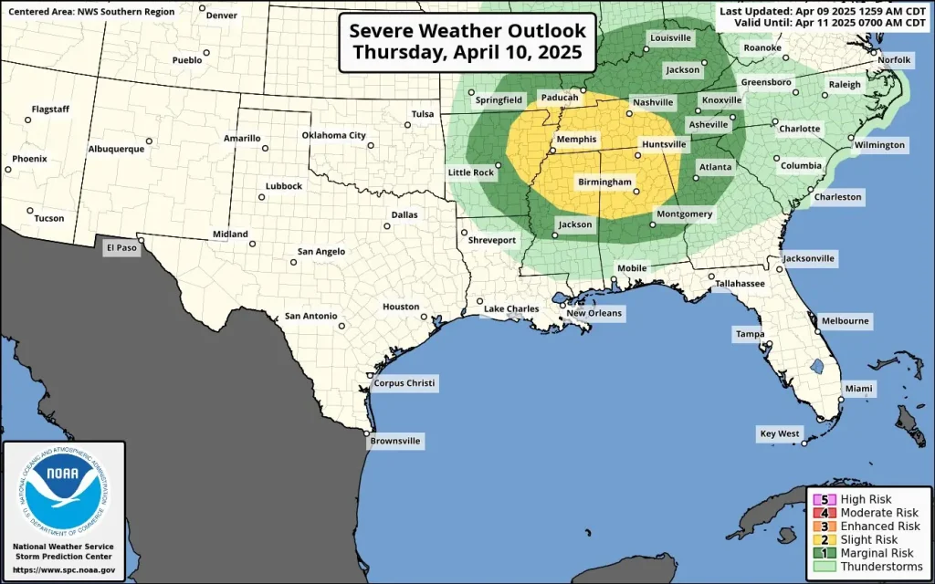
Damaging storms expected Thursday across the Lower Ohio Valley and Mid-South
A developing storm system over the Eastern United States is expected to bring severe weather, including thunderstorms, heavy rain, and snow, from Thursday, April 10, 2025, through the weekend.
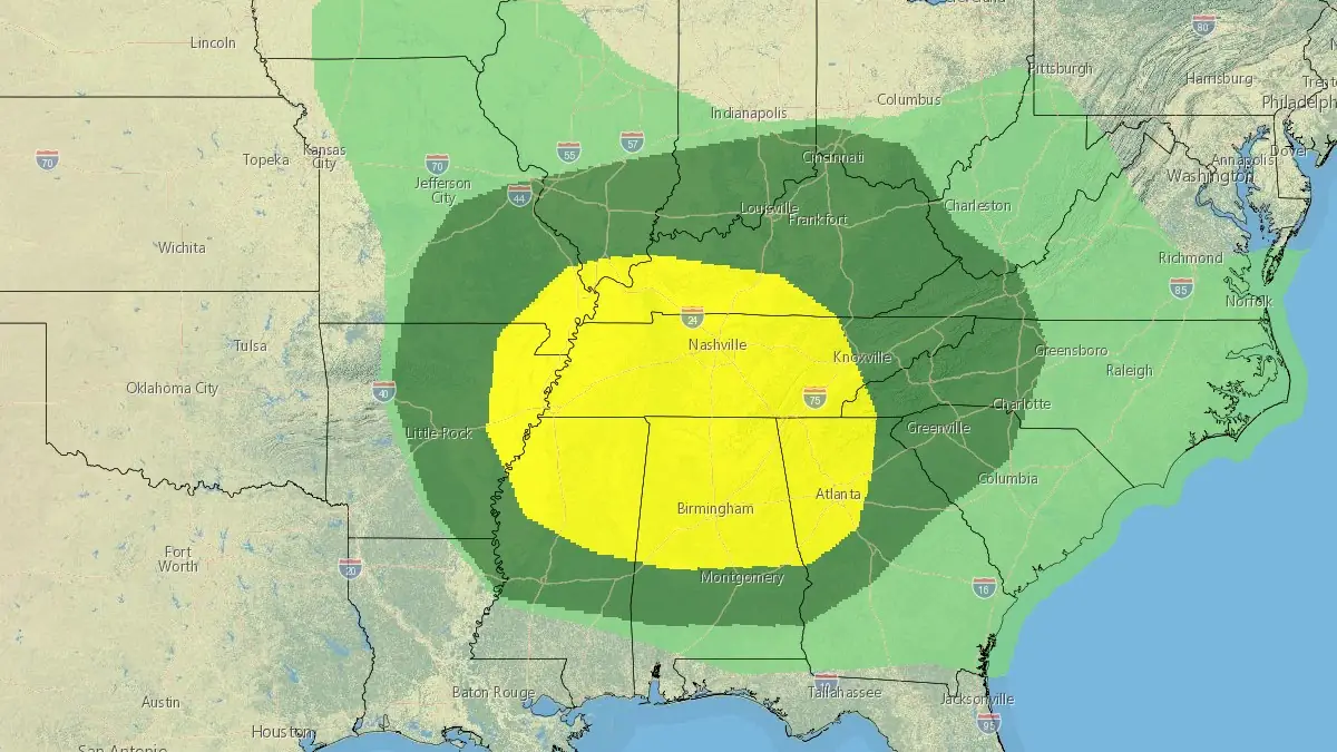
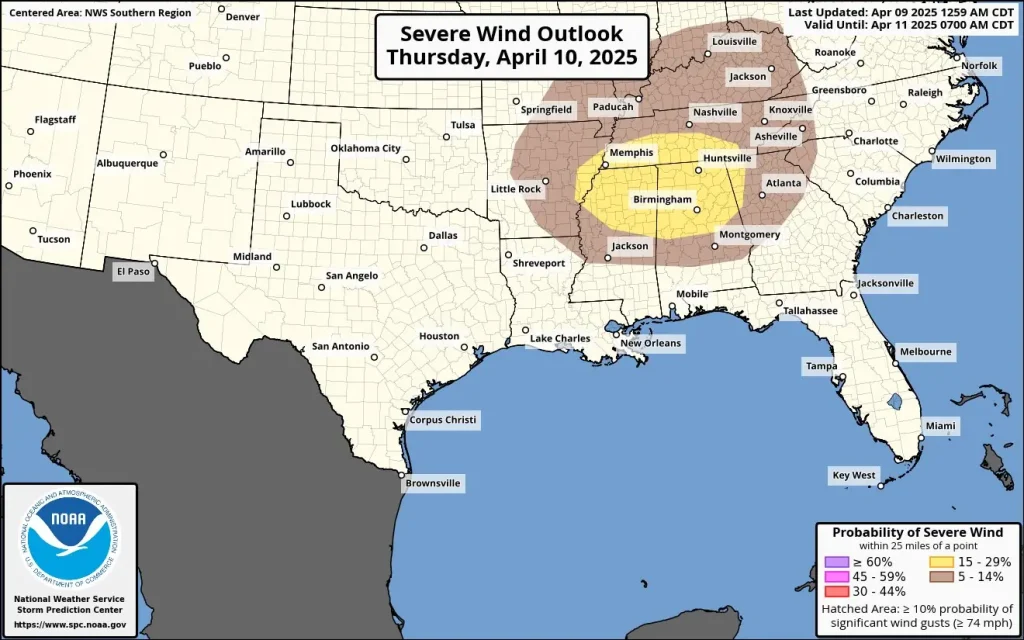
Image credit: NWS/WPC, The Watchers. Valid: Thursday, April 10, 2025
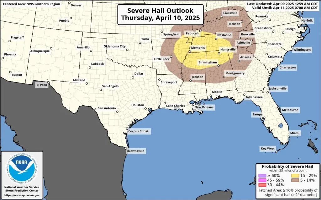
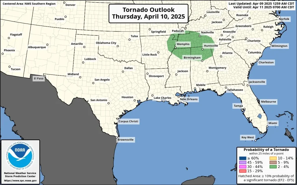
A strengthening low-pressure system is forecast to move southeastward into the Lower Ohio Valley and Mid-South by Thursday afternoon and evening, April 10. This system is anticipated to produce strong to severe thunderstorms in these regions late Thursday into early Friday, with damaging winds and large hail as the main hazards.
A Slight Risk (level 2 out of 5) for severe thunderstorms is in place for today, covering approximately 322 600 km² (124 000 mi²) and affecting around 16.8 million people.
Some of the larger cities within this risk area include Memphis, TN (population 633 000), Nashville, TN (population 715 000), Atlanta, GA (population 499 000), Birmingham, AL (population 196 000), and Huntsville, AL (population 221 000).
Other cities also within or near the risk zone are Little Rock, AR (population 201 000), Chattanooga, TN (population 182 000), Jackson, MS (population 149 000), Tuscaloosa, AL (population 110 000), and Decatur, AL (population 58 000).
As the low-pressure system intensifies and tracks northeastward into the Mid-Atlantic on Friday, it will interact with cold high pressure anchored across Southeast Canada. This interaction is expected to result in a cold, soaking rain across much of the northern Mid-Atlantic, leading to a soggy and blustery end to the workweek.
In the warm sector farther south, strong thunderstorms remain a concern from parts of southeast Virginia to northern Florida.
Rain showers are likely to persist into Saturday across parts of the Mid-Atlantic and Northeast, with the possibility of snow on the northern fringe of the precipitation shield in northern New England. Conditions are projected to gradually improve across the Eastern U.S. later Saturday into Sunday as the storm system moves into the Atlantic.
The Western United States is expected to experience very warm and dry conditions through the weekend due to a building upper-level ridge of high pressure. This pattern will promote abundant sunshine and temperatures ranging from 5–17°C (10–30°F) above normal.
High temperatures are forecasted to reach 20–35°C (70–90°F) across the lower elevations of the Southwest, Great Basin, Intermountain West, and northern/central Plains, with some areas in the Desert Southwest and southern Plains, potentially exceeding 38°C (100°F).
Record-breaking temperatures are possible in many locations from Thursday through the weekend.
References:
1 Short Range Forecast Discussion – NWS/WPC – April 10, 2025
I'm a dedicated researcher, journalist, and editor at The Watchers. With over 20 years of experience in the media industry, I specialize in hard science news, focusing on extreme weather, seismic and volcanic activity, space weather, and astronomy, including near-Earth objects and planetary defense strategies. You can reach me at teo /at/ watchers.news.
Commenting rules and guidelines
We value the thoughts and opinions of our readers and welcome healthy discussions on our website. In order to maintain a respectful and positive community, we ask that all commenters follow these rules.