
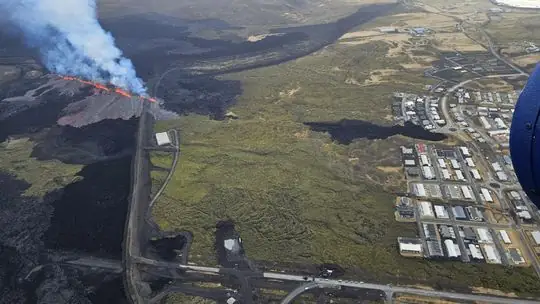
Volcanic eruption reported near Grindavík, Iceland
A new volcanic eruption has just begun north of the dam near Grindavík, Iceland, the Icelandic Met Office (IMO) reported at 09:45 UTC. A Coast Guard helicopter was sent to confirm the exact location and size of the eruption. This is the 11th eruption on the Reykjanes Peninsula since 2021 and the 9th on the Sundhnúk crater series.

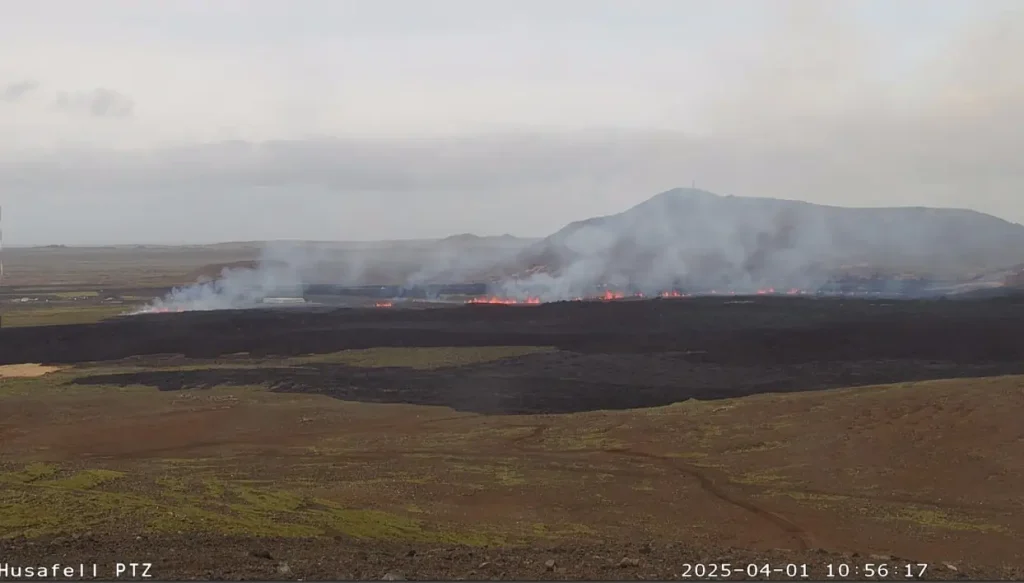
Volcanic eruption in Iceland on April 1, 2025. Credit: afarTV
The length of the magma tunnel under the Sundhnúkur crater series that has already formed is about 11 km (6.8 miles), which is the longest that has been measured since November 11, 2023.
Based on current wind directions, gas pollution from the eruption will travel northeast toward the capital area. At this time, it is not possible to predict the intensity of the pollution.
The eruption follows intense earthquake swarm since 06:30 UTC today.
IMO said signals from GPS meters were stronger than those observed during recent events in the Sundhnúkur crater row. This indicates that a considerable amount of magma is currently on the move.
The signals show that magma is moving both to the northeast and southward toward Grindavík.
Emergency responders in Grindavík have reported that earthquakes can be felt in the town, and signs of deformation are also visible there, suggesting that fault movements could occur within the town itself.
Local media reports the Blue Lagoon was evacuated early this morning, and work has since been underway to evacuate Grindavík. However, several residents have refused to leave the town.
Updates
10:36 UTC, April 1
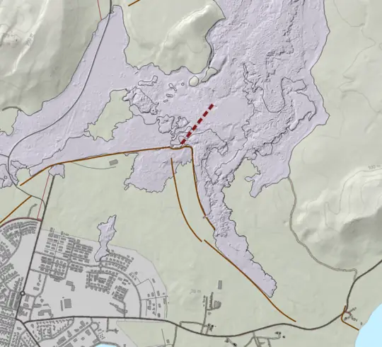
The fissure is now about 500 m (1640 feet) long and has reached through the protective barrier north of Grindavík. The fissure continues to grow, and it cannot be ruled out that it may continue to open further south.
10:54 UTC
The Aviation Color Code was raised to Red.
The fissure is now about 700 m (2 300 feet) long and has remained relatively stable. However, it cannot be ruled out that it may extend further north or south.
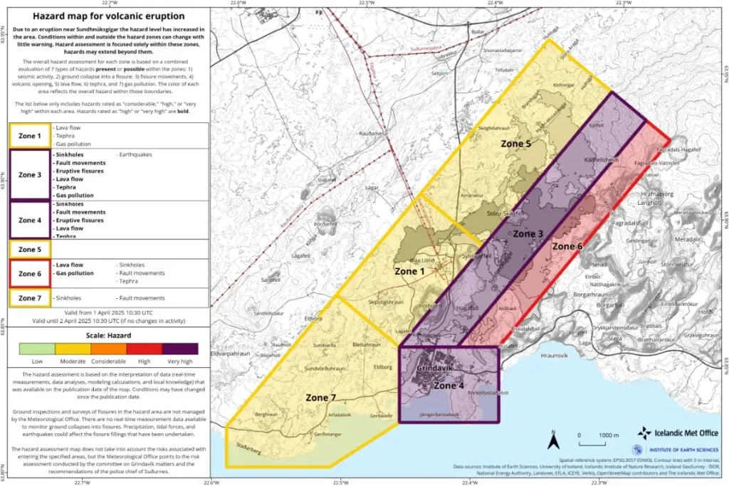
The alert level for the Sundhnúkur crater row (Zone 3) has been raised to very high hazard (purple), and in Grindavík (Zone 4) has been increased from high hazard (red) to very high hazard (purple). This hazard assessment is valid until 10:30 UTC on April 2 unless conditions change.
12:20 UTC
The fissure has extended southward, and a new fissure opened a few hundred meters inside the dikes north of Grindavik — between the dikes and Grindavik.
References:
1 Volcanic eruption just north of Grindavik – IMO – April 1, 2025
I'm a dedicated researcher, journalist, and editor at The Watchers. With over 20 years of experience in the media industry, I specialize in hard science news, focusing on extreme weather, seismic and volcanic activity, space weather, and astronomy, including near-Earth objects and planetary defense strategies. You can reach me at teo /at/ watchers.news.
Commenting rules and guidelines
We value the thoughts and opinions of our readers and welcome healthy discussions on our website. In order to maintain a respectful and positive community, we ask that all commenters follow these rules.