
Highest snowfall totals in decades expected as extreme cold grips Louisiana and Mississippi, U.S.
A powerful winter storm is set to impact Louisiana and Mississippi on Tuesday, January 21, 2025, bringing heavy snowfall, dangerously low temperatures, and hazardous travel conditions. The National Weather Service (NWS) New Orleans office has indicated that snowfall on Tuesday, January 21, 2025, could be the highest recorded in the area in decades.

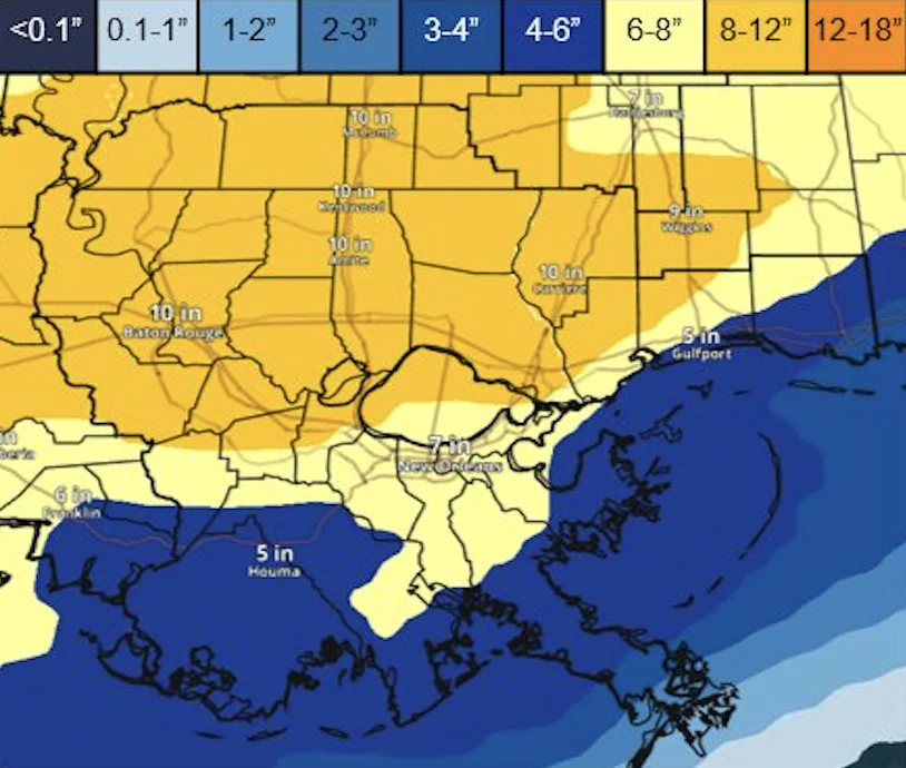
NWS snowfall projection map showing expected snow accumulation across Louisiana and Mississippi from January 20 to 21, 2025. Image credit: NWS
Heavy snowfall is expected across Louisiana and Mississippi on January 21, with forecasts predicting 10 to 15 cm (4 to 6 inches) in northern areas including Morganza, Centreville, McComb, and Baton Rouge. Areas further south including Gulfport, Pascagoula, and New Orleans, may receive up to 7.5 cm (3 inches) of snow.
“Snowfall across the area on Tuesday has the potential to be the highest we have seen in this area in decades,” forecasters at the NWS New Orleans office said.
The most significant snowfall event recorded in the region occurred between February 14 and 15, 1895, when Baton Rouge received 31.8 cm (12.5 inches). Gulfport’s highest total on record was 17.8 cm (7.0 inches) on December 31, 1963, while McComb’s heaviest snowfall reached 12.7 cm (5.0 inches) on December 8, 2017. New Orleans recorded its highest snowfall on December 31, 1963, with 6.9 cm (2.7 inches).

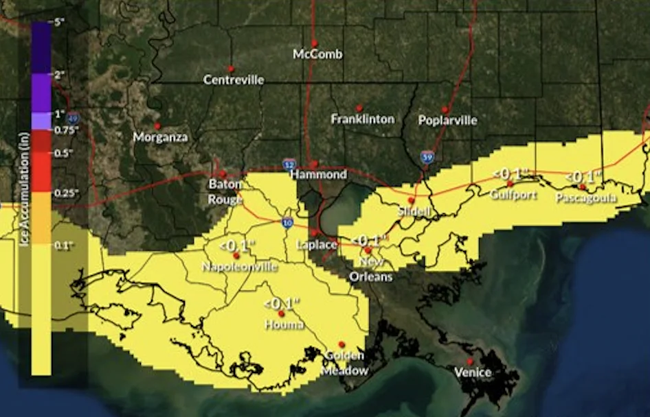
Ice accumulation is also a concern with a light glaze of less than 2.5 mm (0.1 inches) expected in areas southwest of the tidal lakes and along the coast. The highest snow totals are forecast during daylight hours on January 21.
The coldest temperatures are anticipated from January 20 through January 23, with wind chills dropping as low as -12 to -9 °C (10 to 15 °F) in northern Louisiana and Mississippi and -9 to -4 °C (15 to 25 °F) in southern regions, including New Orleans.
Snowfall projections indicate a low (10%) probability of totals reaching 25 cm (10 inches) in some locations.
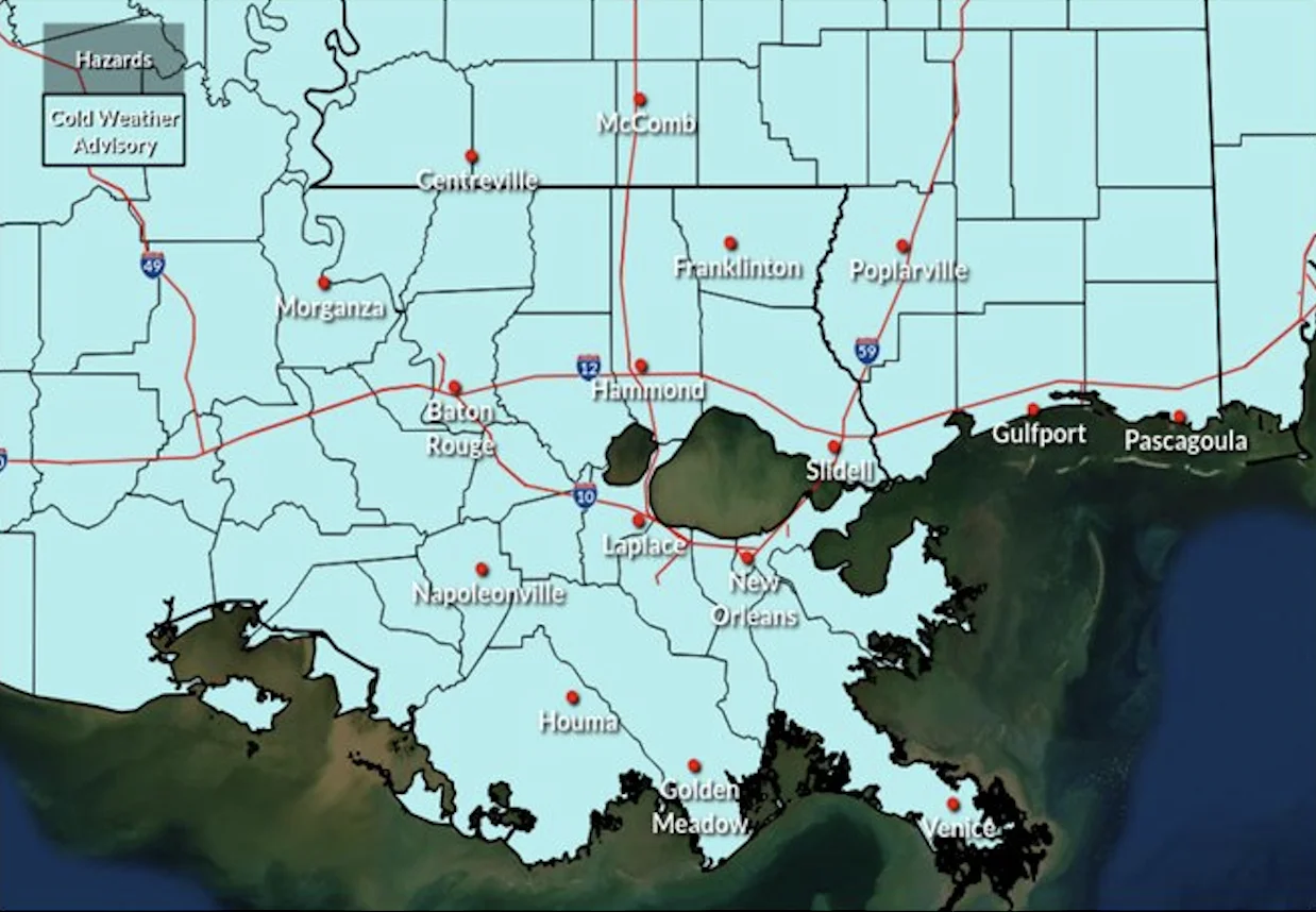
The National Weather Service (NWS) has issued a Cold Weather Warning and has urged residents to wear layered clothing, keep pets indoors, and use heaters safely.
A Winter Storm Watch remains in effect with meteorologists warning of potentially hazardous travel conditions because of snow and ice accumulation.
“You should monitor the latest forecasts for updates, consider delaying all travel, and use extreme caution if travel is absolutely necessary,” NWS New Orleans said.
Icy roads and reduced visibility are expected from late January 20 through the evening of January 21. The heaviest snowfall is projected to occur during the day on January 21 causing moderate to major impacts across the affected areas.
Authorities recommend residents prepare an emergency kit in case of power outages or travel disruptions. Essential items include a flashlight with extra batteries, a first aid kit, a cell phone charger, jumper cables, warm clothing such as mittens, hats, boots, and extra layers. A snow shovel and brush, blankets, non-perishable food, and bottled water are also advised.
Residents should have a spare tire, flares, a tow rope, and sand or kitty litter for traction. “Because you never know when you will encounter winter weather or an emergency road closure,” emergency officials noted while urging residents to stock their vehicles with these items.
Minor ice accumulation is also possible while snow is the primary concern. There is a 10% chance that some locations could experience up to 3.8 mm (0.15 inches) of ice which could lead to slick roads and hazardous driving conditions.
Ice accumulation is expected to be most prevalent on Tuesday, January 21, in the southwest of the tidal lakes and along coastal areas.
References:
1 Weather Forecast Office New Orleans/Baton Rouge – NWS – Accessed on January 20, 2025

Rishika holds a Master’s in International Studies from Stella Maris College, Chennai, India, where she earned a gold medal, and an MCA from the University of Mysore, Karnataka, India. Previously, she served as a Research Assistant at the National Institute of Advanced Studies, Indian Institute of Science, Bengaluru, India. During her tenure, she contributed as a Junior Writer for Europe Monitor on the Global Politics website and as an Assistant Editor for The World This Week. Her work has also been published in The Hindu newspaper, showing her expertise in global affairs. Rishika is also a recipient of the Women Empowerment Award at the district level in Haryana, India, in 2022.
Commenting rules and guidelines
We value the thoughts and opinions of our readers and welcome healthy discussions on our website. In order to maintain a respectful and positive community, we ask that all commenters follow these rules.